Navigation
Child/Junior Footwear
If anyone needs exposure protection while in the water, it would have to be your kids. These child and junior boots will protect their tender tootsies on the land and in the water. These items are specifically designed with kids in mind and parents will appreciate the quality and effectiveness while the kids will appreciate the comfort they provide and how cool they they look when they have them on.
City of Melbourne
![]() Wreck Dive |
Wreck Dive | ![]() Boat access
Boat access
![]()
![]()
![]()
Three-Masted Wooden Ship | Max Depth: 2.4 m (7.87 ft)
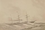
The City of Melbourne shipwreck lies off Point Henry in Corio Bay, Port Phillip. She is historically significant as an American built fast sailing clipper ship that was owned by the Black Ball Line, Liverpool, UK.
It was later used within Port Phillip as a coal hulk and was also acquired for defence use as a block ship.
Diving and Snorkelling the City of Melbourne Shipwreck
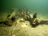
The City of Melbourne shipwreck is a pile of ballast stones about 6 by 3 metres that rise about 20 cm off the bottom. It can be hard to find due to seagrass growth. It's in about 8 feet of water.
City of Melbourne Shipwreck History — Built in 1853
The City of Melbourne was a three-masted wooden full rigged ship of 1,828 tons, built in 1853, by A.S. Austin, in Damariscotta, Maine, USA as the Black Warrior. The vessel was built on the dimensions of 217.3 ft (66 m) long, with a beam of 40.8 ft (12 m) and a draught of 41.1 ft (13 m).
First owned by W. Wilson & Son, Baltimore, Maryland, USA, she was purchaed by James Bains, T.M. MacKay, Joseph Greaves and partners for the Black Ball Line and renamed City of Melbourne on 1 October 1862.
On arriving at the Williamstown Railway Pier and discharging of inward cargo, the Black Ball clipper ship City of Melbourne was loading her outbound cargo when destroyed by fire. The alarm was raised at 2 a.m. on the 26 January 1868. At the time she had on board 3,256 bales of wool, plus a quantity of tallow and leather. The captains of the ships Niagra and Canterbury, with their crews, helped fight the fire, but she developed a dangerous list, and was cut adrift to prevent damage to the pier and other vessels. The rigging of her three masts was cut away, with the foremast and mizenmast soon falling, but the mainmast did not fall until midday. Captain Fullarton, of the Government steamer Pharos, at about 7 p.m. gave orders for one of the Breakwater battery guns be brought to bear on the vessel, and after six well directed shots had been fired into her, by 8 p.m. the City of Melbourne was scuttled in about 8 metres of water. About a month after the fire her remains were raised and converted into a lighter / coal hulk by Howard Smith & Sons.
In 1880 the City of Melbourne was involed in a collision with the S.S. Edina at the mouth of the Yarra River.
In 1885, the City of Melbourne was sold to the Ministry of Defence for 2,150 pounds for the purpose of sinking as a blockship in the shipping channel in case of war with Russia (or any other power). The vessel was handed over without coal gear, hoist, engines or stores. It had been sold for 450 pounds 13 years earlier. There was press outcry at waste of money and impropriety in the purchase of six hulks and lighters (including City of Melbourne) to sink in shipping channels. Mr H.R. Reid, who had conducted negotiations on behalf of the Government, was Chairman of Melbourne Coal Co., which owned City of Melbourne and some of the other vessels. She sank and was raised in 1889.
The City of Melbourne went aground at Cowries Creek, Geelong on 27 July 1889, but floated free three months later and drifted across to Point Henry. She was sold to Howard Smith & Co., and moored off Point Henry as a landing stage for steamer passengers visiting the Bellarine Tea Gardens.
City of Melbourne Sinking — 31 January 1890
The City of Melbourne sank at her moorings at Point Henry, Corio Bay, Port Phillip on 31 January 1890. The vessel was demolished by explosives under the direction of the Minister of Defence on 15 November 1889.
See also, Heritage Council Victoria: City of Melbourne,
Heritage Victoria slide collection on flickr: City of Melbourne, and
Australian National Shipwreck Database: City of Melbourne.
Heritage Warning: Any shipwreck or shipwreck relic that is 75 years or older is protected by legislation. Other items of maritime heritage 75 years or older are also protected by legislation. Activities such as digging for bottles, coins or other artefacts that involve the disturbance of archaeological sites may be in breach of the legislation, and penalties may apply. The legislation requires the mandatory reporting to Heritage Victoria as soon as practicable of any archaeological site that is identified. See Maritime heritage. Anyone with information about looting or stolen artefacts should call Heritage Victoria on (03) 7022 6390, or send an email to heritage.victoria@delwp.vic.gov.au.
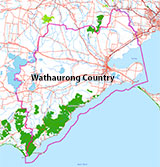
Traditional Owners — This dive site is in the traditional Country of the Wathaurong (Wadda-Warrung) people of the Kulin Nation. This truly ancient Country includes the coastline of Port Phillip, from the Werribee River in the north-east, the Bellarine Peninsula, and down to Cape Otway in the south-west. We wish to acknowledge the Wathaurong as Traditional Owners. We pay respect to their Ancestors and their Elders, past, present and emerging. We acknowledge Bunjil the Creator Spirit of this beautiful land, who travels as an eagle, and Waarn, who protects the waterways and travels as a crow, and thank them for continuing to watch over this Country today and beyond.
City of Melbourne Location Map
Latitude: 38° 7.629′ S (38.12715° S / 38° 7′ 37.74″ S)
Longitude: 144° 24.816′ E (144.4136° E / 144° 24′ 48.96″ E)
Datum: WGS84 |
Google Map
Added: 2012-07-22 09:00:00 GMT, Last updated: 2022-05-04 18:56:47 GMT
Source: GPS
Nearest Neighbour: Briton, 1,000 m, bearing 85°, E
Three-Masted Wooden Ship, Coal Hulk.
Built: Maine, USA, 1853.
Sunk: 31 January 1890.
Point Henry, Corio Bay, Port Phillip.
Depth: 2.4 m.
[ Top ]
DISCLAIMER: No claim is made by The Scuba Doctor as to the accuracy of the dive site coordinates listed here. Should anyone decide to use these GPS marks to locate and dive on a site, they do so entirely at their own risk. Always verify against other sources.
The marks come from numerous sources including commercial operators, independent dive clubs, reference works, and active divers. Some are known to be accurate, while others may not be. Some GPS marks may even have come from maps using the AGD66 datum, and thus may need be converted to the WGS84 datum. To distinguish between the possible accuracy of the dive site marks, we've tried to give each mark a source of GPS, Google Earth, or unknown.






![Halcyon Infinity 30lb System [SS Small Backplate] Halcyon Infinity 30lb System [SS Small Backplate]](/diveshop/images/halcyon/Halcyon-Evolve-Wing.jpg)


