Navigation
Magnat
![]() Wreck |
Wreck | ![]() Shore access
Shore access
![]()
![]()
Three-Masted Iron Barque | Max Depth: 1 m (3.28 ft)
Level: Open Water and beyond.
The Magnat shipwreck is located near Tarwin Beach, south-east of Venus Bay, on the South Gippsland coast.
The Magnat wreck is located 3.1 km (35 to 40 minute walk) along the beach, south-east, from the Venus Bay Life Saving Club. A general rule is that when you almost lose sight of the Venus Bay Life Saving Club you are about there. The wreck is opposite a large blowout and shell midden in the sand dunes.
The wreck will need to be inspected at low tide, 0.5 metres at the most, less is better (check tides before you go). If you walk along the beach at low tide in this area you can't miss it, there are occasions however when the wreck is completely covered over with sand.
See WillyWeather (Venus Bay) as a guide for the tide times and the height of the tide.
Magnat Shipwreck History — Built in 1885
The Magnat was a three masted iron barque of 1,120 tons, built in 1885, by S.P. Austin and Sons, of Sunderland, England, on the dimensions of 206 ft (63 m) in length, a breadth of 33.5 ft (10 m) and a depth of 19.2 ft (5.85 m), and was said to be a reasonably flat bottomed vessel. The barque was originally built as the Edward Pembroke, but was sold to G. Bolte and C. Fesenfeldt and others in 1899, and renamed the Magnat and registered in Elsfleth, Germany.
The master and part owner of the Magnat, Captain Friedrich Ostermann, had only recently acquired the vessel, as he had lost his previous vessel off the coast of Chile a short time earlier, which he had also named Magnat. Captain Ostermann was gaoled in Chile for this loss for a period of two years, but the full sentence was not served, and he was released early when the charts were proven to be inaccurate.
After his release, Captain Ostermann returned to Germany and he, along with C. Fehsenfeldt of Bremen, purchased the Edward Pembroke. This vessel, when renamed Magnat, made its first voyage under her new owners taking a load of timber from Norway to Capetown. There it remained in ballast for several months.
Magnat Sinking — Wrecked 9 May 1900
After a number of months waiting in Cape Town, orders came through, directing the Magnat to proceed to in ballast to Newcastle, NSW, to load coal for Valparaiso, Chile. In late March 1900, the vessel slipped its anchors and preceded to sea, under the command of Captain Friedrich Ostermann, with a crew of 17. The vessel had a routine voyage across the Indian Ocean until entering Bass Strait where easterly winds were in encountered slowing its progress. The situation then deteriorated dramatically.
As reported in the Age of 11 May 1900:
"On Tuesday afternoon, when the vessel was off Cape Patterson, a strong south-westerly gale sprang up, and soon she was rolling uneasily in the terrific seas. Towards dusk rain commenced to fall in torrents, and officers and crew realised that in the inky blackness of the night there was great danger of going ashore. The captain was quick to recognise the peril of being embayed between Cape Patterson and Cape Liptrap, and every inch of canvas that could be safely carried was crowded on to keep the vessel out to sea. The efforts of captain and crew were, however, unavailing. Just about midnight the look out man reported 'breakers ahead' and high above the roaring gale rose the voice of the surf thundering on the land, so near at hand as to cause most of the men to despair at saving the ship. An attempt was made to alter her course, but in the huge breakers she was tossed like a cork on the seething sea, and refused to answer to her helm. It was impossible to avert the danger. The wind was blowing the vessel directly onto the land, and at about two o'clock she ran ashore."
The Magnat was 32 miles off its course, when it struck the sandy beach at Tarwin Lower at 2 a.m. on Wednesday 9 May 1900. Captain Ostermann blamed the tide, stating that it must have carried him that far off coarse in 20 hours. The Magnat went ashore broadside on to the sandy beach with no injury or loss of life. Luck favoured the crew and the vessel as the rocky outcrops of Cape Liptrap and Cape Patterson lie not far away. Also, not known to the crew of the Magnat, was that at about the same time their vessel went ashore, the 1,523 ton Sierra Nevada went ashore at Portsea Back Beach with 23 losing their lives.
The next morning when the wreck was found by some local stockmen, the crew were armed with knives, terrified that there were Aboriginal people lurking nearby. The wreck was then reported to Constable Thyer of Inverloch, who visited the site later that day. On his arrival at the Magnat, Constable Thyer stated that the vessel had already settled about six feet into the sand and was sitting perfectly upright with the bow facing Cape Liptrap. He then went aboard via a block and tackle set up by the crew and interviewed the captain on the details regarding the loss. On his return to the shore the constable was nearly drowned when the block and tackle came loose and he was dropped into the sea.
The following day the steamer Lady Loch arrived with the Queenscliff life boat in tow. Captain Livingstone of the Lady Loch consulted with the superintendent of the life boat on what could be done. However, the Magnat was too high up on the beach and the steamer could not get anywhere near the wreck, as for nearly a half mile out to sea, the water was no more than four feet deep. With nothing that could be done, and the crew in no danger, the steamer headed for home.
The Magnat was slowly sinking into the sand and it was reported that the vessel was imbedded in the sand six feet, but structurally undamaged. In early July 1900, an attempt was made to tow the vessel free with steam tugs, which was initially successful until the tow cables parted and the vessel once was once again stranded on the beach, this time the force of striking broke the keel, sealing the Magnat's fate. After the striking the second time, the hull lay in the opposite direction, with its bow pointing towards Cape Patterson and the stern towards Cape Liptrap. The large vessel was then abandoned to the salvages with the hull slowly disappearing below the shifting sands over the ensuring years.
A dance was held for the locals on the stricken vessel.
See also, MMAV: Magnat 1885-1900,
Heritage Council Victoria: Magnat, and
Australian National Shipwreck Database: Magnat.
Heritage Warning: Any shipwreck or shipwreck relic that is 75 years or older is protected by legislation. Other items of maritime heritage 75 years or older are also protected by legislation. Activities such as digging for bottles, coins or other artefacts that involve the disturbance of archaeological sites may be in breach of the legislation, and penalties may apply. The legislation requires the mandatory reporting to Heritage Victoria as soon as practicable of any archaeological site that is identified. See Maritime heritage. Anyone with information about looting or stolen artefacts should call Heritage Victoria on (03) 7022 6390, or send an email to heritage.victoria@delwp.vic.gov.au.
Finding the Magnat Shipwreck
The GPS marks we know of in circulation for the Magnat are:
- MAAV:
Latitude: 38° 43.733′ S (38.728879° S / 38° 43′ 43.96″ S)
Longitude: 145° 49.868′ E (145.831135° E / 145° 49′ 52.09″ E) - GPS:
Latitude: 38° 41.950′ S (38.699167° S / 38° 41′ 57″ S)
Longitude: 145° 47.783′ E (145.796389° E / 145° 47′ 47″ E)
4,473 m, bearing 317°, NW
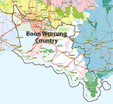
Traditional Owners — This dive site is in the traditional Country of the Boon Wurrung / Bunurong people of the Kulin Nation. This truly ancient Country includes parts of Port Phillip, from the Werribee River in the north-west, down to Wilson's Promontory in the south-east, including the Mornington Peninsula, French Island and Phillip Island, plus Western Port. We wish to acknowledge the Boon Wurrung as Traditional Owners. We pay respect to their Ancestors and their Elders, past, present and emerging. We acknowledge Bunjil the Creator Spirit of this beautiful land, who travels as an eagle, and Waarn, who protects the waterways and travels as a crow, and thank them for continuing to watch over this Country today and beyond.
Magnat Location Map
Latitude: 38° 43.733′ S (38.728879° S / 38° 43′ 43.96″ S)
Longitude: 145° 49.868′ E (145.831135° E / 145° 49′ 52.09″ E)
Datum: WGS84 |
Google Map
| Get directions
Added: 2012-07-22 09:00:00 GMT, Last updated: 2022-05-09 14:32:54 GMT
Source: Maritime Archaeology Association of Victoria
Nearest Neighbour: Duke of Wellington, 10,982 m, bearing 157°, SSE
Three-Masted Iron Barque, 1,120 tons.
Built: Sunderland, England, 1885.
Sunk: 8 May 1900.
Venus Bay, South Gippsland.
Depth: 1 m.
[ Top ]
DISCLAIMER: No claim is made by The Scuba Doctor as to the accuracy of the dive site coordinates listed here. Should anyone decide to use these GPS marks to locate and dive on a site, they do so entirely at their own risk. Always verify against other sources.
The marks come from numerous sources including commercial operators, independent dive clubs, reference works, and active divers. Some are known to be accurate, while others may not be. Some GPS marks may even have come from maps using the AGD66 datum, and thus may need be converted to the WGS84 datum. To distinguish between the possible accuracy of the dive site marks, we've tried to give each mark a source of GPS, Google Earth, or unknown.










![Halcyon Infinity 30lb System [SS Small Backplate] Halcyon Infinity 30lb System [SS Small Backplate]](/diveshop/images/halcyon/Halcyon-Evolve-Wing.jpg)


