Navigation
Scuba Diving TECHNICAL
The Scuba Doctor is the leading source for equipment for advanced and technical divers. We have supplied thousands of experienced tech and rebreather divers worldwide with quality scuba diving equipment from the finest manufacturers.
Every year experienced divers die in diving related avoidable accidents that should not have happened because the victim was "always so careful". One of the more common examples is a failure to analyse gas before diving, but there are many different types of avoidable accidents. The usual explanation put forward is a lapse in following their training, typically as a result of complacency. The victim is blamed for becoming complacent, the dive community is again reminded to be vigilant against complacency, and then another avoidable accident occurs. Perhaps a different way of explaining the cause of these predictable accidents could help effect a change in this unfortunate cycle.
The concept of Normalisation of Deviance has been used to describe the cause of NASA's flawed decisions that led to the Challenger space shuttle disaster. Normalisation of deviance from dive safety begins when the diver has a lapse in one or more safety protocols (often as a result of time and/or financial pressures) and nothing bad happens. The lapse reoccurs without incident and slowly the diver grows more accustomed to the deviant behaviour. Eventually the diver becomes so accustomed to a deviation from dive safety standards that they consider their unsafe behaviour to be acceptably normal. Ultimately one or more safety protocols are permanently deleted from their routine; enabling the diver have a serious, perhaps fatal, accident. To other divers, the accident is bewildering because the behaviour seems obviously unsafe and the victim had enough training and certainly enough experience to "know better".
It's clearly not productive to keep blaming the victim for these avoidable accidents. We can't solve this complex problem in a Tech Tip but a step to addressing this dive safety issue is to begin a discussion within the dive training community. Do we need a different educational approach that formally recognises and addresses normalisation of deviance as an underlying cause of many avoidable accidents among experienced divers? If you are an experienced diver, or dive professional, The Scuba Doctor urges you to raise awareness of this issue among your peers.
Werfa
![]() Wreck Dive |
Wreck Dive | ![]() Boat access
Boat access
![]()
![]()
![]()
![]()
![]()
Iron Steamer and Coal Hulk | Max Depth: 65 m (213 ft) — Graveyard
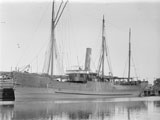
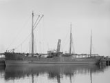
The Werfa shipwreck lies in Bass Strait and is considered to be one of the Victorian Ships' Graveyard wreck dives.
There are many swim throughs on the shipwreck. The stern is quite distinct with iron rectangles. You can go down to the stern to investigate the rudder which is fully intact.
Werfa Shipwreck History — Built in 1883
The Werfa was an iron steamer of Units: unknown unit type given, built in 1883, by Palmers Shipbuilding & Iron Co. Ltd, at Hawdon, Newcastle-on-Tyne, UK, with an overall length of 216 ft (66 m), a beam of 30.2 ft (9.2 m) and draught of 15.5 ft (4.72 m).
Originally a steam collier owned by Wefa Steamship Company Ltd. of Cardiff, Wales. In 1898, the Werfa arrived in Freemantle, Western Australia. In 1899, the Werfa was owned and operated by Bellambie Coal Co., trading between Newcastle and Sydney. The Werfa was purchased by McIlwraith, McEacharn Ltd, of Melbourne, and converted to a coal hulk in 1914.
On 5 August 1925, the visiting American destroyer, USS MacDonough, sank the Werfa in Victoria Dock, as the American Fleet left Melbourne.
Werfa Sinking — Scuttled 20 March 1929
The Werfa was raised eventually prepared for scuttling. On 20 March 1929, the tug Minah left the Workshops Jetty Williamstown with the Werfa in tow, bound for Bass Strait. The Werfa was finally scuttled in the Victorian Ships' Graveyard.
See also, Heritage Council Victoria: Werfa, and
Australian National Shipwreck Database: Werfa.
Heritage Warning: Any shipwreck or shipwreck relic that is 75 years or older is protected by legislation. Other items of maritime heritage 75 years or older are also protected by legislation. Activities such as digging for bottles, coins or other artefacts that involve the disturbance of archaeological sites may be in breach of the legislation, and penalties may apply. The legislation requires the mandatory reporting to Heritage Victoria as soon as practicable of any archaeological site that is identified. See Maritime heritage. Anyone with information about looting or stolen artefacts should call Heritage Victoria on (03) 7022 6390, or send an email to heritage.victoria@delwp.vic.gov.au.
Traditional Owners — This dive site does not lie in the acknowledged traditional Country of any first peoples of Australia.
Werfa Location Map
Latitude: 38° 21.380′ S (38.356327° S / 38° 21′ 22.78″ S)
Longitude: 144° 34.039′ E (144.567317° E / 144° 34′ 2.34″ E)
Datum: WGS84 |
Google Map
Added: 2012-07-22 09:00:00 GMT, Last updated: 2022-04-28 05:43:33 GMT
Source: Book - Victoria's Ships' Graveyard GPS (verified)
Nearest Neighbour: Leeuwin, 561 m, bearing 325°, NW
Iron Steamer | Coal Hulk, 862 ton.
Built: Newcastle-on-Tyne, UK, 1883.
Scuttled: 20 March 1929.
Victorian Ships' Graveyard, Bass Strait.
Depth: 62 to 65 m.
[ Top ]
DISCLAIMER: No claim is made by The Scuba Doctor as to the accuracy of the dive site coordinates listed here. Should anyone decide to use these GPS marks to locate and dive on a site, they do so entirely at their own risk. Always verify against other sources.
The marks come from numerous sources including commercial operators, independent dive clubs, reference works, and active divers. Some are known to be accurate, while others may not be. Some GPS marks may even have come from maps using the AGD66 datum, and thus may need be converted to the WGS84 datum. To distinguish between the possible accuracy of the dive site marks, we've tried to give each mark a source of GPS, Google Earth, or unknown.




![Halcyon Infinity 30lb System [SS Small Backplate] Halcyon Infinity 30lb System [SS Small Backplate]](/diveshop/images/halcyon/Halcyon-Evolve-Wing.jpg)

