Navigation
Clonmel
![]() Wreck Dive |
Wreck Dive | ![]() Boat access
Boat access
![]()
![]()
Paddle Steamer | Max Depth: 7 m (23 ft)
Historic shipwreck protected zone. Permit Required.
For more details please see vic-shipwreck-protection-zones.
Do not dive or snorkel near the Clonmel without a permit. The shipwreck lies in a 50 metre radius protection zone. If you enter this zone severe penalties apply. Stay clear!
Level: Open Water and beyond.
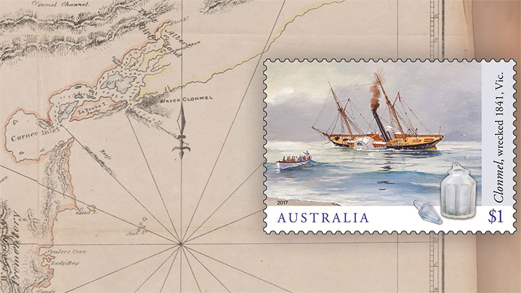
The paddle steamer Clonmel (aka PS Clonmel) was one of the first steam-powered vessels on the Australian coast. However, its career was short, being wrecked on its third voyage on what is now known as Clonmel Island at the Corner Inlet and Port Albert entrance, on Victoria's East Gippsland Coast.
Although the wreck of the Clonmel was a disaster at the time, it is now one of the most significant archaeological sites in Victoria. The site is archaeologically significant for being the earliest located steamship wreck in Australian waters. It is also technically significant for the remains of a wooden hulled paddle steamship, including its early flue type boiler which is believed to be the only example known in Australia. It is historically significant for its role in the discovery of Port Albert and subsequent development of Gippsland.
Diving and Snorkelling the Clonmel Shipwreck
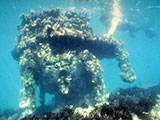
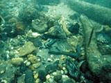
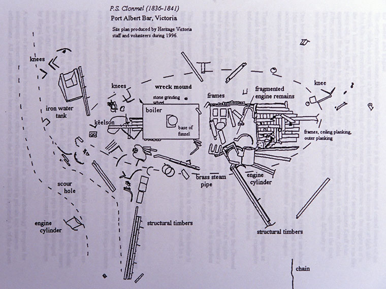
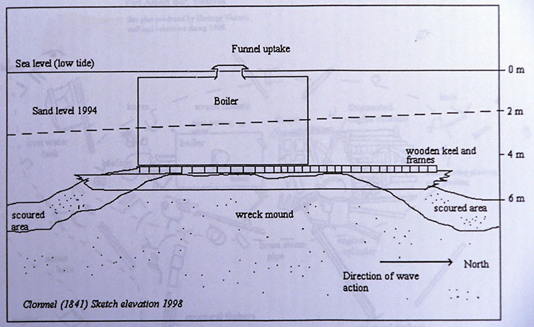
The remains of the Clonmel's engines, hull structure and cargo are present at the site. However, the interesting stuff is often covered by the shifting sands.
See WillyWeather (Clonmel Island) as a guide for the tide times and the height of the tide.
Bass Strait Warning: Always keep an eye on sea conditions throughout any shore or boat dive in Bass Strait on Victoria's coastline. Please read the warnings on the web page diving-in-bass-strait before diving or snorkelling this site.
The site of the Clonmel is a historic shipwreck protected zone declared under the Australian Government's Underwater Cultural heritage Act 2018, with a 50 metre radius from the position of the boiler:
Latitude: 38° 44.640′ S (38.744° S / 38° 44′ 38.4″ S)
Longitude: 146° 40.668′ E (146.6778° E / 146° 40′ 40.08″ E)
.
A permit from Heritage Victoria is required to dive the Clonmel. Anchoring is prohibited.
Clonmel Shipwreck History — Built in 1836
The Clonmel was a wooden paddle steamer of 524 tons, built in 1836, at Birkenhead, England. The vessel was built on the dimensions of 154.8 ft (47 m) in length, a breadth of 21 ft (6.4 m) and a depth of 16.6 ft (5.06 m). Its steam propulsion was supplemented by sail and in the Clonmel's case, it had two masts and was schooner rigged. It was driven by a single steam engine developing 220 horsepower, which had been built by Forrester & Co. of Liverpool, England.
The Clonmel ran around the British Isles for about 15 months before being sold to Sydney owners, was newly copper sheathed and despatched under Captain Tollervey, leaving The Downs on 20 May 1840 and arriving in Sydney on 5 October 1840.] She had been purchased to run between Sydney, Melbourne and Launceston, with the first trip scheduled for 17 November 1840, but was postponed several times for modifications, notably to allow for the smaller size of coals from Newcastle.
Adapted specifically for the Australian intercolonial passenger trade between Sydney, Melbourne and Launceston, the paddle steamer Clonmel was arguably the first luxury steamship to operate in Australian waters. With the latest maritime technology from England and elegantly appointed cabins, Clonmel had the ability to travel between Melbourne and Sydney in 24 hours, which was an exciting development at the time.
The Clonmel was brought to Australia in a time of economic depression. Its owners shouldered a large financial risk in bringing such a large expensive ship for from the UK to Australia. Prior the arrival of the Clonmel, transport of passengers and goods between Melbourne, Sydney and Tasmania was solely in sailing vessels, and more often than not in the smaller coastal sailing ships that were relatively uncomfortable and unreliable because they depended on the vagaries of the weather.
After a series of delays, the Clonmel left on her first voyage in Australia from Sydney at 6 p.m. on 1 December 1840, arrived at Port Phillip around 8 a.m. on 9 December 1840, having a scheduled stop at Batemans Bay en route. She left for Launceston and returned. She left for Sydney 15 or 16 December 1840 but ran short of coal and was obliged to put in at Batemans Bay, a delay of two days, arriving at Sydney on the evening of 22 December 1840.
PS Clonmel Sinking — Wrecked 2 January 1841
On its final voyage, the Clonmel left Sydney on 31 December 1840 bound for Melbourne under the command of Captain Tollervey, with 42 crew, 38 passengers, including prominent bankers and business people, as well as a valuable cargo of bank notes, expensive drapery and general cargo. She rounded the South Head against a strong southerly wind.
The voyage was fairly routine as the vessel entered Bass Strait, steering a course along the coast, which was the practise with many early steamers. On the morning of 1 January 1841 she sighted Ram Head, Victoria, by which time the wind had dropped and the sea was smooth. Captain Tollervey steered for Wilsons Promontory. As the Clonmel preceded along Ninety Mile Beach it ran into thick fog and visibility was severely restricted. Unbeknown to the crew, the vessel was being set in shore by the currents, and with a calm sea the danger was not detected until the vessel was practically on the shore.
The Clonmel struck a sandbank at Corner Inlet at a speed of 10 knots between 3 and 4 a.m. on Saturday 2 January 1841. On striking, the engines were kept running ahead to try to force the vessel over the bar, however, this did not succeed and it remained fast upon the sand.
Using Clonmel's whaleboats and quarter-boats, all 80 passengers and crew were eventually transported safely to shore, the captain being the last to leave. Shelter and provisions were ferried ashore and a comfortable camp set up. The following morning a volunteer party of five crew and two of the passengers, D. C. Simson and T. D. Edwards, set out for Melbourne in the whaleboat. Early on the third day they met with a cutter, whose captain brought them to Williamstown. Everyone survived, though the ship sank and much of the cargo was lost.
The story of the Clonmel is a window into the lives and motivations early Australians, from the entrepreneurs led by Edye Manning who with his partners brought the ship to Australia, or the newly married Cashmores who lost the stock of a new shop they had hoped to establish in Melbourne, or the master Captain Tollervy whose actions resulted in the loss of the vessel, or the crew who bravely rowed one of the ship's boats to Melbourne to raise the alarm.
This unfortunate incident also had a benefit, as it led to the discovery of Port Albert, which, intern, stimulated the opening up of Gippsland to early settlers. Thus the wreck of the Clonmel was instrumental in the settlement of Gippsland and the establishment of the towns of Port Albert, Tarraville and Alberton.
Some artefacts from the Clonmel are housed at the Port Albert Maritime Museum, and others also made their way into the Anglican Church in Port Albert.
See also, Wikipedia: PS Clonmel,
Heritage Council Victoria: PS Clonmel,
Heritage Victoria slide collection on flickr: PS Clonmel,
Australia Post: Shipwrecks: Capturing our maritime past - Part 3, and
Australian National Shipwreck Database: PS Clonmel.
Heritage Warning: Any shipwreck or shipwreck relic that is 75 years or older is protected by legislation. Other items of maritime heritage 75 years or older are also protected by legislation. Activities such as digging for bottles, coins or other artefacts that involve the disturbance of archaeological sites may be in breach of the legislation, and penalties may apply. The legislation requires the mandatory reporting to Heritage Victoria as soon as practicable of any archaeological site that is identified. See Maritime heritage. Anyone with information about looting or stolen artefacts should call Heritage Victoria on (03) 7022 6390, or send an email to heritage.victoria@delwp.vic.gov.au.
Finding the Clonmel Shipwreck
Over the years we've been provided with different GPS marks for the Clonmel shipwreck. The GPS marks we know of in circulation for the Clonmel are:
- Victorian Government GPS (verified) protected zone location (50m radius):
Latitude: 38° 44.640′ S (38.744° S / 38° 44′ 38.4″ S)
Longitude: 146° 40.668′ E (146.6778° E / 146° 40′ 40.08″ E)
- Different protected zone location (50m radius):
Latitude: 38° 44.733′ S (38.74555556° S / 38° 44′ 44″ S)
Longitude: 146° 40.617′ E (146.67694444° E / 146° 40′ 37″ E)
188 m, bearing 203°, SSW
We believe the second GPS mark may be a AUS66 to WGS84 datum error.
Traditional Owners — This dive site is in the traditional Country of the Gunaikurnai people of south-eastern Victoria including a large part of Gippsland. This truly ancient Country includes the coastal and inland areas to the southern slopes of the Victorian Alps, plus Buchan Caves, Port Albert, Moe, Morwell, Traralgon, Yarrum, Sale, Mafra, Bairnsdale, and Lakes Entrance. It also stretches 100 metres out to sea from low tide. "Gunaikurnai" is a name adopted by the people of the Brataualung, Brayakaulung, Brabralung, Krauatungalung and Tatungalung family clans. We wish to acknowledge the Gunaikurnai as Traditional Owners. We pay respect to their Ancestors and their Elders, past, present and emerging.
Clonmel Location Map
Latitude: 38° 44.640′ S (38.744° S / 38° 44′ 38.4″ S)
Longitude: 146° 40.668′ E (146.6778° E / 146° 40′ 40.08″ E)
Datum: WGS84 |
Google Map
Added: 2012-07-22 09:00:00 GMT, Last updated: 2022-05-10 02:55:19 GMT
Source: Victorian Government GPS (verified)
Nearest Neighbour: Wave, 1,612 m, bearing 173°, S
Historic shipwreck protected zone.
Permit Required.
Paddle Steamer.
Built: 1836.
Sunk: 2 January 1841.
Clonmel Island, Port Albert.
Depth: 7 m.
[ Top ]
DISCLAIMER: No claim is made by The Scuba Doctor as to the accuracy of the dive site coordinates listed here. Should anyone decide to use these GPS marks to locate and dive on a site, they do so entirely at their own risk. Always verify against other sources.
The marks come from numerous sources including commercial operators, independent dive clubs, reference works, and active divers. Some are known to be accurate, while others may not be. Some GPS marks may even have come from maps using the AGD66 datum, and thus may need be converted to the WGS84 datum. To distinguish between the possible accuracy of the dive site marks, we've tried to give each mark a source of GPS, Google Earth, or unknown.
Copyright © 2005-2022 by The Scuba Doctor Australia, ABN 88 116 755 170. All rights reserved.
tel. +61 3 5985 1700 :: email. diveshop@scubadoctor.com.au :: Web site by it'sTechnical 2022






![Halcyon Infinity 30lb System [SS Small Backplate] Halcyon Infinity 30lb System [SS Small Backplate]](/diveshop/images/halcyon/Halcyon-Evolve-Wing.jpg)


