Melbourne Drift Dives

Drift diving can provide you with some of the most exhilarating dives of your life. Especially in Melbourne where at the right time of the year, the currents can be very strong.
Some Melbourne drift dives are about the thrill of being swept effortlessly along in fast current. Others are about cruising along slowly taking in the spectacular underwater terrain. And in Melbourne, some are about covering an area of the sandy sea bed floor of Port Phillip while gathering a feed of scallops.
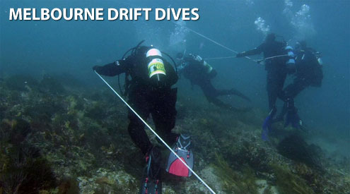
Drift diving in Port Philip is a little different to drift diving in other areas of the world because of our strong currents and the amount of boating traffic. Divers are typically split into separate groups depending on numbers and are given a long length of rope, around 50 metres, with a buoy and dive flag attached to one end. The idea is to descend as a group spaced along the line keeping parallel to the current. It sound tricky but it isn't. This is really the easiest form of diving as very little kicking is required or navigation. You just go with the flow! Your air supply lasts longer and the terrain is always changing.
Before you undertake a drift dive in Melbourne, please read our guide to Diving in Melbourne Currents.
Safety Tip: We recommend you read our Boat Diving Safety and Using a Dive Float and Flag pages and use the described Cray/Drift Buoy Line Diver Freedom System when drift diving from a private boat.
Melbourne Drift Dive Site Locations
You can see where the popular Melbourne and Victorian drift dive locations are via our Melbourne Dive Sites Map. The GPS marks for these drift dives are also listed here, plus on our Melbourne Dive Site GPS Marks page.
Here are some Melbourne drift dive sites where you might get to fly underwater.
[ Top ]
Artefacts Flood | Drift Dive | Boat access |
| Latitude: 38° 17.995′ S (38.299917° S / 38° 17′ 59.7″ S) Longitude: 144° 41.287′ E (144.688117° E / 144° 41′ 17.22″ E) | ||
| Datum: WGS84 | Google Map | |
| Added: 2012-07-22 01:00:00 GMT, Last updated: 2022-04-28 17:41:02 GMT Source: GPS | ||
| Nearest Neighbour: Quarantine Station Reef, 563 m, bearing 221°, SW | ||
| Ticonderoga Bay, Port Phillip. Depth: 10 to 15 m. | ||
| See the Artefacts Flood dive site page | ||
Boarfish Reef Drift | Drift Dive | Boat access |
| Latitude: 38° 16.915′ S (38.281917° S / 38° 16′ 54.9″ S) Longitude: 144° 39.275′ E (144.654583° E / 144° 39′ 16.5″ E) | ||
| Datum: WGS84 | Google Map | |
| Added: 2012-07-22 01:00:00 GMT, Last updated: 2022-04-06 11:45:36 GMT Source: GPS | ||
| Nearest Neighbour: Shortland Bluff Bommie, 102 m, bearing 49°, NE | ||
| Depth: 6 to 32 m. Dive only on: SWF, SWE. | ||
| See the Boarfish Reef Drift dive site page | ||
Catch Bag Reef Drift | Drift Dive | Boat access |
| Latitude: 38° 17.144′ S (38.285733° S / 38° 17′ 8.64″ S) Longitude: 144° 37.981′ E (144.633017° E / 144° 37′ 58.86″ E) | ||
| Datum: WGS84 | Google Map | |
| Added: 2012-07-22 01:00:00 GMT, Last updated: 2022-04-29 04:44:13 GMT Source: GPS | ||
| Nearest Neighbour: Lonsdale Wall Shallow, 207 m, bearing 265°, W | ||
| Depth: 12 to 24 m. | ||
| See the Catch Bag Reef Drift dive site page | ||
Cattle Jetty Drift | Drift Dive | Boat access |
| Latitude: 38° 18.095′ S (38.301583° S / 38° 18′ 5.7″ S) Longitude: 144° 40.825′ E (144.680417° E / 144° 40′ 49.5″ E) | ||
| Datum: WGS84 | Google Map | |
| Added: 2012-07-22 01:00:00 GMT, Last updated: 2022-05-07 15:34:58 GMT Source: GPS | ||
| Nearest Neighbour: Quarantine Station Reef, 380 m, bearing 128°, SE | ||
| Depth: 8 to 18 m. | ||
| See the Cattle Jetty Drift dive site page | ||
Geoffs Scallop Hole | Drift Dive | Boat access |
| Latitude: 38° 21.549′ S (38.35915° S / 38° 21′ 32.94″ S) Longitude: 144° 47.781′ E (144.79635° E / 144° 47′ 46.86″ E) | ||
| Datum: WGS84 | Google Map | |
| Added: 2019-02-17 05:35:16 GMT, Last updated: 2022-03-27 07:54:34 GMT Source: Geoff Rodda GPS | ||
| Nearest Neighbour: JLs Scallop Beds, 673 m, bearing 86°, E | ||
| Depth: 10 to 17 m. | ||
| See the Geoffs Scallop Hole dive site page | ||
JLs Scallop Beds | Drift Dive | Boat access |
| Latitude: 38° 21.525′ S (38.35875° S / 38° 21′ 31.5″ S) Longitude: 144° 48.243′ E (144.80405° E / 144° 48′ 14.58″ E) | ||
| Datum: WGS84 | Google Map | |
| Added: 2019-02-17 14:09:35 GMT, Last updated: 2021-05-14 13:47:10 GMT Source: John Lawler GPS (verified) | ||
| Nearest Neighbour: Geoffs Scallop Hole, 673 m, bearing 266°, W | ||
| Depth: 10 to 17 m. | ||
| See the JLs Scallop Beds dive site page | ||
JLs Scallop Drift | Drift Dive | Boat access |
| Latitude: 38° 20.238′ S (38.3373° S / 38° 20′ 14.28″ S) Longitude: 144° 51.091′ E (144.851517° E / 144° 51′ 5.46″ E) | ||
| Datum: WGS84 | Google Map | |
| Added: 2019-02-17 13:53:57 GMT, Last updated: 2021-05-14 13:47:33 GMT Source: John Lawler GPS (verified) | ||
| Nearest Neighbour: Rye Scallop Drift, 450 m, bearing 343°, NNW | ||
| Depth: 15 m. | ||
| See the JLs Scallop Drift dive site page | ||
Kelp Beds Reef Drift | Drift Dive | Boat access |
| Latitude: 38° 17.008′ S (38.283469° S / 38° 17′ 0.49″ S) Longitude: 144° 39.584′ E (144.659729° E / 144° 39′ 35.02″ E) | ||
| Datum: WGS84 | Google Map | |
| Added: 2012-07-22 01:00:00 GMT, Last updated: 2022-04-29 04:50:58 GMT Source: GPS | ||
| Nearest Neighbour: Hot Spot, 275 m, bearing 39°, NE | ||
| Depth: 10 to 21 m. Dive only on: Flood. | ||
| See the Kelp Beds Reef Drift dive site page | ||
Quarantine Station Reef | Drift Dive | Boat access |
| Latitude: 38° 18.222′ S (38.3037° S / 38° 18′ 13.32″ S) Longitude: 144° 41.030′ E (144.683833° E / 144° 41′ 1.8″ E) | ||
| Datum: WGS84 | Google Map | |
| Added: 2012-07-22 01:00:00 GMT, Last updated: 2022-04-29 05:41:41 GMT Source: GPS | ||
| Nearest Neighbour: Cattle Jetty Drift, 380 m, bearing 308°, NW | ||
| Depth: 12 to 22 m. Dive only on: SWF, SWE. | ||
| See the Quarantine Station Reef dive site page | ||
Rye Scallop Beds | Drift Dive | Boat access |
| Latitude: 38° 20.812′ S (38.346867° S / 38° 20′ 48.72″ S) Longitude: 144° 47.684′ E (144.794733° E / 144° 47′ 41.04″ E) | ||
| Datum: WGS84 | Google Map | |
| Added: 2019-02-17 14:16:00 GMT, Last updated: 2021-05-15 00:19:59 GMT Source: GPS | ||
| Nearest Neighbour: Geoffs Scallop Hole, 1,373 m, bearing 174°, S | ||
| Depth: 10 to 17 m. | ||
| See the Rye Scallop Beds dive site page | ||
Rye Scallop Drift | Drift Dive | Boat access |
| Latitude: 38° 20.005′ S (38.333417° S / 38° 20′ 0.3″ S) Longitude: 144° 51.003′ E (144.85005° E / 144° 51′ 0.18″ E) | ||
| Datum: WGS84 | Google Map | |
| Added: 2012-07-22 01:00:00 GMT, Last updated: 2021-05-15 00:20:16 GMT Source: GPS | ||
| Nearest Neighbour: JLs Scallop Drift, 450 m, bearing 163°, SSE | ||
| Depth: 15 m. | ||
| See the Rye Scallop Drift dive site page | ||
San Remo Bridge | Drift Dive | Shore access |
| Latitude: 38° 31.116′ S (38.518605° S / 38° 31′ 6.98″ S) Longitude: 145° 21.866′ E (145.364429° E / 145° 21′ 51.94″ E) | ||
| Datum: WGS84 | Google Map | Get directions | |
| Added: 2019-05-05 02:36:27 GMT, Last updated: 2022-03-22 06:16:17 GMT Source: Google Earth | ||
| Nearest Neighbour: San Remo Jetty, 220 m, bearing 172°, S | ||
| San Remo, Phillip Island. Depth: 3 to 13 m. | ||
| See the San Remo Bridge dive site page | ||
Sponge Garden Drift | Drift Dive | Boat access |
| Latitude: 38° 16.501′ S (38.275017° S / 38° 16′ 30.06″ S) Longitude: 144° 39.971′ E (144.666183° E / 144° 39′ 58.26″ E) | ||
| Datum: WGS84 | Google Map | |
| Added: 2012-07-22 01:00:00 GMT, Last updated: 2021-12-20 09:45:08 GMT Source: GPS (verified) | ||
| Nearest Neighbour: Torpedo Reef, 286 m, bearing 215°, SW | ||
| Depth: 12 to 20 m. Dive only on: Ebb. | ||
| See the Sponge Garden Drift dive site page | ||
Total of 13 dive sites.
[ Top ]
DISCLAIMER: No claim is made by The Scuba Doctor as to the accuracy of the dive site coordinates listed here. Should anyone decide to use these GPS marks to locate and dive on a site, they do so entirely at their own risk. Always verify against other sources.
The marks come from numerous sources including commercial operators, independent dive clubs, reference works, and active divers. Some are known to be accurate, while others may not be. Some GPS marks may even have come from maps using the AGD66 datum, and thus may need be converted to the WGS84 datum. To distinguish between the possible accuracy of the dive site marks, we've tried to give each mark a source, e.g. GPS, Google Earth, or unknown.
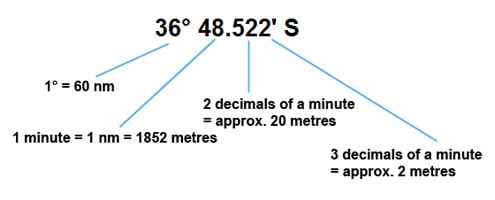
If you don't understand the differences between the different ways coordinates are given, plus how different datum come into play, you might find the article GPS Conversions by Lloyd Borrett a useful read. It describes the problems associated with locating dive sites using a GPS receiver.

Scuba Doctor Dive Map KML File
In the true spirit of making it easy to obtain, utilise and share the information for non-commercial purposes, you can now Download/view the Scuba Doctor Dive Map GPS Marks (KML file | 427.19 KB | 24-May-2022) in the Keyhole Markup Language (KML) file format used to display geographic data in an Earth browser such as Google Earth or Google Maps.
Some marine GPS units can import the information from a KML file. For others you can use use a file translate program (e.g. GPSBabel) to convert the KML file into an import file format (e.g. GPX) supported by your GPS unit.
Please Help Us To Correct GPS Marks and Add More Melbourne Dive Sites
If you have have information about other dive sites you'd be happy to see added to the information available here, or any corrections and/or updates to the diving site GPS marks listed here, please feel free to Contact Us. See also, Dive Site Help.

