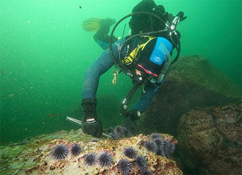
Melbourne Sea Urchin Dives

We're often asked about where we think are the best places to catch a feed of Sea Urchin near Melbourne, Victoria. So here we list the local Sea Urchin diving and snorkelling sites we know about. Happy Sea Urchin hunting!
Albert William | Wreck Dive | Shore access |
| Latitude: 37° 52.328′ S (37.872125° S / 37° 52′ 19.65″ S) Longitude: 144° 54.621′ E (144.910358° E / 144° 54′ 37.29″ E) | ||
| Datum: WGS84 | Google Map | Get directions | |
| Added: 2021-02-08 05:52:17 GMT, Last updated: 2022-04-28 17:31:12 GMT Source: Google Earth | ||
| Nearest Neighbour: Point Gellibrand, 465 m, bearing 280°, W | ||
| Iron Lighter. Built: 1863. Sunk: 18 May 1955. Williamstown, Port Phillip. Depth: 3 m. | ||
| See the Albert William dive site page | ||
Katie Cove, Williamstown | Shore Dive | Shore access |
| Latitude: 37° 52.243′ S (37.870719° S / 37° 52′ 14.59″ S) Longitude: 144° 53.916′ E (144.898595° E / 144° 53′ 54.94″ E) | ||
| Datum: WGS84 | Google Map | Get directions | |
| Added: 2021-01-30 02:39:30 GMT, Last updated: 2022-04-17 13:52:41 GMT Source: Google Earth | ||
| Nearest Neighbour: Williamstown Beach Rotunda, 456 m, bearing 301°, WNW | ||
| Williamstown, Port Phillip. Depth: 2 to 6 m. | ||
| See the Katie Cove, Williamstown dive site page | ||
Keefers Boatyard | Shore Dive | Shore access |
| Latitude: 37° 59.467′ S (37.991114° S / 37° 59′ 28.01″ S) Longitude: 145° 2.587′ E (145.043109° E / 145° 2′ 35.19″ E) | ||
| Datum: WGS84 | Google Map | Get directions | |
| Added: 2012-07-22 01:00:00 GMT, Last updated: 2022-03-22 05:10:14 GMT Source: Google Earth | ||
| Nearest Neighbour: Sea Scouts Jetty, 601 m, bearing 216°, SW | ||
| Beaumaris Bay, Bayside, Port Phillip. Depth: 0 to 6 m. | ||
| See the Keefers Boatyard dive site page | ||
Point Cooke Beach | Shore Dive | Shore access |
| Latitude: 37° 55.781′ S (37.929684° S / 37° 55′ 46.86″ S) Longitude: 144° 46.367′ E (144.772791° E / 144° 46′ 22.05″ E) | ||
| Datum: WGS84 | Google Map | Get directions | |
| Added: 2012-07-22 01:00:00 GMT, Last updated: 2022-04-18 11:54:52 GMT Source: Google Earth | ||
| Nearest Neighbour: Diana, Point Cooke, 1,510 m, bearing 91°, E | ||
| Point Cook, Port Phillip. Depth: 2 to 5 m. | ||
| See the Point Cooke Beach dive site page | ||
Point Gellibrand | Shore Dive | Shore access |
| Latitude: 37° 52.283′ S (37.871381° S / 37° 52′ 16.97″ S) Longitude: 144° 54.308′ E (144.90514° E / 144° 54′ 18.5″ E) | ||
| Datum: WGS84 | Google Map | Get directions | |
| Added: 2012-07-22 01:00:00 GMT, Last updated: 2022-05-03 08:34:38 GMT Source: Google Earth | ||
| Nearest Neighbour: Albert William, 465 m, bearing 100°, E | ||
| Williamstown, Port Phillip. Depth: 2 to 5 m. | ||
| See the Point Gellibrand dive site page | ||
Sea Scouts Jetty | Shore Dive | Shore access |
| Latitude: 37° 59.729′ S (37.995482° S / 37° 59′ 43.74″ S) Longitude: 145° 2.344′ E (145.03907° E / 145° 2′ 20.65″ E) | ||
| Datum: WGS84 | Google Map | Get directions | |
| Added: 2021-03-17 17:39:55 GMT, Last updated: 2022-03-22 05:09:48 GMT Source: Google Earth | ||
| Nearest Neighbour: Table Rock, Ricketts Point, 226 m, bearing 267°, W | ||
| Beaumaris Bay, Bayside, Port Phillip. Depth: 1 to 5 m. | ||
| See the Sea Scouts Jetty dive site page | ||
Williamstown Beach Breakwater | Shore Dive | Shore access |
| Latitude: 37° 52.097′ S (37.868282° S / 37° 52′ 5.82″ S) Longitude: 144° 53.358′ E (144.889295° E / 144° 53′ 21.46″ E) | ||
| Datum: WGS84 | Google Map | Get directions | |
| Added: 2012-07-22 01:00:00 GMT, Last updated: 2022-04-17 08:36:45 GMT Source: Google Earth | ||
| Nearest Neighbour: Williamstown Beach Rotunda, 428 m, bearing 94°, E | ||
| Williamstown, Port Phillip. Depth: 2 to 5 m. | ||
| See the Williamstown Beach Breakwater dive site page | ||
Williamstown Beach Rotunda | Shore Dive | Shore access |
| Latitude: 37° 52.116′ S (37.8686° S / 37° 52′ 6.96″ S) Longitude: 144° 53.649′ E (144.89415° E / 144° 53′ 38.94″ E) | ||
| Datum: WGS84 | Google Map | Get directions | |
| Added: 2021-01-29 10:42:15 GMT, Last updated: 2022-04-17 08:33:59 GMT Source: Google Earth | ||
| Nearest Neighbour: Williamstown Beach Breakwater, 428 m, bearing 274°, W | ||
| Williamstown, Port Phillip. Depth: 1 to 6 m. | ||
| See the Williamstown Beach Rotunda dive site page | ||
Total of 8 dive sites.
If you have other Sea Urchin dive and snorkelling sites you could add to the list, please Contact Us with the details. If you have more information, pictures, or videos of the Sea Urchin dive sites already listed here, we'd love to hear from you.
Please read our article on How to Catch Sea Urchin for more information and tips for catching Sea Urchin in Victoria.

