Navigation
Cave divers use a distinct set of markers to determine the direction and distance travelled in a cave. These markers must be identifiable through sight and touch should the divers find themselves in limited or zero visibility. Many wreck divers have also adopted using these directional and non-directional markers.
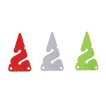
Directional markers are known as "line arrows" in the cave diving community. Many popular cave and wreck diving systems have permanent line arrows at regular intervals (for example, every 30 metres or 100 feet) pointing to the nearest exit. If there is a numerical value displayed on the line arrow, it is most likely identifying the distance to the nearest exit.
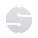
Non-directional markers are known as "cookies" in the cave diving community. Cookies are used to mark reference points for divers during circuits and traverses, distinguishing lines at a 'T' intersection, or placed by each member of a team on a jump or gap line to identify who has exited should the team get separated. Non-directional markers should have some form of personal identification printed on them such as initials, or drawings. Some cave divers add a personal tactile element to help identify their marker should they encounter zero visibility; these tactile identifiers may include slits on the side or holes punched through the marker. A non-directional marker is only to be referenced by the diver or team who installed it and should be ignored by others.
Referencing Exit Markers (REM) are a relatively new marker designed to be used as an arrow by the diver placing it and a cookie by others. It's a hybrid marker. A REM is rectangular in shape with slots included enabling divers to attach it to a line. It also has blank space available to include personal or team identification on one side and a small slate on the other to write on for reasons such as survey work, team separation (i.e. I exited the cave at 37 minutes), and more.
You can trust the range of top-quality line markers and cookies from The Scuba Doctor.
Dominion
![]() Wreck Dive |
Wreck Dive | ![]() Shore access
Shore access
![]()
![]()
![]()
![]()
![]()
![]()
Three-Masted Wooden Barque/Lighter | Max Depth: 4 m (13 ft)
Level: Open Water and beyond.
The Dominion shipwreck lies about 20 metres north-west of the Ozone. It was scuttled in 1925, together with the Ozone, in an attempt to form a breakwater in Half Moon Bay at Indented Head on the Bellarine Peninsula in Port Phillip.
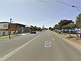
Half Moon Bay Beach and Hood Bight Beach are two east facing beaches, bordered by low rocky points. The Esplanade runs behind both beaches, with a narrow foreshore reserve between the road and the beaches. The reserve increases in width on the points. There is a camping reserve in Batman Park at Half Moon Bay, and the Indented Head Yacht Club and picnic area in Hood Bight. Several boat sheds back both beaches and there is a large car park, boat ramp, jetty and picnic area on Indented Head, at the southern end of Hood Bight. Both beaches are narrow and steep and fronted by 100 metre wide sand flats.
Diving and Snorkelling the Dominion Shipwreck
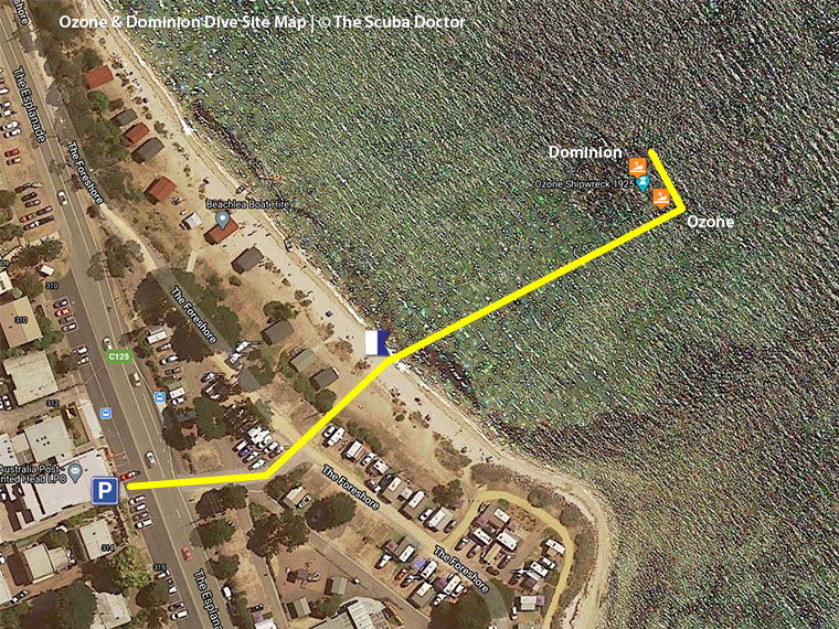
From the beach, make your way out over the shallow sandy bottom to the Ozone and explore the remains. Then move on to the Dominion which lies about 20 metres, north-west on a bearing of 322°.
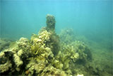
The Dominion shipwreck is now a series of metal ribs and hull timbers in about three metres of water.
The area is popular for dive training as it allows divers to have an interesting wreck dive at the same time.
Location: The Esplanade, Indented Heads, Victoria 3223
MELWAY Ref: Page 446 A1
Beach Marker: 31B
Parking: There is parking along The Esplanade between Batman Road and Helen Street. It can be quite difficult to find parking in the peak summer months, but usually easy the rest of the year. Before gearing up check out the water. If you see lots of white water, head on home. If it looks okay, gear up and proceed from where you're parked, across the road, through the camping grounds, down to the southern end of Half Moon Bay Beach.
Warning: The area is subject to a lot of boat and PWC traffic. Always take a dive float with a dive flag. Always go with a dive buddy.
Entry/Exit: Shore entry from the southern end of Half Moon Bay Beach near beach marker 31B.
Ideal Conditions: Conditions are usually best with no wind, or an offshore south-westerly wind. Great after a few days of offshore south-westerly to westerly winds as surface conditions remain calm. Avoid when there are strong notherly to easterly winds. Best at high tide for extra depth. See WillyWeather (Indented Head) as a guide for the tide times and the height of the tide.
Dominion Shipwreck History — Built in 1875
The Dominion was a three-masted wooden barque, built in 1875, by Peter Baldwin in Quebec, Canada. The vessel was 199.9 ft (61 m) in length, with a beam of 37.1 ft (11 m), and a depth of 24.4 ft (7.44 m).
The Dominion was originally a wool ship, then later a Newcastle coal hulk.
In 1902, owners Howard Smith & Co. had the Dominion towed into Melbourne from Fremantle, and converted to a lighter. Licence to operate as a coal/wool lighter issued by Melbourne Harbor Trust (MHT) to owners, Howard Smith and Co. Ltd. on 23 February 1907. Renewed 1 June 1916.
On 25 January 1917, the new owner Australian Steamships Ltd, had a MHT license renewal. This was renewed again on 12 February 1918. Register closed November 1921 — Burnt.
Dominion Sinking — 1925
In 1925, Captain Forbes, master of the Bay trader Athletic in the 1870s and in command of the S.S. Edina for 40 years, retired to live at Indented Head, Port Phillip. Anxious to provide a breakwater for the protection of small craft, in 1925 he purchased the hulk Dominion which was towed to Indented Head and run aground. He also purchased the hulk of the P.S. Ozone and had her sunk to complete the breakwater. Unfortunately, vandals set fire to the Dominion, and the Ozone did not settle in the planned position and the scheme failed.
See also, Heritage Council Victoria: Dominion,
Heritage Victoria slide collection on flickr: Dominion, and
Australian National Shipwreck Database: Dominion.
Heritage Warning: Any shipwreck or shipwreck relic that is 75 years or older is protected by legislation. Other items of maritime heritage 75 years or older are also protected by legislation. Activities such as digging for bottles, coins or other artefacts that involve the disturbance of archaeological sites may be in breach of the legislation, and penalties may apply. The legislation requires the mandatory reporting to Heritage Victoria as soon as practicable of any archaeological site that is identified. See Maritime heritage. Anyone with information about looting or stolen artefacts should call Heritage Victoria on (03) 7022 6390, or send an email to heritage.victoria@delwp.vic.gov.au.
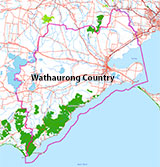
Traditional Owners — This dive site is in the traditional Country of the Wathaurong (Wadda-Warrung) people of the Kulin Nation. This truly ancient Country includes the coastline of Port Phillip, from the Werribee River in the north-east, the Bellarine Peninsula, and down to Cape Otway in the south-west. We wish to acknowledge the Wathaurong as Traditional Owners. We pay respect to their Ancestors and their Elders, past, present and emerging. We acknowledge Bunjil the Creator Spirit of this beautiful land, who travels as an eagle, and Waarn, who protects the waterways and travels as a crow, and thank them for continuing to watch over this Country today and beyond.
Dominion Location Map
Latitude: 38° 8.342′ S (38.139037° S / 38° 8′ 20.53″ S)
Longitude: 144° 42.810′ E (144.713507° E / 144° 42′ 48.63″ E)
Datum: WGS84 |
Google Map
| Get directions
Added: 2012-07-22 09:00:00 GMT, Last updated: 2022-05-03 16:05:01 GMT
Source: GPS
Nearest Neighbour: Ozone, 13 m, bearing 142°, SE
Wooden Barque/Lighter.
Built: Quebec, Canada, 1875.
Sunk: 1925.
Indented Head, Bellarine Peninsula.
Depth: 2 to 4 m.
[ Top ]
DISCLAIMER: No claim is made by The Scuba Doctor as to the accuracy of the dive site coordinates listed here. Should anyone decide to use these GPS marks to locate and dive on a site, they do so entirely at their own risk. Always verify against other sources.
The marks come from numerous sources including commercial operators, independent dive clubs, reference works, and active divers. Some are known to be accurate, while others may not be. Some GPS marks may even have come from maps using the AGD66 datum, and thus may need be converted to the WGS84 datum. To distinguish between the possible accuracy of the dive site marks, we've tried to give each mark a source of GPS, Google Earth, or unknown.
Copyright © 2005-2022 by The Scuba Doctor Australia, ABN 88 116 755 170. All rights reserved.
tel. +61 3 5985 1700 :: email. diveshop@scubadoctor.com.au :: Web site by it'sTechnical 2022








![Halcyon Infinity 30lb System [SS Small Backplate] Halcyon Infinity 30lb System [SS Small Backplate]](/diveshop/images/halcyon/Halcyon-Evolve-Wing.jpg)


