Navigation
Every diver knows how important the little things are to make your dive go smoothly. The Scuba Doctor dive shop has the dive accessories and gadgets that will enhance the pleasure of your scuba dive.
Falls of Halladale
![]() Wreck Dive |
Wreck Dive | ![]() Boat access
Boat access
![]()
![]()
![]()
Four-Masted Iron Barque | Max Depth: 12 m (39 ft)
Level: Open Water and beyond.
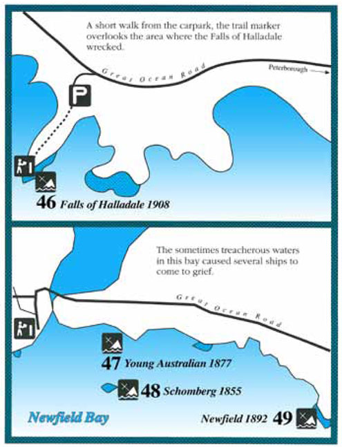
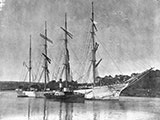
Falls of Halladale was one of the last of the "windjammers". It belonged top the celebrated Glasgow Falls Line: a fleet which was built for carrying cargo and for speed under sail. The Falls of Halladale shipwreck lies between Peterborough to the east and Port Campbell to the west on Victoria's Shipwreck Coast. It's part of the west-coast-shipwreck-trail.
Falls of Halladale had a reputation for running overdue and was frequently reported as "missing" at sea. The longest and most arduous of the ship's journeys was from Liverpool to San Francisco in 1903. The captain intended to take the vessel around Cape Horn but fierce winds and mountainous seas forced a change of course around the much longer "great circle Route". By the time the ship reached New Zealand, the exhausted crew mutinied and forced the ship to anchor in Foveaux Strait for several days. Finally with the mutineers in irons, Falls of Halladale limped into San Francisco 273 days after it had left Liverpool.
When Falls of Halladale wrecked at just north-west of Peterborough, a cargo of thousands of slate tiles sank with it. Twenty-two thousand were recovered during legal salvage operations between 1974 and 1986. The tiles can be seen today at Flagstaff Hill Maritime Museum where they have been used as roofing tiles on eight of the restored village buildings.
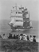
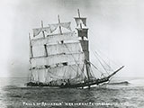
The Falls of Halladale shipwreck was a four-masted iron-hulled sailing barque that was built in 1886 for the long-distance bulk carrier trade. The Falls of Halladale was on the final leg of its voyage from New York to Melbourne when its captain became unsure of his location due to the presence of sea mist. The vessel, with all its sails set, ran aground on 14 November 1908 on a reef north-west of Peterborough on Victoria's Shipwreck Coast. For some time after it remained intact attracting many local sightseers. The vessel eventually became a total loss.
Diving the Falls of Halladale Shipwreck
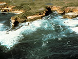
The Falls of Halladale shipwreck lies approximately 300 m (984 ft) off Wreck Point, north-west of Peterborough. The vessel lies on a rocky bottom in 3 to 12 metres of water. The bow faces towards the north and the wreckage extends out to sea for approximately 100 m (328 ft).
Given the relatively easy access to the Falls of Halladale and her iron hull, this is one of the best and most popular wreck dives in the area. It's best done as a boat dive, but on the right day, it can be done as a shore dive as well.
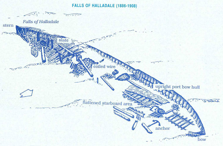
The port side of the vessel is upright with five to six metres of the hull at the bow and two to three metres at the stern. The starboard side has flattened out and masts are scattered towards the east. As a diver swims towards the stern, the site appears as a complex lattice of iron beams and hull plates which were the floors, frames and bilge plating. The scattered beams and plates provide a perfect home for many reef fish.
Some slate and coiled wire cargo stowed at the stern of the vessel 80 years ago, still remain in their original area of stowage. Other features of the site include large iron anchors, bollards, deck supports and iron knees.
Shipwrecks of South-west Victoria | Source: Flagstaff Hill Maritime Museum
Location: North-west of Peterborough, Victoria 3270
Ideal Conditions: The site is flanked by a reef which causes heavy breaks in all but the calmest conditions. In rough weather, waves break over the site and are hazardous to all small craft. The best conditions to dive the shipwreck occur during periods of low swell and northerly winds. See WillyWeather (Peterborough) as a guide for the tide times and the height of the tide.
Boat Launching: The nearest boat launching facilities are the Peterborough Curdies River Dorey Street Boat Ramp and the Peterborough Bay of Islands Boat Ramp.
{{southern-ocean-warning}}Falls of Halladale Shipwreck History — Built in 1886
The Falls of Halladale was a four-masted iron-hulled barque of 2,085 tons gross, launched in July 1886, by Russell & Co of Greenock, Scotland. The vessel was 275.2 ft (84 m) in length, with breadth of 41.6 ft (13 m), and a depth of 23.9 ft (7.28 m).
The Falls of Halladale was the seventh vessel in a series of eight similar iron-hulled sailing ships, all built by Russell & Co and all named after waterfalls in Scotland. The vessel was to sacrifice speed for carrying power with economy realised by a smaller sail area resulting in a smaller crew. Her yards were also smaller than a typical ship of her type of this period.
Falls of Halladale Last Voyage and Sinking — 14 November 1908
The Falls of Halladale left New York on 4 August 1908 bound for Melbourne and Sydney, under the command of Captain David Thompson with 28 crew. The captain was pleased with the general cargo he had secured for the journey. Valued at £35,000, it included 500 sewing machines, plumbing iron, 6,500 gallons of oil, 14,400 gallons of benzine, glassware and 56,763 beautiful American slate tiles.
Falls of Halladale was making good time, 102 days out from New York, as it neared the southern Victorian coastline in the early hours of Saturday 13 November 1908. The sea was calm and the weather fine. A mist hung over the sea creating an illusionary horizon. This confused the captain who calculated the ship's position as 15 kilometres from the coast.
As the fog lifted, the crew and captain of Falls of Halladale found themselves with full sails set and billowing and only a few hundred metres from the shore heading straight for the rocks. The call "land close to the lee bow" was screamed but it was too late. The anchors could not be let go in time, and the ship had no headway to change tack. Within two minutes the ship had struck a submerged reef heavily amidships, at 3 a.m. Sunday 14 November 1908, about 200 yards from shore. The vessel grounded in fair weather on an east-north-east tack.
An eye witness said, "the ship seemed to leap from the water. In falling it seemed to jam hard and fast on the rocks". As the waves broke over the deck, the ship began to fill with water. The order "save your lives" was given and two lifeboats were hoisted clear of the ship. The lifeboats could not land directly on shore at the wreck site but instead were rowed for three hours a distance of four and a half miles to a sandy beach in the Bay of Islands.
The stranding of Falls of Halladale was witnessed by the postmistress at Peterborough. She had been issued with a telescope by the government for sighting vessels in distress and was able to raise the alarm among the townsfolk. A small group set out for the Bay of Islands to help the stranded sailors. The rocket crew arrived from Port Campbell but were not needed as the crew and Captain had all made it safely to shore.
Falls of Halladale sat wedged firmly between two reefs for weeks and drew a large crowd of onlookers. One newspaper reported, "she is resting on an almost even keel with all her masts and rigging standing and with her canvas swelling out in a light breeze. She presents a most impressive sight".
After two months the ship was wrecked. Rough seas had pounded the vessel and the salvage company had blasted the ship. Much of the valuable cargo was washed ashore including a large quantity of oil, causing one of Victoria's earliest oil spills.
Two salvage ventures proved to be financial disasters. Captain Thompson of the Falls of Halladale was found guilty by the Court of Marine Inquiry of a gross act of misconduct in that he carelessly navigated the vessel. His certificate was suspended for six months.
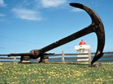
22,000 slate tiles were salvaged in the 1980s and used as roofing at Flagstaff Hill Maritime Village, Warrnambool. An anchor that was recovered in 1974 is on display at the village.
See also, west-coast-shipwreck-trail,
Wikipedia: Falls of Halladale,
Heritage Council Victoria: Falls of Halladale,
Heritage Victoria slide collection on flickr: Falls of Halladale,
Australian National Shipwreck Database: Falls of Halladale, and
Dive Information Sheet: Falls of Halladale (1886-1908).
This vessel is one of the many historic shipwrecks included in Victoria's shipwreck-discovery-trail. Qualified divers can explore the wrecks of old wooden clippers, iron steamships and cargo and passenger vessels located along the coast and in Port Phillip. Some of these wreck dives are suitable for beginners, even snorkellers, while other wrecks require the skills and experience of advanced divers.
Heritage Warning: Any shipwreck or shipwreck relic that is 75 years or older is protected by legislation. Other items of maritime heritage 75 years or older are also protected by legislation. Activities such as digging for bottles, coins or other artefacts that involve the disturbance of archaeological sites may be in breach of the legislation, and penalties may apply. The legislation requires the mandatory reporting to Heritage Victoria as soon as practicable of any archaeological site that is identified. See Maritime heritage. Anyone with information about looting or stolen artefacts should call Heritage Victoria on (03) 7022 6390, or send an email to heritage.victoria@delwp.vic.gov.au.
Finding the Falls of Halladale Shipwreck
Over the years we've been provided with different GPS marks for the Falls of Halladale. The GPS marks we know of in circulation for the Falls of Halladale are:
- Peter Ronald GPS (verified):
Latitude: 38° 36.394′ S (38.606571763735° S / 38° 36′ 23.66″ S)
Longitude: 142° 51.482′ E (142.85802893758° E / 142° 51′ 28.9″ E) - Dive Victoria:
Latitude: 38° 36.500′ S (38.608333° S / 38° 36′ 30″ S)
Longitude: 142° 51.500′ E (142.858333° E / 142° 51′ 30″ E)
164 m, bearing 144°, SE
Traditional Owners — This dive site is in the traditional Country of the Eastern Maar people of south-western Victoria between the Shaw and Eumerella Rivers and from Yambuk in the south to beyond Lake Linlithgow in the north. This truly ancient Country extends as far north as Ararat and encompasses the coastal townships of Port Fairy in the west, Warrnambool, Peterborough, Port Campbell, Apollo Bay, Lorne, and Airies Inlet in the east, including the Great Ocean Road area. It also stretches 100 metres out to sea from low tide and therefore includes the iconic Twelve Apostles. "Eastern Maar" is a name adopted by the people who identify as Maar, Eastern Gunditjmara, Tjap Wurrung, Peek Whurrong, Kirrae Whurrung, Kuurn Kopan Noot and/or Yarro waetch (Tooram Tribe) amongst others. We wish to acknowledge the Eastern Maar as Traditional Owners. We pay respect to their Ancestors and their Elders, past, present and emerging.
Falls of Halladale Location Map
Latitude: 38° 36.428′ S (38.607139° S / 38° 36′ 25.7″ S)
Longitude: 142° 51.434′ E (142.857225° E / 142° 51′ 26.01″ E)
Datum: WGS84 |
Google Map
Added: 2012-07-22 09:00:00 GMT, Last updated: 2022-05-23 19:42:42 GMT
Source: Peter Ronald GPS
Nearest Neighbour: Nursery Bay, 573 m, bearing 67°, ENE
Four-Masted Iron Barque.
Built: Greenock, Scotland, 1886.
Sunk: 14 November 1908.
Peterborough, Shipwreck Coast.
Depth: 18 m.
[ Top ]
DISCLAIMER: No claim is made by The Scuba Doctor as to the accuracy of the dive site coordinates listed here. Should anyone decide to use these GPS marks to locate and dive on a site, they do so entirely at their own risk. Always verify against other sources.
The marks come from numerous sources including commercial operators, independent dive clubs, reference works, and active divers. Some are known to be accurate, while others may not be. Some GPS marks may even have come from maps using the AGD66 datum, and thus may need be converted to the WGS84 datum. To distinguish between the possible accuracy of the dive site marks, we've tried to give each mark a source of GPS, Google Earth, or unknown.
Copyright © 2005-2022 by The Scuba Doctor Australia, ABN 88 116 755 170. All rights reserved.
tel. +61 3 5985 1700 :: email. diveshop@scubadoctor.com.au :: Web site by it'sTechnical 2022







![Halcyon Infinity 30lb System [SS Small Backplate] Halcyon Infinity 30lb System [SS Small Backplate]](/diveshop/images/halcyon/Halcyon-Evolve-Wing.jpg)


