Navigation
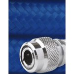
The Miflex Low Pressure (LP) BCD/Inflator/Jacket Blue colour hoses are supplied fitted with a standard Seatec style fitting, with an internal Schraider type valve and a 3/8" UNF male thread (to connect to the 1st stage regulator). There is a range of standard sizes to suit your requirements.
These hoses are suitable for the majority of BCD and Jacket connections, plus dry suit inflator connections, where a standard quick release coupler is utilised. But there are some fittings that require a different Quick Disconnect fitting. These we accommodate in our range with the use of adaptors that can be fitted to our regulator hoses (to convert them to an inflator hose).
Fenwick Bight
![]() Reef Dive |
Reef Dive | ![]() Boat access
Boat access
![]()
![]()
![]()
![]()
![]()
Depth: 10 m (33 ft) to 30 m (98 ft)
Level: Advanced Open Water and beyond.
Fenwick Bight is an interesting dive site at the southern end of Wilsons Promontory, with South Point marking the western end of the bight. It faces south into the often wild seas of Bass Strait, and is located within the Wilsons Promontory Marine National Park. It's a very rewarding boat dive site for adventurous divers.
Fenwick Bight was named after Frederick Fenwick, an early settler (Inverloch Historical Society).
Diving at Fenwick Bight
At Fenwick Bight the diving is on a fringe of granite boulders along the shoreline, ending in sand in moderate depths.
The eastern end of Fenwick Bight offers a little shelter and easy diving in good weather, but is still exposed to southerly and south-westerly winds. Out toward the point it is a little deeper with vertical walls and interesting small caves. The dive is a good place to see Barber Perch, Boarfish, Leatherjackets, Sea Carp (Marblefish) and Wrasse.
It's a very remote dive site location, only accessible with a dive boat.
Ideal Conditions: Fenwick Bight is best dived with calm seas, no swell and no wind. Light offshore south-westerly to westerly winds may be acceptable. Avoid diving with moderate to strong onshore south-easterly to south-westerly winds. Because of the depths that can be reached here, plus the sometimes strong currents, Fenwick Bight is best dived at slack water. See WillyWeather (Fenwick Bight) as a guide for the tide times and the height of the tide.
Bass Strait Warning: Always keep an eye on sea conditions throughout any shore or boat dive in Bass Strait on Victoria's coastline. Please read the warnings on the web page diving-in-bass-strait before diving or snorkelling this site.
Wilsons Promontory Marine National Park
This site lies in Wilsons Promontory Marine National Park, Victoria's largest marine sanctuary. There is a huge diversity of marine life within the waters at the Prom. Brilliantly coloured fish are present such as the Red Velvetfish, Eastern Blue Groper and Wrasse as well as Leafy Seadragons and schools of Barber Perch. Intertidal molluscs such as limpets and snails, as well as anemones, brittlestars and seastars, are also common within the waters.
Divers will experience fascinating sponge gardens which consist of a techni-coloured assemblage of sponges, sea tulips, sea whips, lace corals and seafans. Octopus emerge at night whilst sharks and rays roam the sandy areas.
The offshore islands support many colonies of fur seals and oceanic birds such as Little Penguins, Fairy Prions, Silver Gulls and Pacific Gulls.
See also, Parks Victoria: Wilsons Promontory Marine National Park,
Park Note: Wilsons Promontory Marine National Park, and
Wikipedia: Wilsons Promontory Marine National Park.
You are not permitted to carry a spear gun while snorkelling or scuba diving in Wilsons Promontory Marine National Park.
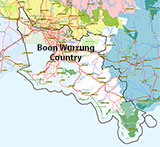
Traditional Owners — This dive site is in the traditional Country of the Boon Wurrung / Bunurong people of the Kulin Nation. This truly ancient Country includes parts of Port Phillip, from the Werribee River in the north-west, down to Wilson's Promontory in the south-east, including the Mornington Peninsula, French Island and Phillip Island, plus Western Port. We wish to acknowledge the Boon Wurrung as Traditional Owners. We pay respect to their Ancestors and their Elders, past, present and emerging. We acknowledge Bunjil the Creator Spirit of this beautiful land, who travels as an eagle, and Waarn, who protects the waterways and travels as a crow, and thank them for continuing to watch over this Country today and beyond.
Fenwick Bight Location Map
Latitude: 39° 7.885′ S (39.131416° S / 39° 7′ 53.1″ S)
Longitude: 146° 23.242′ E (146.387364° E / 146° 23′ 14.51″ E)
Datum: WGS84 |
Google Map
Added: 2022-04-23 09:21:02 GMT, Last updated: 2022-04-23 09:50:38 GMT
Source: Google Earth
Nearest Neighbour: South Point, 1,336 m, bearing 245°, WSW
Wilsons Promontory Marine National Park.
Depth: 10 to 30 m.
[ Top ]
DISCLAIMER: No claim is made by The Scuba Doctor as to the accuracy of the dive site coordinates listed here. Should anyone decide to use these GPS marks to locate and dive on a site, they do so entirely at their own risk. Always verify against other sources.
The marks come from numerous sources including commercial operators, independent dive clubs, reference works, and active divers. Some are known to be accurate, while others may not be. Some GPS marks may even have come from maps using the AGD66 datum, and thus may need be converted to the WGS84 datum. To distinguish between the possible accuracy of the dive site marks, we've tried to give each mark a source of GPS, Google Earth, or unknown.
Copyright © 2005-2022 by The Scuba Doctor Australia, ABN 88 116 755 170. All rights reserved.
tel. +61 3 5985 1700 :: email. diveshop@scubadoctor.com.au :: Web site by it'sTechnical 2022


![Halcyon Infinity 30lb System [SS Small Backplate] Halcyon Infinity 30lb System [SS Small Backplate]](/diveshop/images/halcyon/Halcyon-Evolve-Wing.jpg)


