Navigation
J4 26m Submarine
![]() Wreck Dive |
Wreck Dive | ![]() Boat access
Boat access
![]()
![]()
![]()
Diesel Electric Submarine | Max Depth: 27 m (89 ft) — Graveyard
Level: Advanced Open Water and beyond.
The J4 Submarine (aka Shallow, 26 metre, 27 metre and 90 Foot Broken sub) is part of our very own piece of WWI maritime history, plus an exciting and awe-inspiring playground for divers and freedivers.
The wreck of the J4 Submarine is located in the Victorian Ships' Graveyard, Bass Strait. It lies on its keel running North-South with its bow pointing out to sea on a rocky seabed.
Scuba Diving and Freediving the J4 Submarine Shipwreck
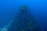
The stern of the J4 Submarine almost merges into the surrounding reef. (See also Sub Reef.) During its scuttling the bow section broke off, exposing the forward torpedoes tubes and bow modifications. This makes the torpedo tubes easily accessible to scuba divers without penetration. The conning tower is intact and in excellent condition.
Scuba divers and freedivers can penetrate the submarine through the numerous hatch openings. Such penetration should not be taken lightly, as being shallower than the other subs, this wreck is particularly susceptible to surge. Unwary divers can be literally sucked in and catapulted through the wreck's interior. However, the surge prevents any silting, and under suitable conditions, this makes for one of Melbourne's top dives.
J4 Submarine Wreck
from Allie Beckhurst
on Vimeo.
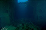
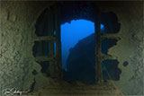
Inside the J4 Submarine can very peaceful with streams of light peering in through the cracks and holes in the hull. Once inside, divers can see the bulkheads, which supported the submarine against pressure at great depths. Although the engine has been removed, the engine bed can still be seen at the stern.
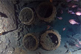
The broken bow section of the J4 Submarine contains four torpedo tubes, which can be easily seen by using a torch and positioning yourself between the bow and the main body.
As with the other J-class submarines, the J4 Submarine is host to a variety of plant and animal life. Good conditions for photography are often found near the conning tower, which is usually surrounded by many fish.
A bronze plaque has been placed on the conning tower by the Melbourne Bottom Scratchers Scuba Dive Club who rediscovered the submarine on 16 May 1982.
The J4 Submarine is an excellent dive for Advanced Open Water divers. As this is a penetration dive, divers should be experienced, plus appropriately qualified and equipped. Some experienced freedivers have been known to descend down and through the J4 Submarine.
The best part about the J4 Submarine is the relatively shallow depth. As a result, you can spend plenty of time exploring. You can easily penetrate the length of the submarine, plus spend time exploring outside.
Dive charter boats regularly schedule dives on the J4 Submarine, heading out from Portsea and Queenscliff. Private dive boats usually launch at the Sorrento Boat Ramp or the Queenscliff Boat Ramp.
Bass Strait Warning: Always keep an eye on sea conditions throughout any shore or boat dive in Bass Strait on Victoria's coastline. Please read the warnings on the web page diving-in-bass-strait before diving or snorkelling this site.
J4 Submarine Shipwreck History — Built in 1916
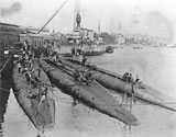
Originally HMS J4, later HMAS J4, this is one of the J class submarines designed and built during WW1 by the British Royal Navy. The J class of submarines was a seven submarine class developed in response to claims that Germany was developing submarines that were fast enough — 22 knots (41 kpm) — to operate alongside surface fleets. The rumours were actually false.
The J Class design brief was for a submarine to operate on the wings of battle fleets, diving at the commencement of engagements, and picking off stragglers, damaged ships, and acting as an anti-submarine submarine.
This class of submarines were the only design of submarines ever to have had 3 screw propellers, and at the time were the fastest subs around with a surface speed of 19 knots (35 kpm). Six J class submarines were completed during mid-1916, while a seventh entered service in 1917.
The HMS J4 submarine was commissioned in the Royal Navy on 17 July 1916 under the command of Lieutenant Commander DI McGillevie RN and was allocated to the 11th Submarine Flotilla based at Blyth, Northumberland. The wartime complement was 5 officers and 40 sailors.
HMS J4 Submarine Operations
In June 1917 it was decided to conduct a large scale operation using both destroyers and submarines to flush out enemy submarines either leaving for patrol or returning to their bases from the Atlantic. Known as Operation BB, it was planned to force enemy submarines to dive through certain areas heavily patrolled by destroyers so that they would be on the surface while passing through adjacent areas patrolled by British submarines. The British submarines employed included J1, J2, J4 and J5. During the ten days, 15 to 24 June 1917, 19 German submarines passed in or out of the North Sea; 12 homeward bound and seven outward bound. There were 26 sightings and 11 attacks made, eight by destroyers and three by submarines. J4 saw nothing of the enemy.
On 23 April 1918, the German High Seas Fleet made its last sortie of the war into the North Sea in an attempt to intercept a British convoy sailing between Norway and Scotland. At that time four British submarines were patrolling the approaches to the Bight, including J4 and J6. The German ships were not sighted by J4 and in the prevailing haze, the Commanding Officer of J6 thought that they were British. No attacks were made, and the timing of the German sortie was wrong for them to catch the convoy.
The J4 submarine was in refit at Chatham at the end of the war.
Although larger and more powerful than previous British submarines, the J class could not keep up with surface vessels and operated independently during the war. Between them, the submarines sank a U-boat, and heavily damaged two battleships. The J6 Submarine had been sunk in error in 1918 by a British ship.
HMAS J4 Submarine Operations
Following the conclusion of hostilities in World War I, the Admiralty in 1918 presented the six remaining boats of the J Class, plus six navy destroyers, to the Australian Government. All the submarines commissioned into the Royal Australian Navy at Portsmouth on 25 March 1919, as tenders to the submarine depot ship HMAS Platypus. The Commanding Officer of J4 was Lieutenant Ambrose N Lee RN.
The beam tubes were removed from all six J Class submarines before they sailed for Australia. The tubes were despatched separately to Garden Island. The reasons given for the removal were that the beam tubes were not a success and that increased accommodation was required.
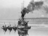
On 9 April 1919, HMAS Platypus and the submarines, escorted by the light cruiser HMAS Sydney, sailed from Portsmouth for Australia, their first two ports of call being Gibraltar and Valetta. Other ports of call included Port Said, Aden, Colombo, Singapore, Thursday Island, and Brisbane. The J5 developed engine trouble during the voyage and was taken under tow by the HMAS Sydney, and later the HMAS Brisbane. When they arrived in Sydney, Australia on 15 July 1919, the six submarines were all in poor condition. They were taken in hand at Garden Island Dockyard for refitting.
After her refit was completed in February 1920, HMAS J4 sailed on 16 February 1920, in company with J1 and HMAS Platypus, for the submarine base at Geelong, Victoria. Osborne House, previously a rest home for nurses, was used as the base for the six submarines. The ironclad Cerberus was renamed HMAS Platypus II on 1 April 1921 and acted as a depot ship to the J Class submarines whilst stationed at Geelong. The HMAS Platypus II is not to be confused with the HMAS Platypus which was one of the six gift vessels which escorted the J submarines from England to Australia.
The J1, J2, J4 and J5 submarines carried out a major cruise in Tasmanian waters in January 1921. The J3 and J4 submarines carried out a similar major cruise in Tasmanian waters in January 1922.
After uneventful service, little of which was spent at sea, J4 and her five sisters paid off into Reserve and decommissioned at Western Port on 12 July 1922. The boats had become victims of the worsening economic conditions of the time, coupled with their high cost of maintenance.
J4 Submarine Details
Built in 1915/1916 at Portsmouth Naval Dockyard, England, launched on 2 February 1916 as a double-hulled type, triple screw submarine. At that time the J class were the fastest subs in existence.
It's commonly believed that the J-class submarines were identical in dimensions and layout, but this is not so. Royal Navy drawings placed the J class into two groups of J1–J4 and J5–J7, and that the bridge of J7 was moved 60 feet aft compared to J5–J6. Plans show a difference in overall length between the two groups, with J5–J7 at 274 feet 9 inches being 9 inches shorter than J1–J4 which were 275 feet 6 inches.
The overall length of the J4 Submarine was approximately 275.5 ft (84 m), beam 23.25 ft (7.09 m) and draught 16 ft (4.88 m) giving a displacement weight of 1,210 l-ton (1,229 t) surfaced and 1,820 l-ton (1,849 t) submerged.
The J-class submarines were powered by three 12-cylinder Vickers solid injection, direct reversing, 4-cycle, diesel engines of 14.5-inch bore and 14-inch stroke, producing a total of 3,600 HP at 380 rpm. For submerged running there were two Mather & Platt 700 HP electric motors, for a total of 1,400 HP, powered by four banks of 58 cell batteries.
The vessel had a maximum speed of 19 knots (35 kpm) surfaced and 9.4 knots (17 kpm) submerged, with a range of 4,000 nm (7,408 km) at 12 knots (22 kpm) and 2,250 nm (4,167 km) at full speed surfaced. The maximum safe diving depth was 300 ft (91 m). The J-class submarines were equipped with a powerful long-range wireless and were ideally suited to reconnoitre in enemy water.
The J Class submarines principal weapons originally were:
- 6 x 18-inch (457 mm) torpedo tubes (4 bow, 2 beam)
- 1 x 4-inch (102 mm) gun
- The J1, for a brief period, was fitted with Depth charges
J4 Submarine Sinking — Scuttled 28 April 1927
The decision to scrap the submarines J1 to J5 was taken on 19 November 1923, following a cut in the defence budget by some 500,000 pounds. In January 1924, the Melbourne Salvage Company purchased the J1, J2, J4 and J5 submarines for 10,500 pounds. The purchasers were under a bond of 1,000 pounds to the Defence Department as a guarantee of the final destruction of the submarines. The contract also included the sinking in deep water or breaking up or otherwise disposing of the submarines to the satisfaction of the government contract board.
The J4 Submarine sunk accidentally at the Dock Pier, Williamstown in the afternoon of Thursday 10 July 1924, while she was being stripped. An attempt to refloat her, made on Saturday 27 November 1926, worked for a couple of hours but then failed after the submarine had been taken just 60 feet towards the shore. The bow and conning tower were left above water. The J4 was successfully raised on Monday 6 December 1926 and taken to Nelson Pier. Thus the J4 Submarine had spent more than two years on the harbour floor.
On Thursday 28 April 1927, the J4 Submarine was towed four miles outside Port Phillip Heads where the seacocks were opened. In half an hour she sank in deep water.
Some accounts say the conning tower of J4 was removed and erected on St Kilda pier as a starting tower for the yacht club and was used until 1956 when the old pier was demolished. It has been suggested that the starting tower was in fact the conning tower of the HMV Torpedo boat Childers, not the J4 however this is disputed.
The J4 Submarine was relocated by the Melbourne Bottom Scratchers Scuba Dive Club on 16 May 1982. The team were boat captain Steven Capon, plus divers Andy Downard, John Stevens, John McCormick, Ken Jarvis, Peter Sutton, Pam Stevenson, Marion McCormick, and Wayne Dillon.
Four subs, J1, J2, J4, and J5, were scuttled in the Victorian Ships' Graveyard. Two were scuttled as breakwaters: J3 near Swan Island, and J7 at Sandringham Yacht Club.
For more information, see the J4 Submarine page on the Heritage Victoria web site, or download/view the J4 Submarine Dive Information Sheet.
See also
Heritage Council Victoria: J-4 Submarine,
Australian National Shipwreck Database: J-4 Submarine,
Royal Australian Navy: HMAS J4,
WW1 J Class Submarines,
WW1 J Class Subs,
Wikipedia: HMS J4, and
Wikipedia: J-class submarine.
This vessel is one of the many historic shipwrecks included in Victoria's shipwreck-discovery-trail. Qualified divers can explore the wrecks of old wooden clippers, iron steamships and cargo and passenger vessels located along the coast and in Port Phillip. Some of these wreck dives are suitable for beginners, even snorkellers, while other wrecks require the skills and experience of advanced divers.
Heritage Warning: Any shipwreck or shipwreck relic that is 75 years or older is protected by legislation. Other items of maritime heritage 75 years or older are also protected by legislation. Activities such as digging for bottles, coins or other artefacts that involve the disturbance of archaeological sites may be in breach of the legislation, and penalties may apply. The legislation requires the mandatory reporting to Heritage Victoria as soon as practicable of any archaeological site that is identified. See Maritime heritage. Anyone with information about looting or stolen artefacts should call Heritage Victoria on (03) 7022 6390, or send an email to heritage.victoria@delwp.vic.gov.au.
Finding the J4 Submarine Shipwreck
Over the years we've been provided with different GPS marks for the J4 Submarine. The GPS marks we know of in circulation for the J4 Submarine are:
- Victoria's Ships' Graveyard:
Latitude: 38° 17.979′ S (38.299657° S / 38° 17′ 58.77″ S)
Longitude: 144° 33.820′ E (144.563673° E / 144° 33′ 49.22″ E) - Dive Victoria:
Latitude: 38° 17.968′ S (38.29946667° S / 38° 17′ 58.08″ S)
Longitude: 144° 33.829′ E (144.56381667° E / 144° 33′ 49.74″ E)
25 m, bearing 30°, NNE - Allie Beckhurst:
Latitude: 38° 17.986′ S (38.29976667° S / 38° 17′ 59.16″ S)
Longitude: 144° 33.813′ E (144.56355° E / 144° 33′ 48.78″ E)
16 m, bearing 221°, SW - Geoff Rodda:
Latitude: 38° 17.975′ S (38.299583333333° S / 38° 17′ 58.5″ S)
Longitude: 144° 33.824′ E (144.56373333333° E / 144° 33′ 49.44″ E)
10 m, bearing 32°, NNE - Dave Kelly:
Latitude: 38° 17.977′ S (38.299614° S / 38° 17′ 58.61″ S)
Longitude: 144° 33.817′ E (144.563614° E / 144° 33′ 49.01″ E)
7 m, bearing 312°, NW
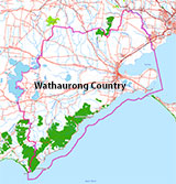
Traditional Owners — This dive site is in the traditional Country of the Wathaurong (Wadda-Warrung) people of the Kulin Nation. This truly ancient Country includes the coastline of Port Phillip, from the Werribee River in the north-east, the Bellarine Peninsula, and down to Cape Otway in the south-west. We wish to acknowledge the Wathaurong as Traditional Owners. We pay respect to their Ancestors and their Elders, past, present and emerging. We acknowledge Bunjil the Creator Spirit of this beautiful land, who travels as an eagle, and Waarn, who protects the waterways and travels as a crow, and thank them for continuing to watch over this Country today and beyond.
J4 26m Submarine Location Map
Latitude: 38° 17.979′ S (38.299657° S / 38° 17′ 58.77″ S)
Longitude: 144° 33.820′ E (144.563673° E / 144° 33′ 49.22″ E)
Datum: WGS84 |
Google Map
Added: 2012-07-22 09:00:00 GMT, Last updated: 2022-05-08 02:46:51 GMT
Source: Book - Victoria's Ships' Graveyard GPS (verified)
Nearest Neighbour: Sub Reef, 440 m, bearing 95°, E
J-Class Submarine, 1,820 ton.
Built: Portsmouth, UK, 1915/1916.
Scuttled: 28 April 1927.
Victorian Ships' Graveyard, Bass Strait.
Depth: 19 to 28 m.
[ Top ]
DISCLAIMER: No claim is made by The Scuba Doctor as to the accuracy of the dive site coordinates listed here. Should anyone decide to use these GPS marks to locate and dive on a site, they do so entirely at their own risk. Always verify against other sources.
The marks come from numerous sources including commercial operators, independent dive clubs, reference works, and active divers. Some are known to be accurate, while others may not be. Some GPS marks may even have come from maps using the AGD66 datum, and thus may need be converted to the WGS84 datum. To distinguish between the possible accuracy of the dive site marks, we've tried to give each mark a source of GPS, Google Earth, or unknown.
Copyright © 2005-2022 by The Scuba Doctor Australia, ABN 88 116 755 170. All rights reserved.
tel. +61 3 5985 1700 :: email. diveshop@scubadoctor.com.au :: Web site by it'sTechnical 2022










![Halcyon Infinity 30lb System [SS Small Backplate] Halcyon Infinity 30lb System [SS Small Backplate]](/diveshop/images/halcyon/Halcyon-Evolve-Wing.jpg)


