Navigation
The Scuba Doctor tries to only carry the best of the best and provide you with the best value for money prices. This means we carry the best product of the best swimming brands in each product category, ensuring the swimmer's need for a quality product that performs for the intended use is always met. This includes all swimming accessories consisting of ear plugs, towels, sports bottles, nose clips, hair and body products designed especially for swimmers.
Middle Brighton Pier
![]() Pier Dive |
Pier Dive | ![]() Shore access
Shore access
![]()
![]()
![]()
![]()
![]()
![]()
Depth: 2 m (6.56 ft) to 8 m (26 ft)
Level: Open Water and beyond.
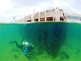
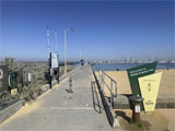
The Middle Brighton Pier site is a good, safe controlled training area excellent for divers just getting into the sport. Head out past the Brighton Baths and across the sandy flats along the southern edge rock wall.
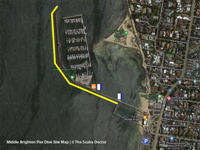
Park and gear up as close to the entry/exit point as possible as there is a very gentle and paved ramp leading right into the water from the car park if you wish to dive around the sea baths and the reef further out. To dive the breakwater you can enter from the first or second landing. It is better not to do a giant stride as the water is shallow, just climb down the ladder.
Under the pier there isn't much life around other than seastars. Out along the breakwater is quite nice with lots of nooks and crannies to find blennies, starfish, zebrafish, moonlighters, leatherjackets, seahorse and life similar to South Road. It is nice to ascend along the back wall to see a cool view of the CBD before heading back to the pier. You can combine diving the breakwater with the reef if you reach the corner of the breakwater and swim out diagonally SW.
Best dived midweek, or as a night dive, when the car parking is easier.
Location: Brighton
MELWAY Ref: Page 67 C10
Weather Required: The northern breakwater of the adjacent marina coupled with the shallow water to the north should offer protection from northerly winds. This site should also be diveable in easterlies and south easterlies and possibly north westerlies.
See WillyWeather (Brighton) as a guide for the tide times and the height of the tide.
Facilities: Public toilets open during the day near the cafe. A parking fee is required at all times of the year including public holidays. The parking ticket machine also accepts credit cards. There is good lighting at night.
Spearfishing is illegal within 30 metres of any pier or jetty and in Marine National Parks. See Spearfishing Laws.
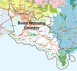
Traditional Owners — This dive site is in the traditional Country of the Boon Wurrung / Bunurong people of the Kulin Nation. This truly ancient Country includes parts of Port Phillip, from the Werribee River in the north-west, down to Wilson's Promontory in the south-east, including the Mornington Peninsula, French Island and Phillip Island, plus Western Port. We wish to acknowledge the Boon Wurrung as Traditional Owners. We pay respect to their Ancestors and their Elders, past, present and emerging. We acknowledge Bunjil the Creator Spirit of this beautiful land, who travels as an eagle, and Waarn, who protects the waterways and travels as a crow, and thank them for continuing to watch over this Country today and beyond.
Middle Brighton Pier Location Map
Latitude: 37° 54.523′ S (37.908713° S / 37° 54′ 31.37″ S)
Longitude: 144° 58.941′ E (144.982345° E / 144° 58′ 56.44″ E)
Datum: WGS84 |
Google Map
| Get directions
Added: 2012-07-22 09:00:00 GMT, Last updated: 2022-03-22 14:55:44 GMT
Source: Google Earth
Nearest Neighbour: Middle Brighton Baths, 319 m, bearing 129°, SE
Brighton, Bayside, Port Phillip.
Depth: 2 to 8 m.
[ Top ]
DISCLAIMER: No claim is made by The Scuba Doctor as to the accuracy of the dive site coordinates listed here. Should anyone decide to use these GPS marks to locate and dive on a site, they do so entirely at their own risk. Always verify against other sources.
The marks come from numerous sources including commercial operators, independent dive clubs, reference works, and active divers. Some are known to be accurate, while others may not be. Some GPS marks may even have come from maps using the AGD66 datum, and thus may need be converted to the WGS84 datum. To distinguish between the possible accuracy of the dive site marks, we've tried to give each mark a source of GPS, Google Earth, or unknown.
Copyright © 2005-2022 by The Scuba Doctor Australia, ABN 88 116 755 170. All rights reserved.
tel. +61 3 5985 1700 :: email. diveshop@scubadoctor.com.au :: Web site by it'sTechnical 2022







![Halcyon Infinity 30lb System [SS Small Backplate] Halcyon Infinity 30lb System [SS Small Backplate]](/diveshop/images/halcyon/Halcyon-Evolve-Wing.jpg)


