Navigation
Murnanes Bay
![]() Reef Dive |
Reef Dive | ![]() Shore access
Shore access
![]()
![]()
![]()
Depth: 1 m (3.28 ft) to 10 m (33 ft)
Level: Open Water and beyond.
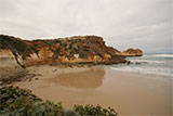
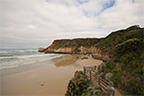
Murnane's Bay (aka Murane Bay) dive site is a more deeply embayed, 80-metre long beach, that still receives waves averaging 1 metre. It lies on the Shipwreck Coast of Victoria and is part of the Bay of Islands Coastal Park which continues on from the Port Campbell National Park at Peterborough and extends through to Warrnambool.
Murnane's Bay is a 25-minute drive from Warrnambool along the Great Ocean Road. It features limestone stacks protruding from the water. Here you can have the iconic Twelve Apostle experience from the shore free from the crowds. The waves can be wild here so it can only be dived on very calm days.
There are toilets and a car park above the beach, with steps down to the beach. The beach is low and flat and awash at high tide. It has a shallow surf including a few reefs and rocks. A permanent rip runs out of the bay and there is a sea arch in the making on the eastern headland.
There is plenty of interesting structure to explore and marine life to see at Murnane's Bay.
Murnane's Bay is best dived at high tide. See WillyWeather (Childers Cove) as a guide for the tide times and the height of the tide.
{{southern-ocean-warning}}Traditional Owners — This dive site is in the traditional Country of the Eastern Maar people of south-western Victoria between the Shaw and Eumerella Rivers and from Yambuk in the south to beyond Lake Linlithgow in the north. This truly ancient Country extends as far north as Ararat and encompasses the coastal townships of Port Fairy in the west, Warrnambool, Peterborough, Port Campbell, Apollo Bay, Lorne, and Airies Inlet in the east, including the Great Ocean Road area. It also stretches 100 metres out to sea from low tide and therefore includes the iconic Twelve Apostles. "Eastern Maar" is a name adopted by the people who identify as Maar, Eastern Gunditjmara, Tjap Wurrung, Peek Whurrong, Kirrae Whurrung, Kuurn Kopan Noot and/or Yarro waetch (Tooram Tribe) amongst others. We wish to acknowledge the Eastern Maar as Traditional Owners. We pay respect to their Ancestors and their Elders, past, present and emerging.
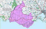
Murnanes Bay Location Map
Latitude: 38° 29.426′ S (38.49044° S / 38° 29′ 25.58″ S)
Longitude: 142° 40.584′ E (142.6764° E / 142° 40′ 35.04″ E)
Datum: WGS84 |
Google Map
| Get directions
Added: 2021-06-04 16:02:32 GMT, Last updated: 2022-05-23 19:27:30 GMT
Source: Google Earth
Nearest Neighbour: Childers Cove, 303 m, bearing 292°, WNW
Shipwreck Coast.
Depth: 1 to 10 m.
[ Top ]
DISCLAIMER: No claim is made by The Scuba Doctor as to the accuracy of the dive site coordinates listed here. Should anyone decide to use these GPS marks to locate and dive on a site, they do so entirely at their own risk. Always verify against other sources.
The marks come from numerous sources including commercial operators, independent dive clubs, reference works, and active divers. Some are known to be accurate, while others may not be. Some GPS marks may even have come from maps using the AGD66 datum, and thus may need be converted to the WGS84 datum. To distinguish between the possible accuracy of the dive site marks, we've tried to give each mark a source of GPS, Google Earth, or unknown.
Copyright © 2005-2022 by The Scuba Doctor Australia, ABN 88 116 755 170. All rights reserved.
tel. +61 3 5985 1700 :: email. diveshop@scubadoctor.com.au :: Web site by it'sTechnical 2022







![Halcyon Infinity 30lb System [SS Small Backplate] Halcyon Infinity 30lb System [SS Small Backplate]](/diveshop/images/halcyon/Halcyon-Evolve-Wing.jpg)


