Navigation
If you intend to do underwater photography or videography, a bright wide beam light is a necessity to adequately light your subjects. At The Scuba Doctor, our goal is to be your source for quality photo and video lights, but not overwhelm you with thousands of choices.
Extreme sports action video cameras like the GoPro, WASPcam and Intova Edge are all the rage, and we have the perfect video lights and mount equipment for them. We also have focus lights for underwater cameras. If you have any questions, or would like to special order something you don't see below, just contact our customer service team.
Nuns Beach
![]() Reef Dive |
Reef Dive | ![]() Shore access
Shore access
![]()
![]()
![]()
![]()
Depth: 2 m (6.56 ft) to 14 m (46 ft)
Level: Open Water and beyond.
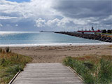
Nuns Beach (aka Nunns Beach) is a heavily modified and now artificial beach located at Portland, on Portland Bay (aka Henty Bay) on Victoria's Discovery Coast.
Nuns Beach lies immediately north of Portland Harbour and is backed by a car park along Lee Breakwater Road. A long beach originally ran below the white limestone cliffs on either side of Portland Harbour. The harbour construction resulted in erosion of most of this beach and exposure of the backing cliffs. Some sand accumulated on the northern side of the harbour breakwater to form Nuns Beach. In addition, a groyne has been built at the northern end of the 300 metre long, east facing beach. In 1990, sand from Pivot Beach was dumped here to replenish the beach. The beach is well protected by Cape Nelson and the harbour walls. Waves average less than 0.5 metre which, with the fine beach sand, ensures a low, shallow beach and attached bar.
Diving and Snorkelling at Nuns Beach
This dive is parallel to the Portland Lee Breakwater wall, 20 to 50 metres north of the wall. Swim due east and from 4 metres deep onwards, signs of reef appear. The reef systems can be sparce or prolific, depending on how far off the Lee Breakwater wall you are.
Looking around these reef systems, you may find Weedy Seadragons, Shaw's Box fish, Angel Sharks, Fiddler Rays, Reef fish, Nudibranchs, sponges, soft corals and false corals.
Location: Lee Breakwater Road, Portland, Victoria 3305
Parking: The best parking is in the parking areas along Lee Breakwater Road, just north of the breakwater. Vehicles can also be parked along Bentinck Street.
Facilities: Toilets, showers and changerooms are available at the shore end of the breakwater.
Safety First: Beware of fishing line as the breakwater is a popular fishing spot. Always carry a good dive knife and/or line cutter. This area is frequented by boats, so please make sure you tow your dive float with dive flag in this area.
Entry/exit: You enter and exit the water off Nuns Beach on the northern side of the Lee Breakwater rock wall. Recreational diving within the boundaries of the breakwaters of Port of Portland is prohibited.
Ideal Conditions: Nuns Beach faces east and is sheltered from westerly to southerly swells by the main breakwater to the south. It's also well protected by winds from most directions, however, easterlies are not favourable to this location. Best dived on a westerly or southerly wind and low swell for the best visibility. See WillyWeather (Nuns Beach) as a guide for the tide times and the height of the tide.
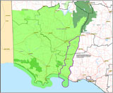
{{southern-ocean-warning}} {{sally-watson}}Traditional Owners — This dive site is in the traditional Country of the Gunditjmara people of far south-western Victoria which continues over the state border into a small part of south-east South Australia and is bordered by the Glenelg River to the west and the Wannon River in the north. This truly ancient Country extends 100 metres out to sea from low tide and also includes Deen Maar (aka Lady Julia Percy Island) where the Gunditjmara believe the spirits of their dead travel to wait to be reborn. We wish to acknowledge the Gunditjmara as Traditional Owners. We pay respect to their Ancestors and their Elders, past, present and emerging.
Nuns Beach Location Map
Latitude: 38° 20.566′ S (38.34277° S / 38° 20′ 33.97″ S)
Longitude: 141° 36.489′ E (141.60815° E / 141° 36′ 29.34″ E)
Datum: WGS84 |
Google Map
| Get directions
Added: 2022-03-12 13:27:04 GMT, Last updated: 2022-05-24 12:48:39 GMT
Source: Google Earth
Nearest Neighbour: Portland Lee Breakwater, 54 m, bearing 186°, S
Portland, Discovery Coast.
Depth: 2 to 14 m.
[ Top ]
DISCLAIMER: No claim is made by The Scuba Doctor as to the accuracy of the dive site coordinates listed here. Should anyone decide to use these GPS marks to locate and dive on a site, they do so entirely at their own risk. Always verify against other sources.
The marks come from numerous sources including commercial operators, independent dive clubs, reference works, and active divers. Some are known to be accurate, while others may not be. Some GPS marks may even have come from maps using the AGD66 datum, and thus may need be converted to the WGS84 datum. To distinguish between the possible accuracy of the dive site marks, we've tried to give each mark a source of GPS, Google Earth, or unknown.
Copyright © 2005-2022 by The Scuba Doctor Australia, ABN 88 116 755 170. All rights reserved.
tel. +61 3 5985 1700 :: email. diveshop@scubadoctor.com.au :: Web site by it'sTechnical 2022








![Halcyon Infinity 30lb System [SS Small Backplate] Halcyon Infinity 30lb System [SS Small Backplate]](/diveshop/images/halcyon/Halcyon-Evolve-Wing.jpg)


