Navigation
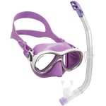
These mask and snorkel sets from The Scuba Doctor are top quality options for scuba diving and snorkelling.
Note: For child and junior sized mask and snorkel sets, please look at our Kids Corner.
Ocean Drive, Port Fairy
![]() Reef Dive |
Reef Dive | ![]() Shore access
Shore access
![]()
![]()
![]()
![]()
![]()
Depth: 2 m (6.56 ft) to 20 m (66 ft)
Level: Open Water and beyond.
Ocean Drive is a diving and snorkelling site which lies on the south side of Port Fairy on Victoria's Shipwreck Coast where Ocean Drive intersects with Phillip Street. It's to the west of Pea Soup Beach.
Diving and Snorkelling at Ocean Drive, Port Fairy
The Ocean Drive, Port Fairy beach faces south into the Southern Ocean and has lots of fish and invertebrate life. Nice site for snorkelling.
Best option is to explore the reefs to the east and west. Night diving is great here too, lots of critters including Maori Octopus and Dumpling Squid come out at night.
Location: Ocean Drive & Phillip Street, Port Fairey, Victoria 3284
Beach Marker: Ocean Drive 3
Parking: There is roadside parking along Ocean Drive, Port Fairey. Before gearing up check out the water. If you see lots of white water, head on home.
Safety First: This area is frequented by boats, so please make sure you display your dive flag in this area.
Entry/exit: Enter and exit from the beach.
Ideal Conditions: Diving Ocean Drive, Port Fairy requires calm conditions, a very low swell, plus light offshore north-westerly to north-easterly winds. See WillyWeather (Pea Soup Beach) as a guide for the tide times and the height of the tide.
Boat Launching: You can also tackle this as a boat dive site. Boats can be launched at the Port Fairy, Griffiths Street Boat Ramp.
{{southern-ocean-warning}}Traditional Owners — This dive site is in the traditional Country of the Eastern Maar people of south-western Victoria between the Shaw and Eumerella Rivers and from Yambuk in the south to beyond Lake Linlithgow in the north. This truly ancient Country extends as far north as Ararat and encompasses the coastal townships of Port Fairy in the west, Warrnambool, Peterborough, Port Campbell, Apollo Bay, Lorne, and Airies Inlet in the east, including the Great Ocean Road area. It also stretches 100 metres out to sea from low tide and therefore includes the iconic Twelve Apostles. "Eastern Maar" is a name adopted by the people who identify as Maar, Eastern Gunditjmara, Tjap Wurrung, Peek Whurrong, Kirrae Whurrung, Kuurn Kopan Noot and/or Yarro waetch (Tooram Tribe) amongst others. We wish to acknowledge the Eastern Maar as Traditional Owners. We pay respect to their Ancestors and their Elders, past, present and emerging.
Ocean Drive, Port Fairy Location Map
Latitude: 38° 23.521′ S (38.39201° S / 38° 23′ 31.24″ S)
Longitude: 142° 13.223′ E (142.220385° E / 142° 13′ 13.39″ E)
Datum: WGS84 |
Google Map
| Get directions
Added: 2022-05-19 11:52:46 GMT, Last updated: 2022-05-24 18:57:18 GMT
Source: Google Earth
Nearest Neighbour: Water Tower, Port Fairy, 816 m, bearing 244°, WSW
Port Fairy, Shipwreck Coast.
Depth: 2 to 20 m.
[ Top ]
DISCLAIMER: No claim is made by The Scuba Doctor as to the accuracy of the dive site coordinates listed here. Should anyone decide to use these GPS marks to locate and dive on a site, they do so entirely at their own risk. Always verify against other sources.
The marks come from numerous sources including commercial operators, independent dive clubs, reference works, and active divers. Some are known to be accurate, while others may not be. Some GPS marks may even have come from maps using the AGD66 datum, and thus may need be converted to the WGS84 datum. To distinguish between the possible accuracy of the dive site marks, we've tried to give each mark a source of GPS, Google Earth, or unknown.
Copyright © 2005-2022 by The Scuba Doctor Australia, ABN 88 116 755 170. All rights reserved.
tel. +61 3 5985 1700 :: email. diveshop@scubadoctor.com.au :: Web site by it'sTechnical 2022







![Halcyon Infinity 30lb System [SS Small Backplate] Halcyon Infinity 30lb System [SS Small Backplate]](/diveshop/images/halcyon/Halcyon-Evolve-Wing.jpg)


