Navigation
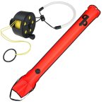
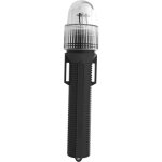
If you're separated from the boat while scuba diving, getting attention can be a matter of life and death. We're constantly evaluating the latest emergency signaling devices to see how they perform against our existing favourites. Be seen and heard with our selection of the best visual and audible signaling gear.
Please keep the following in mind...
- Even small SMBs are more visible than a diver with no signaling device.
- By twilight, lights are far easier to spot than even the most visible SMBs are in daylight.
- Flashing lights aren’t particularly more noticeable than non-flashing, but a benefit of a flash or strobe mode is that it dramatically increases battery life.
Point Lonsdale Back Beach
![]() Reef Dive |
Reef Dive | ![]() Shore access
Shore access
![]()
![]()
![]()
![]()
Depth: 1 m (3.28 ft) to 10 m (33 ft)
Level: Advanced Open Water and beyond.
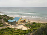
Point Lonsdale Back Beach (aka Point Lonsdale Back Surf Beach) is a challenging site for experienced divers and snorkellers and the home of the Point Lonsdale Surf Lifesaving Club. The beach lies on the Barwon Coast of the Bellarine Peninsula and faces south-west into Bass Strait.
This 'back beach' is extremely popular over the summer months with locals and visitors alike. However, it also requires respect and caution — strong permanent rips decorate the beach and can catch out unsuspecting swimmers. The entry point is about 150 metres west of the Port Phillip Heads Marine National Park, so the chances are some of you dive could be within this area.
Point Lonsdale forms the western side of Port Phillip Heads, with The Rip separating it from Point Nepean. The town of Point Lonsdale has a protected bay beach and more exposed ocean beaches. The main ocean beach is known as the Surf or Back Beach and is the site of Point Lonsdale Surf Life Saving Club. A walking track leads from the surf club over the dunes to the beach. Surf Beach extends for 900 metres from a wide, intertidal rock platform, located just east of the surf lifesaving club, to where more rocks and reefs outcrop in the surf. In fact, low tide rock flats dominate this beach and are clearly visible at low tide. The beach faces south-west and receives waves averaging 1.4 metre, which produce a single attached bar, cut by strong rips every 250 metres. In addition, strong permanent rips run out against some of the reefs, the worst being The Escalator to the left of the club house. These rips have been responsible for many rescues, with an average of 30 each year. There have also been drownings at the beach, so be very wary.
There is plenty of interesting reef to explore south-west out from the beach. You can also head east to check out the Glaneuse Reef area.
Location: Between Laker Drive & Buckley Road on Ocean Road, Point Lonsdale, Victoria 3225
MELWAY Ref: Page 499 J7
Beach Marker: 3W
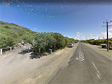
Parking: From Geelong take the Bellarine Highway (B110) and turn right onto Fellows Road. Fellows Road turns left and becomes Ocean Road. There is parking along both sides of Ocean Road, plus at the Point Lonsdale Surf Lifesaving Club and the Ganes Reserve Playground between Laker Drive and Buckley Road. Before gearing up check out the water. If you see lots of white water, head on home.
Warning: Point Lonsdale Back Beach is a highly hazardous beach owing to the waves and strong permanent and shifting rips, together with rocks and reefs. Beach breaks are common over the numerous reefs, with the best known as Glaneuse Reef, located just east of here and adjacent to The Escalator rip. It offers a good left over the reef. Always go with a buddy and be extremely careful. Experienced divers and snorkellers only.
Entry/Exit: From Point Lonsdale Back Beach at beach marker 3W, the rescue base for the surf lifesaving club.
Ideal Conditions: Conditions are usually best with no wind or after a few days of northerlies as surface conditions remain calm. Diving and snorkelling is best with light northerly winds, a low swell at mid to high tide, as the reefs are exposed at low tide.
See WillyWeather (Point Lonsdale Back Beach) as a guide for the tide times and the height of the tide.
Bass Strait Warning: Always keep an eye on sea conditions throughout any shore or boat dive in Bass Strait on Victoria's coastline. Please read the warnings on the web page diving-in-bass-strait before diving or snorkelling this site.
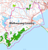
Traditional Owners — This dive site is in the traditional Country of the Wathaurong (Wadda-Warrung) people of the Kulin Nation. This truly ancient Country includes the coastline of Port Phillip, from the Werribee River in the north-east, the Bellarine Peninsula, and down to Cape Otway in the south-west. We wish to acknowledge the Wathaurong as Traditional Owners. We pay respect to their Ancestors and their Elders, past, present and emerging. We acknowledge Bunjil the Creator Spirit of this beautiful land, who travels as an eagle, and Waarn, who protects the waterways and travels as a crow, and thank them for continuing to watch over this Country today and beyond.
Point Lonsdale Back Beach Location Map
Latitude: 38° 17.343′ S (38.289056° S / 38° 17′ 20.6″ S)
Longitude: 144° 36.249′ E (144.604154° E / 144° 36′ 14.95″ E)
Datum: WGS84 |
Google Map
| Get directions
Added: 2022-04-07 15:53:55 GMT, Last updated: 2022-04-07 17:26:50 GMT
Source: Google Earth
Nearest Neighbour: Glaneuse Reef, 395 m, bearing 130°, SE
Point Lonsdale, Bellarine Peninsula.
Depth: 1 to 10 m.
[ Top ]
DISCLAIMER: No claim is made by The Scuba Doctor as to the accuracy of the dive site coordinates listed here. Should anyone decide to use these GPS marks to locate and dive on a site, they do so entirely at their own risk. Always verify against other sources.
The marks come from numerous sources including commercial operators, independent dive clubs, reference works, and active divers. Some are known to be accurate, while others may not be. Some GPS marks may even have come from maps using the AGD66 datum, and thus may need be converted to the WGS84 datum. To distinguish between the possible accuracy of the dive site marks, we've tried to give each mark a source of GPS, Google Earth, or unknown.
Copyright © 2005-2022 by The Scuba Doctor Australia, ABN 88 116 755 170. All rights reserved.
tel. +61 3 5985 1700 :: email. diveshop@scubadoctor.com.au :: Web site by it'sTechnical 2022








![Halcyon Infinity 30lb System [SS Small Backplate] Halcyon Infinity 30lb System [SS Small Backplate]](/diveshop/images/halcyon/Halcyon-Evolve-Wing.jpg)


