Navigation
Every freediver knows how important the little things are to make your dive go smoothly. Here at The Scuba Doctor dive shop you will find the Freediving Accessories and Spares you need to have a successful outing.
Portland Bay Reef
![]() Reef Dive |
Reef Dive | ![]() Boat access
Boat access
![]()
![]()
![]()
![]()
Depth: 10 m (33 ft) to 15 m (49 ft)
Level: Open Water and beyond.
Portland Bay Reef (aka Corkscrew Reef) lies off the end of the "corkscrew" in Portland Bay (aka Henty Bay) on Victoria's Discovery Coast.
The original 'Corkscrew' was built as a gift to the Portland Harbour Trust in 1960 by the contractors who constructed the port. It had an observation deck approximately 10 metres above sea level. It was replaced in 2018 as the original structure was unsafe and in dange of collapse.
Diving Portland Bay Reef
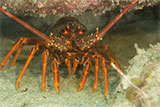
Portland Bay Reef rises from 15 to 10 metres deep and is roughly circular in shape. Weedy Seadragons and Crayfish can be seen as well as a variety of fish. A very nice area for photography.
Location: Portland, Victoria 3305
Safety First: Portland Bay Reef is just outside the Portland Harbour entrance. Check for shipping movements before anchoring here. Best to keep the boat live.
Best dived in good conditions with a low swell. See WillyWeather (Portland Harbour) as a guide for the tide times and the height of the tide.
Portland Bay Reef can be accessed by boat from the Portland Harbour, Lee Breakwater Road North Ramp or the Portland Harbour, Lee Breakwater Road South Ramp.
{{southern-ocean-warning}}Finding the Portland Bay Reef
We are not very confident that the GPS mark we have for Portland Bay Reef is accurate. If anyone has an accurate mark, please pass it on to us.
Divers have the opportunity to catch Southern Rock Lobster (aka Crayfish) at this dive site. Remember your catch bag, current Victorian Recreational Fishing Licence, rock lobster measure, and cray tags. Once you get back to the dive boat, or shore, make sure you clip the tail and tag your Crayfish as per Fisheries requirements. Please abide by all current fishing regulations if you intend to catch crays. See article-catching-crayfish for practical cray hunting advice from The Scuba Doctor, plus melbourne-cray-dives for a list of other crayfish dive sites near Melbourne. For tips on cooking your Crays, please see article-cooking-crayfish.
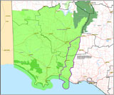
Traditional Owners — This dive site is in the traditional Country of the Gunditjmara people of far south-western Victoria which continues over the state border into a small part of south-east South Australia and is bordered by the Glenelg River to the west and the Wannon River in the north. This truly ancient Country extends 100 metres out to sea from low tide and also includes Deen Maar (aka Lady Julia Percy Island) where the Gunditjmara believe the spirits of their dead travel to wait to be reborn. We wish to acknowledge the Gunditjmara as Traditional Owners. We pay respect to their Ancestors and their Elders, past, present and emerging.
Portland Bay Reef Location Map
Latitude: 38° 20.706′ S (38.3451° S / 38° 20′ 42.36″ S)
Longitude: 141° 37.645′ E (141.627417° E / 141° 37′ 38.7″ E)
Datum: WGS84 |
Google Map
Added: 2022-05-17 08:04:27 GMT, Last updated: 2022-05-24 12:48:39 GMT
Source: Navionics Chart
Nearest Neighbour: Whalers Reef, 1,518 m, bearing 309°, NW
Portland, Discovery Coast.
Depth: 10 to 15 m.
[ Top ]
DISCLAIMER: No claim is made by The Scuba Doctor as to the accuracy of the dive site coordinates listed here. Should anyone decide to use these GPS marks to locate and dive on a site, they do so entirely at their own risk. Always verify against other sources.
The marks come from numerous sources including commercial operators, independent dive clubs, reference works, and active divers. Some are known to be accurate, while others may not be. Some GPS marks may even have come from maps using the AGD66 datum, and thus may need be converted to the WGS84 datum. To distinguish between the possible accuracy of the dive site marks, we've tried to give each mark a source of GPS, Google Earth, or unknown.
Copyright © 2005-2022 by The Scuba Doctor Australia, ABN 88 116 755 170. All rights reserved.
tel. +61 3 5985 1700 :: email. diveshop@scubadoctor.com.au :: Web site by it'sTechnical 2022





![Halcyon Infinity 30lb System [SS Small Backplate] Halcyon Infinity 30lb System [SS Small Backplate]](/diveshop/images/halcyon/Halcyon-Evolve-Wing.jpg)


