Navigation
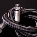
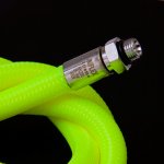
Miflex Xtreme specialist scuba diving low pressure (LP) regulator hoses are available in over 150 colour, length and fitting combinations from 15 cm long to 210 cm long in ten different colours. The Italian manufactured Miflex Xtreme regulator hoses feature an external polyester safety braiding designed to resist the snags and abrasions that divers can often encounter. Unlike traditional rubber hoses, the double braiding is not simply pushed over the hose fittings. Instead, the braiding is tightly bound and fixed to the hose core by the sleeve. The result is performance and durability in extreme situations. All Miflex Xtreme LP regulator hoses are Nitrox Ready as they come Oxygen Cleaned from the factory.
The flexibility of the Miflex Xtreme regulator hose makes the second stage more comfortable in the mouth and results in smoother hose routing, particularly with long hoses. Available in lengths ranging from 10 cm (4 inch) to 210 cm (84 inch). These low-pressure hoses are great for stage/deco bottles, and we offer the 120 cm (48 inch) length commonly used for stage/deco and octopus hoses in your choice of ten colours: Black, Carbon Black, Blue, Red, White, Yellow, Mellow Yellow, Pink, Green and Purple.
Typical LP regulator hoses, including Miflex Xtreme LP regulator hoses, have a 3/8-inch UNF Male fitting at the end that screws into the first stage regulator LP port, and a 9/16-inch UNF Female fitting at the end that screws on to the second stage regulator.
Choosing the Best LP Regulator Hose Length
"Standard" Setup: The most common hose lengths found on 'standard' primary 2nd stage SCUBA regulator setups (the one on the black hose that's typically in your mouth) is 71 cm (28 inch) or 75 cm (30 inch). The most common hose length found on the 'standard' "Octopus" 2nd stage SCUBA regulator setups (the one on the yellow hose that's typically clipped off or in an occy holder) is 90 cm (36 inch), though some people prefer a longer 100 cm (40 inch) hose length.
For many divers, the "standard" primary 2nd stage SCUBA hose length is too long and will cause the hose to "bow out", and create unnecessary drag and tug on the mouth. This makes for an uncomfortable dive, particularly in current. Some experienced divers and instructors choose the slightly shorter hose lengths of 56 cm (22 inch), 60 cm (24 inch) or 65 cm (26 inch), feeling it is more comfortable with less drag and pull.
Experienced Diver / Streamlined Setup: *** Recommended *** Increasingly we see experienced single tank divers using a 100 cm (40 inch) to 150 cm (60 inch) in length, primary 2nd stage SCUBA LP regulator hose routed under their arm with the regulator on a 20/70/110° or 90° swivel (we prefer the 20/70/110° swivel). We also prefer the 'in-between' 120 cm (48 inch) hose length. Experienced divers figure this is the hose that their buddy will grab, or they will donate, in an emergency, thus it should be the longer hose and black, neon yellow, or yellow in colour. They use a shorter 56 cm (22 inch), 60 cm (24 inch) or 65 cm (26 inch) (we prefer the 65 cm) in length, black coloured LP regulator hose for the backup/octopus 2nd stage regulator they will end up breathing from. In this setup, the backup/octopus regulator is typically hung on a necklace directly below the diver's chin.
Stage Setup: The 100 cm (40 inch) length hose is the common choice for technical diving stage, pony and deco regulators. Different hose colours are often used to make it easier to identify which hose is attached to which breathing gas cylinder.
Long Hoses: Many advanced divers and instructors believe the common hose lengths are too short in out-of-air situations and now use a much longer hose, often 150 cm (60 inch) for those who dive open water exclusively. Many technical divers have adopted a length of 210 cm (84 inch) for overhead environments.
Choosing Your Colour Scheme
With so many colour choices in the Miflex Xtreme low-pressure regulator and inflator/jacket/BC hose line up you are free to create your own unique colour scheme.
Technical divers always donate their longer hose primary 2nd stage regulator, and usually don't colour code either regulator. For sport diving with a streamlined configuration, we still prefer the cover of the primary second stage to be black and the cover of the backup (octopus) second stage to be yellow.
For many years the dive industry has supplied the primary 2nd stage regulator coloured black on a short black hose, and the backup/octopus 2nd stage regulator coloured yellow on a longer yellow hose. Most regulator sets still come like this. This setup is based on the notion that in an emergency you will donate your backup/octopus regulator with the yellow cover and hose to your dive buddy.
Training agencies are now realising that this isn't what happens in real life and are starting to teach accordingly. In real life, in an emergency your dive buddy will rip the primary regulator you're breathing from out of your mouth. Your buddy will thus be on a short hose, and you'll be going for your backup/octopus regulator. Not an ideal situation. Thus the training agencies are now suggesting you should have a long hose on your primary 2nd stage regulator, and a short hose on the backup/octopus 2nd stage regulator you'll be switching to.
For this Experienced Diver / Streamlined Setup we suggest the long hose attached to your primary 2nd stage regulator should be coloured Fluro Yellow or Mellow Yellow. The short hose attached to your backup/octopus 2nd stage regulator should be Black or Carbon Black. But you can also use whatever colour choice you prefer for either hose.
If you stick with the traditional (old fashioned) setup, then the cover and hose for your short hose, primary 2nd stage regulator would be coloured Black or Carbon Black. The cover and long hose of your backup/octopus 2nd stage regulator should be Fluro Yellow or Mellow Yellow. But again, you can also use whatever other colour choices you prefer for either hose.
For stage/deco/pony cylinders we suggest using a Green coloured regulator hose for 90+ percent Oxygen mixes. As for gas mixes greater than 21% and less than 90%, we'd suggest using a Fluro Yellow or Mellow Yellow hose, but just take your pick from the many colours available.
Portsea Back Beach Wall
![]() Reef Dive |
Reef Dive | ![]() Boat access
Boat access
![]()
![]()
![]()
![]()
![]()
![]()
Depth: 17 m (56 ft) to 26 m (85 ft)
Level: Advanced Open Water and beyond.
Portsea Back Beach Wall is just outside Port Phillip Heads on the Point Nepean side. The wall runs East to West offshore from the Porstsea Back Beache in Bass Strait, Victoria. It lies an area of scattered reef with depths ranging from 12 to 30 metres.
The sea life in this is area is prolific with Blue Devils, Weedy Seadragons, Seals, Abalone and much more. Crayfish abound under ledges and often they are found in the open, walking around unafraid. Schools of Snapper, Kingfish and Barracouta have been sighted here.
There are so many reefs covering a huge area along the coast here that it's hard to describe the many different sites in this area. Subject to swells and a slight current, it's very weather dependant.
The Soft calcium that comprises most of the terrain in this area has eroded into lots of little swim throughs valleys and overhangs all topped off with a light scattering of kelp. This is a fantastic dive site for an avid fish photographer.
Bass Strait Warning: Always keep an eye on sea conditions throughout any shore or boat dive in Bass Strait on Victoria's coastline. Please read the warnings on the web page diving-in-bass-strait before diving or snorkelling this site.
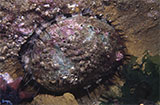
Divers have the opportunity to catch Abalone at this dive site. Remember your catch bag, legal abalone tool, current Victorian Recreational Fishing Licence, and abalone measure. Please abide by all current fishing regulations if you intend to catch abalone.
See article-catching-abalone for practical abalone hunting advice from The Scuba Doctor, plus melbourne-abalone-dives for a list of other Abalone dive sites near Melbourne.
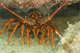
Divers have the opportunity to catch Southern Rock Lobster (aka Crayfish) at this dive site. Remember your catch bag, current Victorian Recreational Fishing Licence, rock lobster measure, and cray tags. Once you get back to the dive boat, or shore, make sure you clip the tail and tag your Crayfish as per Fisheries requirements. Please abide by all current fishing regulations if you intend to catch crays. See article-catching-crayfish for practical cray hunting advice from The Scuba Doctor, plus melbourne-cray-dives for a list of other crayfish dive sites near Melbourne. For tips on cooking your Crays, please see article-cooking-crayfish.
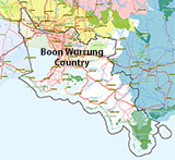
Traditional Owners — This dive site is in the traditional Country of the Boon Wurrung / Bunurong people of the Kulin Nation. This truly ancient Country includes parts of Port Phillip, from the Werribee River in the north-west, down to Wilson's Promontory in the south-east, including the Mornington Peninsula, French Island and Phillip Island, plus Western Port. We wish to acknowledge the Boon Wurrung as Traditional Owners. We pay respect to their Ancestors and their Elders, past, present and emerging. We acknowledge Bunjil the Creator Spirit of this beautiful land, who travels as an eagle, and Waarn, who protects the waterways and travels as a crow, and thank them for continuing to watch over this Country today and beyond.
Portsea Back Beach Wall Location Map
Latitude: 38° 20.787′ S (38.34645° S / 38° 20′ 47.22″ S)
Longitude: 144° 41.595′ E (144.69325° E / 144° 41′ 35.7″ E)
Datum: WGS84 |
Google Map
Added: 2012-07-22 09:00:00 GMT, Last updated: 2022-05-08 00:17:57 GMT
Source: GPS
Nearest Neighbour: Toms Reef, 312 m, bearing 134°, SE
Depth: 17 to 26 m.
[ Top ]
DISCLAIMER: No claim is made by The Scuba Doctor as to the accuracy of the dive site coordinates listed here. Should anyone decide to use these GPS marks to locate and dive on a site, they do so entirely at their own risk. Always verify against other sources.
The marks come from numerous sources including commercial operators, independent dive clubs, reference works, and active divers. Some are known to be accurate, while others may not be. Some GPS marks may even have come from maps using the AGD66 datum, and thus may need be converted to the WGS84 datum. To distinguish between the possible accuracy of the dive site marks, we've tried to give each mark a source of GPS, Google Earth, or unknown.
Copyright © 2005-2022 by The Scuba Doctor Australia, ABN 88 116 755 170. All rights reserved.
tel. +61 3 5985 1700 :: email. diveshop@scubadoctor.com.au :: Web site by it'sTechnical 2022








![Halcyon Infinity 30lb System [SS Small Backplate] Halcyon Infinity 30lb System [SS Small Backplate]](/diveshop/images/halcyon/Halcyon-Evolve-Wing.jpg)


