Navigation
St Leonards Pier
![]() Pier Dive |
Pier Dive | ![]() Shore access
Shore access
![]()
![]()
![]()
![]()
![]()
No Swimming or Diving Beneath St Leonards Pier or Piles — In the interest of public safety Parks Victoria recommends that divers, snorkellers and swimmers do not dive beneath the pier and its piles. This is due to observed deterioration of concrete on the underside of the deck of St Leonards Pier. This deterioration can result in possible concrete spalling into the water. Signage will be displayed on site to notify members of the public of this hazard. Parks Victoria will continue to monitor the condition of the pier and advise stakeholders of any further change in condition. 30-Oct-20
Depth: 4 m (13 ft) to 6 m (20 ft)
Level: Open Water and beyond.
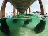
St Leonards Pier (aka St Leonards Jetty and Breakwater) is rated as the best pier dive on the Bellarine Peninsula. With plenty of colour and growth on the pylons, this dive site is well worth a visit day or night either diving or snorkelling. Great site for macro photography.
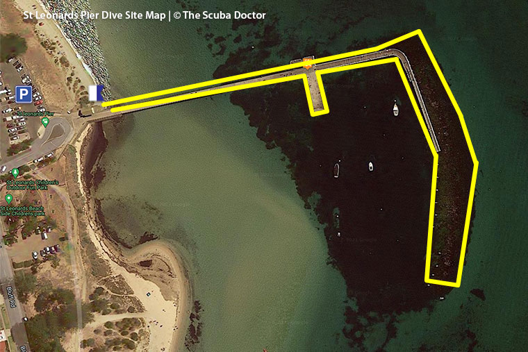
St Leonards Pier faces east-north-east and extends from the Bellarine Peninsula about 200 metres into Port Phillip. At the head there is another section running at 90 degrees for about 65 metres.
Diving and Snorkelling at St Leonards Pier
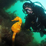
Over years and years, the pylons have attracted diverse underwater creatures: on a typical day, you'll see seahorses, nudibranchs, puffer fish, Old Wives, Globefish, wrasse leatherjackets, Common Stargazers (recognisable by the eyes on top of their heads), rays and seastars during the day, among many others. Octopus, Giant Australian Cuttlefish and Southern Bobtail Squid (aka Southern Dumpling Squid) appear at night.
There is an unidentified shipwreck at this dive site, on the northern side of the main pier, close to shore. It's believed to have sunk in the 1850s, and it's worth having a look at. There are some wooden ribs sticking out of the sand.
As the dive site is quite sheltered, it's sometimes used for beginner dive training.
"St Leonards' Locals" by Mary Malloy.
See also, St. Leonard's Pier and Wreck in "Shore Dives of Victoria" by Ian Lewis, 3rd edition page 61.
Location: The Esplanade, St Leonards, Victoria 3223
MELWAY Ref: Page 460 C9
Beach Marker: 24B
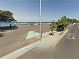
Parking: There is car parking off The Esplanade between Harvey Road and Murradoc Road (aka Drysdale-St Leonard Road), St Leonards. Before gearing up check out the water. If you see lots of white water, head on home.
Facilities: South of the pier is Harvey Park featuring BBQ facilities and a playground that overlooks the beach.
Safety First: St Leonards Pier is a popular fishing spot, so you should always carry a dive knife and/or a line cutter.
Entry/exist: From the car park, walk down to the beach, and enter under the pier. Alternatively, you can do a giant stride off the lower landing, located on the northern side of the pier.
Ideal Conditions: St Leonards Pier is protected from west and south winds. A great site when major winds are coming from the north-west, west and south-west.
See WillyWeather (St Leonards) as a guide for the tide times and the height of the tide. See also St Leonards Surf Cam.
Spearfishing is illegal within 30 metres of any pier or jetty and in Marine National Parks. See Spearfishing Laws.
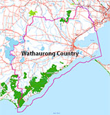
Traditional Owners — This dive site is in the traditional Country of the Wathaurong (Wadda-Warrung) people of the Kulin Nation. This truly ancient Country includes the coastline of Port Phillip, from the Werribee River in the north-east, the Bellarine Peninsula, and down to Cape Otway in the south-west. We wish to acknowledge the Wathaurong as Traditional Owners. We pay respect to their Ancestors and their Elders, past, present and emerging. We acknowledge Bunjil the Creator Spirit of this beautiful land, who travels as an eagle, and Waarn, who protects the waterways and travels as a crow, and thank them for continuing to watch over this Country today and beyond.
St Leonards Pier Location Map
Latitude: 38° 10.213′ S (38.170223° S / 38° 10′ 12.8″ S)
Longitude: 144° 43.246′ E (144.720771° E / 144° 43′ 14.78″ E)
Datum: WGS84 |
Google Map
| Get directions
Added: 2012-07-22 09:00:00 GMT, Last updated: 2022-04-18 14:23:19 GMT
Source: Google Earth
Nearest Neighbour: Governor Reef, 1,873 m, bearing 18°, NNE
St Leonards, Bellarine Peninsula.
Depth: 4 to 6 m.
[ Top ]
DISCLAIMER: No claim is made by The Scuba Doctor as to the accuracy of the dive site coordinates listed here. Should anyone decide to use these GPS marks to locate and dive on a site, they do so entirely at their own risk. Always verify against other sources.
The marks come from numerous sources including commercial operators, independent dive clubs, reference works, and active divers. Some are known to be accurate, while others may not be. Some GPS marks may even have come from maps using the AGD66 datum, and thus may need be converted to the WGS84 datum. To distinguish between the possible accuracy of the dive site marks, we've tried to give each mark a source of GPS, Google Earth, or unknown.
Copyright © 2005-2022 by The Scuba Doctor Australia, ABN 88 116 755 170. All rights reserved.
tel. +61 3 5985 1700 :: email. diveshop@scubadoctor.com.au :: Web site by it'sTechnical 2022




![Halcyon Infinity 30lb System [SS Small Backplate] Halcyon Infinity 30lb System [SS Small Backplate]](/diveshop/images/halcyon/Halcyon-Evolve-Wing.jpg)


