Navigation
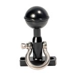
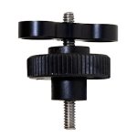
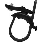
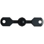
A good tray and arm system is often overlooked when building up an underwater camera set-up. A sturdy tray is not only for attaching lights on to your system but also for enhanced image stability. A clever underwater photographer also uses their arm system for buoyancy control by adding arm sections that provide lift underwater for their otherwise heavy photographic equipment.
Underwater camera trays and arm come in all shapes and styles and not everything will fit everything else. If you are unsure what kind of arm system is best for you don't hesitate to contact us. We'd be happy to advise you on this.
The Scuba Doctor is one of the largest dive retailers and mail order suppliers of new Scuba Gear plus Underwater Arms, Camera Trays and Mounts. The best combination of quality services, vast selection, knowledgeable staff and competitive pricing.
Please see our guide to Underwater Camera Arms and Trays for more about the foundations of your underwater lighting setup.
The Hole, 13th Beach
![]() Reef Dive |
Reef Dive | ![]() Shore access
Shore access
![]()
![]()
![]()
![]()
![]()
Depth: 1 m (3.28 ft) to 12 m (39 ft)
Level: Open Water and beyond.
The Hole, 13th Beach (aka Bull Plateau) lies towards the eastern end of Thirteenth Beach, west of Barwon Heads on Victoria's Surf Coast facing south into Bass Strait. Charelemont Reef lies about 900 metres offshore.
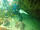
This site makes for exhilarating snorkelling and diving when conditions permit. There is a plateau of reef covered in bull kelp and crayweed. Further out there is a drop off and an area of wonderful marine life.
Thirteenth Beach: The name is taken from the close proximity of the beach to the thirteenth hole of the Barwon Heads Golf Course. Thirteenth Beach is part of the 7 kilometres long section of coast between Barwon Heads (to the east) and Black Rock (to the west) and faces essentially due south. The beach receives waves averaging 1.5 metres, is moderately sloping and is in places fronted by bars. Strong permanent rips lie east of the Barwon Heads 13th Beach Surf Life Savings Club. Barwon Bluff Marine Sanctuary lies at the eastern end of 13th Beach. The western end is adjacent to the Black Rock sewer outlet and should be avoided. The beach is backed by a vegetated foredune for most of its length, including Barwon Heads to Torquay Road.
Location: Barwon Heads, Victoria 3227
MELWAY Ref: Page 497 A6
Beach Marker: 30W
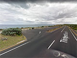
Parking: When heading south from Barwon Heads on Ewing Blyth Drive it curves right and becomes Thirteenth Beach Road. The first car park on Thirteenth Beach Road, past Barwon Bluff, is where you need to be. If you see lots of white water, head on home. If conditions are right, gear up and walk down the steps at the western end of the parking area onto Thirteenth Beach.
Entry/Exit: From Thirteenth Beach.
Ideal Conditions: Thirteenth Beach is a popular surf beach with plenty of strong permanent rips. Conditions need to be very calm with little wind, flat seas, and no swell to safely snorkel or dive here. The beach faces faces south, so light offshore northerly winds can be acceptable. See WillyWeather (Thirteenth Beach) as a guide for the tide times and the height of the tide.
Bass Strait Warning: Always keep an eye on sea conditions throughout any shore or boat dive in Bass Strait on Victoria's coastline. Please read the warnings on the web page diving-in-bass-strait before diving or snorkelling this site.
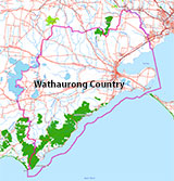
Traditional Owners — This dive site is in the traditional Country of the Wathaurong (Wadda-Warrung) people of the Kulin Nation. This truly ancient Country includes the coastline of Port Phillip, from the Werribee River in the north-east, the Bellarine Peninsula, and down to Cape Otway in the south-west. We wish to acknowledge the Wathaurong as Traditional Owners. We pay respect to their Ancestors and their Elders, past, present and emerging. We acknowledge Bunjil the Creator Spirit of this beautiful land, who travels as an eagle, and Waarn, who protects the waterways and travels as a crow, and thank them for continuing to watch over this Country today and beyond.
The Hole, 13th Beach Location Map
Latitude: 38° 17.324′ S (38.288726° S / 38° 17′ 19.41″ S)
Longitude: 144° 29.216′ E (144.486934° E / 144° 29′ 12.96″ E)
Datum: WGS84 |
Google Map
| Get directions
Added: 2022-04-02 13:37:42 GMT, Last updated: 2022-04-03 12:43:22 GMT
Source: Google Earth
Nearest Neighbour: Barwon Bluff South, 964 m, bearing 102°, ESE
Barwon Heads, Surf Coast.
Depth: 1 to 12 m.
[ Top ]
DISCLAIMER: No claim is made by The Scuba Doctor as to the accuracy of the dive site coordinates listed here. Should anyone decide to use these GPS marks to locate and dive on a site, they do so entirely at their own risk. Always verify against other sources.
The marks come from numerous sources including commercial operators, independent dive clubs, reference works, and active divers. Some are known to be accurate, while others may not be. Some GPS marks may even have come from maps using the AGD66 datum, and thus may need be converted to the WGS84 datum. To distinguish between the possible accuracy of the dive site marks, we've tried to give each mark a source of GPS, Google Earth, or unknown.
Copyright © 2005-2022 by The Scuba Doctor Australia, ABN 88 116 755 170. All rights reserved.
tel. +61 3 5985 1700 :: email. diveshop@scubadoctor.com.au :: Web site by it'sTechnical 2022






![Halcyon Infinity 30lb System [SS Small Backplate] Halcyon Infinity 30lb System [SS Small Backplate]](/diveshop/images/halcyon/Halcyon-Evolve-Wing.jpg)


