Navigation
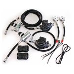
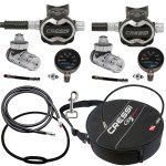
Sidemount diving requires a unique configuration of regulators different from twin sets or single cylinder diving. Dual 1st stages with short HP hoses mount to sidemounted stage cylinders with hose lengths for your needs.
Swivel 1st stages make hose routing easy and natural with a 5th port for further flexibility. Mount the 1st stage on the valve and both your high pressure and low pressure can route straight down your cylinder neatly.
Reversible 2nd stages can be adapted so the hose can be attached to either side. Your short hose can be fitted with an elbow to make the hose routing more natural for the backup 2nd stage and a long hose for your primary donate.
The Pinnacles
![]() Reef Dive |
Reef Dive | ![]() Boat access
Boat access
![]()
![]()
![]()
![]()
Depth: 9 m (30 ft) to 38 m (125 ft)
The Pinnacles are located in the South Eastern area of Phillip Island, well outside Port Phillip Heads and East past Point Nepean in Bass Strait.
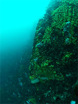
The Pinnacles are a collection of large pinnacles of rock rising from a rocky bottom at 38 metres up 9 metres from the surface. The height of these bommies has attracted large amounts of fish life and they are also covered in lovely coloured soft corals and sponges. This dive site is probably an underwater extension of the land-based site of The Pinnacles granite formations found in the Phillip Island Nature Park, Cape Woolamai.
Diving The Pinnacles
Best done as a boat dive launching from Newhaven on Phillip Island, as it's a long way from The Heads and Point Nepean. Use a plough or sarca anchor in preference to a sand anchor. Anchor in the deep section and check that the swell and wind is holding your anchor line clear of the rising reef structure.
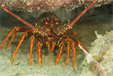
Divers have the opportunity to catch Southern Rock Lobster (aka Crayfish) at this dive site. Remember your catch bag, current Victorian Recreational Fishing Licence, rock lobster measure, and cray tags. Once you get back to the dive boat, or shore, make sure you clip the tail and tag your Crayfish as per Fisheries requirements. Please abide by all current fishing regulations if you intend to catch crays. See article-catching-crayfish for practical cray hunting advice from The Scuba Doctor, plus melbourne-cray-dives for a list of other crayfish dive sites near Melbourne. For tips on cooking your Crays, please see article-cooking-crayfish.
Finding The Pinnacles
Thanks to the work of Peter Beaumont and Packo the GPS marks for The Pinnacles were updated on 5th May 2018. Peter reports the given longitude of 145° 20.226' E is a deep anchoring point some distance west of the 8 to 9 metre soundings at the top of The Pinnacles. Packo suggests first-timers who are sounding for the summit might try somewhere about 15 to 20 metres further east at around 145° 20.240' E.
We have another mystery GPS Mark for The Pinnacles, way south of The Pinnacles GPS mark we're using.
Source: Dive Victoria:
Latitude: 38° 34.683′ S (38.57805° S / 38° 34′ 40.98″ S)
Longitude: 145° 20.216′ E (145.3369333° E / 145° 20′ 12.96″ E)
593 m, bearing 181°, S
It's deep and it's unlikely anything is there. Possibly a transcription error.
Bass Strait Warning: Always keep an eye on sea conditions throughout any shore or boat dive in Bass Strait on Victoria's coastline. Please read the warnings on the web page diving-in-bass-strait before diving or snorkelling this site.
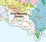
Traditional Owners — This dive site is in the traditional Country of the Boon Wurrung / Bunurong people of the Kulin Nation. This truly ancient Country includes parts of Port Phillip, from the Werribee River in the north-west, down to Wilson's Promontory in the south-east, including the Mornington Peninsula, French Island and Phillip Island, plus Western Port. We wish to acknowledge the Boon Wurrung as Traditional Owners. We pay respect to their Ancestors and their Elders, past, present and emerging. We acknowledge Bunjil the Creator Spirit of this beautiful land, who travels as an eagle, and Waarn, who protects the waterways and travels as a crow, and thank them for continuing to watch over this Country today and beyond.
The Pinnacles Location Map
Latitude: 38° 34.363′ S (38.572717° S / 38° 34′ 21.78″ S)
Longitude: 145° 20.226′ E (145.3371° E / 145° 20′ 13.56″ E)
Datum: WGS84 |
Google Map
Added: 2012-07-22 09:00:00 GMT, Last updated: 2021-06-22 03:15:09 GMT
Source: Peter Beaumont GPS (verified)
Nearest Neighbour: Phillip Island Cray Reef, 1,976 m, bearing 84°, E
Cape Woolamai, Phillip Island.
Depth: 9 to 38 m.
Dive only on: SWF, SWE, Ebb, Flood.
[ Top ]
DISCLAIMER: No claim is made by The Scuba Doctor as to the accuracy of the dive site coordinates listed here. Should anyone decide to use these GPS marks to locate and dive on a site, they do so entirely at their own risk. Always verify against other sources.
The marks come from numerous sources including commercial operators, independent dive clubs, reference works, and active divers. Some are known to be accurate, while others may not be. Some GPS marks may even have come from maps using the AGD66 datum, and thus may need be converted to the WGS84 datum. To distinguish between the possible accuracy of the dive site marks, we've tried to give each mark a source of GPS, Google Earth, or unknown.
Copyright © 2005-2022 by The Scuba Doctor Australia, ABN 88 116 755 170. All rights reserved.
tel. +61 3 5985 1700 :: email. diveshop@scubadoctor.com.au :: Web site by it'sTechnical 2022








![Halcyon Infinity 30lb System [SS Small Backplate] Halcyon Infinity 30lb System [SS Small Backplate]](/diveshop/images/halcyon/Halcyon-Evolve-Wing.jpg)


