Navigation
Our selection of the Top 10 Best scuba diving neoprene and membrane drysuits will keep you warm and comfortable. Just put on the right drysuit undergarments for the conditions and feeling cold will be a thing of the past!
The Plateau
![]() Reef Dive |
Reef Dive | ![]() Boat access
Boat access
![]()
![]()
![]()
![]()
![]()
![]()
![]()
![]()
Depth: 15 m (49 ft) to 45 m (148 ft)
Level: Advanced Open Water and beyond.
The Plateau is a reef dive in the middle of the Port Phillip Heads. The Plateau is a huge rocky platform in around the 16-metre range, winding its way around the edge of this platform is the Entrance Deep. This is the deepest water in Victoria, originally part of the River Yarra. Depths at the bottom of this area are between 40 metres and 103 metres.
Like all dives in this particular area, amazing hard corals and soft sponges can be found on the face, with overhangs and small drop-offs. The dive is certainly one that you'll never forget, especially if the clarity of the water is good. You may even see the dolphins and seals that are know to show up here.
The slack water period here is short, hard to pick, and the currents a little unpredictable. Then of course there is the problem of the dive site being in the shipping channel. Diving is only possible when sea conditions, the tide, and shipping allow. Despite all of that this area is awesome with some fantastic rock formations sheltering an amazing array of sea life.
The Rip & Tides Warning: Always keep an eye on sea conditions throughout any shore or boat dive within "The Rip" (aka "The Heads"). This is a dangerous stretch of water, where Bass Straight meets Port Phillip, which has claimed many ships and lives. Please read the warnings on the web page diving-the-rip before diving or snorkelling this site.
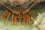
Divers have the opportunity to catch Southern Rock Lobster (aka Crayfish) at this dive site. Remember your catch bag, current Victorian Recreational Fishing Licence, rock lobster measure, and cray tags. Once you get back to the dive boat, or shore, make sure you clip the tail and tag your Crayfish as per Fisheries requirements. Please abide by all current fishing regulations if you intend to catch crays. See article-catching-crayfish for practical cray hunting advice from The Scuba Doctor, plus melbourne-cray-dives for a list of other crayfish dive sites near Melbourne. For tips on cooking your Crays, please see article-cooking-crayfish.
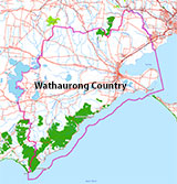
Traditional Owners — This dive site is in the traditional Country of the Wathaurong (Wadda-Warrung) people of the Kulin Nation. This truly ancient Country includes the coastline of Port Phillip, from the Werribee River in the north-east, the Bellarine Peninsula, and down to Cape Otway in the south-west. We wish to acknowledge the Wathaurong as Traditional Owners. We pay respect to their Ancestors and their Elders, past, present and emerging. We acknowledge Bunjil the Creator Spirit of this beautiful land, who travels as an eagle, and Waarn, who protects the waterways and travels as a crow, and thank them for continuing to watch over this Country today and beyond.
The Plateau Location Map
Latitude: 38° 17.621′ S (38.293683° S / 38° 17′ 37.26″ S)
Longitude: 144° 37.976′ E (144.632933° E / 144° 37′ 58.56″ E)
Datum: WGS84 |
Google Map
Added: 2012-07-22 09:00:00 GMT, Last updated: 2022-05-08 03:09:19 GMT
Source: GPS
Nearest Neighbour: 65 Metre Hole, 310 m, bearing 13°, NNE
Depth: 15 to 45 m.
Dive only on: SWE.
[ Top ]
DISCLAIMER: No claim is made by The Scuba Doctor as to the accuracy of the dive site coordinates listed here. Should anyone decide to use these GPS marks to locate and dive on a site, they do so entirely at their own risk. Always verify against other sources.
The marks come from numerous sources including commercial operators, independent dive clubs, reference works, and active divers. Some are known to be accurate, while others may not be. Some GPS marks may even have come from maps using the AGD66 datum, and thus may need be converted to the WGS84 datum. To distinguish between the possible accuracy of the dive site marks, we've tried to give each mark a source of GPS, Google Earth, or unknown.
Copyright © 2005-2022 by The Scuba Doctor Australia, ABN 88 116 755 170. All rights reserved.
tel. +61 3 5985 1700 :: email. diveshop@scubadoctor.com.au :: Web site by it'sTechnical 2022







![Halcyon Infinity 30lb System [SS Small Backplate] Halcyon Infinity 30lb System [SS Small Backplate]](/diveshop/images/halcyon/Halcyon-Evolve-Wing.jpg)


