Navigation
A wetsuit is a garment, usually made of foamed or compressed neoprene, which is worn by surfers, divers, windsurfers, canoeists, and others engaged in water sports, providing thermal insulation, abrasion resistance and buoyancy. The insulation properties depend on bubbles of gas enclosed within the material, which reduce its ability to conduct heat. The bubbles also give the wetsuit a low density, providing buoyancy in water. Contrary to popular beliefs, the layer of warm water normally trapped between the wetsuit and the skin provides very little thermal insulation.
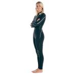
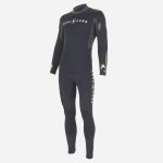
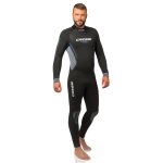
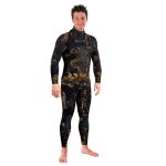
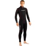
Semi-dry suits are effectively a thick wetsuit with better-than-usual seals at wrist, neck and ankles. The seals limit the volume of water entering and leaving the suit. The wearer gets wet in a semi-dry suit but the water that enters is soon warmed up and does not leave the suit readily, so the wearer remains warm. The trapped layer of water does not add to the suit's insulating ability. Any residual water circulation past the seals still causes heat loss. But semi-dry suits are cheap and simple compared to dry suits. They are made from thick Neoprene, which provides good thermal protection. They lose buoyancy and thermal protection as the trapped gas bubbles in the Neoprene compress at depth. Semi-dry suits can come in various configurations including a single piece or two pieces, made of 'long johns' and a separate 'jacket'. Semi dry suits do not usually include boots, so a separate pair of insulating boots are worn. They are used typically where the water temperature is between 10 and 20 °C (50 and 68 °F).
Urquhart Bluff
![]() Reef Dive |
Reef Dive | ![]() Shore access
Shore access
![]()
![]()
![]()
![]()
Depth: 1 m (3.28 ft) to 10 m (33 ft)
Level: Open Water and beyond.
Urquhart Bluff is a great snorkelling and shore dive site which lies between Aireys Inlet to the west and Angelsea to the east, off the Great Ocean Road (B100) on Victoria's Surf Coast. It's at Urquhart Bluff that Angelsea's sandy beaches end. The coastline rises to form cliffs and continues around to Aireys Inlet.
Urquhart Bluff Beach is a great family beach with outer reefs to protect it from the full onslaught of any large swells. At it's worst Urquhart Bluff is treacherous with dangerous rips. So be warned.
As you head out from the shore there are interesting boulders to see in the first 50–100 metres. If conditions are good you might consider heading further out to the offshore reefs.
Another option is to head west from the beach and explore the interesting reefs around the base of Urquhart Bluff.
Urquhart Bluff was named by Surveyor George Smythe after a fellow surveyor William Urquhart who surveyed much of the early colony of Victoria (Apollo Bay & District Historical Society).
Location: Aireys Inlet, Victoria 3231
Parking: There is a large car parking area at the end of a turnoff from the Great Ocean Road (B100). There are public toilets and picnic tables.
Entry/Exit: From Urquhart Bluff Beach.
Ideal Conditions: Urquhart Bluff Beach faces south-east, so is best dived with light offshore north-westerly wind with calm seas and no swell. See WillyWeather (Urquhart Bluff ) as a guide for the tide times and the height of the tide.
Bass Strait Warning: Always keep an eye on sea conditions throughout any shore or boat dive in Bass Strait on Victoria's coastline. Please read the warnings on the web page diving-in-bass-strait before diving or snorkelling this site.
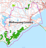
Traditional Owners — This dive site is in the traditional Country of the Wathaurong (Wadda-Warrung) people of the Kulin Nation. This truly ancient Country includes the coastline of Port Phillip, from the Werribee River in the north-east, the Bellarine Peninsula, and down to Cape Otway in the south-west. We wish to acknowledge the Wathaurong as Traditional Owners. We pay respect to their Ancestors and their Elders, past, present and emerging. We acknowledge Bunjil the Creator Spirit of this beautiful land, who travels as an eagle, and Waarn, who protects the waterways and travels as a crow, and thank them for continuing to watch over this Country today and beyond.
Urquhart Bluff Location Map
Latitude: 38° 26.156′ S (38.435936° S / 38° 26′ 9.37″ S)
Longitude: 144° 7.938′ E (144.132304° E / 144° 7′ 56.29″ E)
Datum: WGS84 |
Google Map
| Get directions
Added: 2022-04-01 00:05:57 GMT, Last updated: 2022-04-06 14:44:11 GMT
Source: Google Earth
Nearest Neighbour: Eagle Nest Reef, 1,909 m, bearing 215°, SW
Aireys Inlet, Surf Coast.
Depth: 1 to 10 m.
[ Top ]
DISCLAIMER: No claim is made by The Scuba Doctor as to the accuracy of the dive site coordinates listed here. Should anyone decide to use these GPS marks to locate and dive on a site, they do so entirely at their own risk. Always verify against other sources.
The marks come from numerous sources including commercial operators, independent dive clubs, reference works, and active divers. Some are known to be accurate, while others may not be. Some GPS marks may even have come from maps using the AGD66 datum, and thus may need be converted to the WGS84 datum. To distinguish between the possible accuracy of the dive site marks, we've tried to give each mark a source of GPS, Google Earth, or unknown.
Copyright © 2005-2022 by The Scuba Doctor Australia, ABN 88 116 755 170. All rights reserved.
tel. +61 3 5985 1700 :: email. diveshop@scubadoctor.com.au :: Web site by it'sTechnical 2022






![Halcyon Infinity 30lb System [SS Small Backplate] Halcyon Infinity 30lb System [SS Small Backplate]](/diveshop/images/halcyon/Halcyon-Evolve-Wing.jpg)


