Navigation
Vultee Vengeance Aircraft
![]() Wreck Dive |
Wreck Dive | ![]() Boat access
Boat access
![]()
![]()
![]()
Vultee Vengeance Aircraft | Max Depth: 11 m (36 ft)
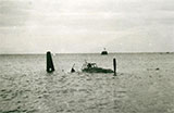
The Vultee Vengeance aircraft was a Second World War-era, single-engined dive bomber that was lost when it crashed at the back of the Williamstown Rifle Range on 6 March 1946. It was salvaged and then dumped into waters off Point Gellibrand, Williamstown, Port Phillip.
Diving the Vultee Vengeance
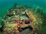
The aircraft is unburied, partially intact (the tail and nose of the plane are missing). Estimated length 2m, width 13m, height 1.5m. The site appears to be that of a small single-engined monoplane with low slung wings. The plane is lying upright in 10 to 11 metres of water and appears to have been extensively salvaged. Both the engine and cockpit instrumentation have been removed, leaving the two wings and centre section of the fuselage.
The rear section of the fuselage including the tail fin is missing. The cockpit is situated immediately above the wings and approximately 0.5 metre wide by 1.3 metres long. Wingtip to broken wingtip is 13.4 metres wide. Aluminium A-frame behind the cockpit, maybe part of missing glass canopy.
See WillyWeather (Point Gellibrand) as a guide for the tide times and the height of the tide.
Vultee Vengeance Wreck History
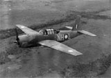
The Vultee Vengeance was an American dive bomber of World War II, built by Vultee Aircraft. The Vengeance was not used operationally by the United States but was operated as a front-line aircraft by the British Royal Air Force, the Royal Australian Air Force, and the Indian Air Force in Southeast Asia and the Southwest Pacific. Australia placed an order for 400 Vengeances as an emergency measure following the outbreak of war in the Pacific. While the first Vengeance was delivered to the Royal Australian Air Force (RAAF) in May 1942, the aircraft did not arrive in substantial numbers until April 1943.
Australian Vengeances flew their last operational sorties on 8 March 1944, as they were considered less efficient than fighter bombers, having a short-range and requiring a long runway, and were withdrawn to allow more effective fighter bombers to move into the forward area.
When production of the Vengeance was completed in 1944, a total of 1,931 aircraft had been produced. The majority were produced at the Vultee plant in Nashville, Tennessee.
Vultee Vengeance General Characteristics
- Crew: Two (Pilot and Navigator/Gunner)
- Length: 39 ft 9 in (12.12 m)
- Wingspan: 48 ft 0 in (14.63 m)
- Height: 15 ft 4 in (4.67 m)
- Wing area: 332 ft sq (30.84 m sq)
- Empty weight: 9,725 lb (4,411 kg)
- Max. takeoff weight: 14,300 lb (6,486 kg)
- Powerplant: 1 x Wright R-2600-A5B-5 Twin Cyclone 14 cylinder radial air-cooled engine, 1,600 hp (1,193 kW)
Vultee Vengeance Performance
- Maximum speed: 275 mph (239 kn, 443 km/h) at 11,000 ft (3,350 m)
- Cruise speed: 235 mph (204 kn, 378 km/h)
- Range: 1,400 miles (1,220 nmi, 2,253 km)
- Service ceiling: 22,500 ft (6,860 m)
Vultee Vengeance Crash — 6 March 1946
On 6 March 1946, Vultee Vengeance "A27-505" was flown by Warrant Officer FO Knudson RAAF from South Australia. His observer, Warrant Officer LR Wastell RAAF was from Northcote in Victoria. They were towing a target for gunnery practice.
While flying over St Kilda the plane suffered an engine failure probably due to a loss of oil pressure. Vengeances were notorious for overheating. It was forced to make a near belly landing at Williamstown and ran into some nearby rocks. Knudson was later admitted to hospital with slight head injuries.
See also, MAAV: Vultee A-35B-VN Vengeance Mk. IV, lost - 1946,
Wikipedia: Vultee A-31 Vengeance,
Heritage Council of Victoria: Vultee Vengeance Aircraft, and
Australian National Shipwreck Database: Vultee Vengeance Aircraft.
Heritage Warning: Any shipwreck or shipwreck relic that is 75 years or older is protected by legislation. Other items of maritime heritage 75 years or older are also protected by legislation. Activities such as digging for bottles, coins or other artefacts that involve the disturbance of archaeological sites may be in breach of the legislation, and penalties may apply. The legislation requires the mandatory reporting to Heritage Victoria as soon as practicable of any archaeological site that is identified. See Maritime heritage. Anyone with information about looting or stolen artefacts should call Heritage Victoria on (03) 7022 6390, or send an email to heritage.victoria@delwp.vic.gov.au.
Finding the Vultee Vengeance Aircraft
We also have the following GPS mark for the Vultee Vengeance from Peter Taylor:
Latitude: 37° 52.867′ S (37.88111667° S / 37° 52′ 52.02″ S)
Longitude: 144° 52.021′ E (144.867015° E / 144° 52′ 1.25″ E)
2,914 m, bearing 270°, W
It's the engine block and a bit of a wing.
We also have the following GPS mark for a wing:
Latitude: 37° 52.277′ S (37.87127778° S / 37° 52′ 16.6″ S)
Longitude: 144° 54.617′ E (144.91027778° E / 144° 54′ 37″ E)
1,407 m, bearing 38°, NE
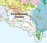
Traditional Owners — This dive site is in the traditional Country of the Boon Wurrung / Bunurong people of the Kulin Nation. This truly ancient Country includes parts of Port Phillip, from the Werribee River in the north-west, down to Wilson's Promontory in the south-east, including the Mornington Peninsula, French Island and Phillip Island, plus Western Port. We wish to acknowledge the Boon Wurrung as Traditional Owners. We pay respect to their Ancestors and their Elders, past, present and emerging. We acknowledge Bunjil the Creator Spirit of this beautiful land, who travels as an eagle, and Waarn, who protects the waterways and travels as a crow, and thank them for continuing to watch over this Country today and beyond.
Vultee Vengeance Aircraft Location Map
Latitude: 37° 52.868′ S (37.881133° S / 37° 52′ 52.08″ S)
Longitude: 144° 54.013′ E (144.900217° E / 144° 54′ 0.78″ E)
Datum: WGS84 |
Google Map
Added: 2019-06-16 09:52:11 GMT, Last updated: 2022-05-01 19:33:41 GMT
Source: Timothy Martin, GPS
Nearest Neighbour: Katie Cove, Williamstown, 1,167 m, bearing 352°, N
Vultee Vengeance Aircraft.
Lost: 6 March 1946.
Depth: 11 m.
[ Top ]
DISCLAIMER: No claim is made by The Scuba Doctor as to the accuracy of the dive site coordinates listed here. Should anyone decide to use these GPS marks to locate and dive on a site, they do so entirely at their own risk. Always verify against other sources.
The marks come from numerous sources including commercial operators, independent dive clubs, reference works, and active divers. Some are known to be accurate, while others may not be. Some GPS marks may even have come from maps using the AGD66 datum, and thus may need be converted to the WGS84 datum. To distinguish between the possible accuracy of the dive site marks, we've tried to give each mark a source of GPS, Google Earth, or unknown.
Copyright © 2005-2022 by The Scuba Doctor Australia, ABN 88 116 755 170. All rights reserved.
tel. +61 3 5985 1700 :: email. diveshop@scubadoctor.com.au :: Web site by it'sTechnical 2022





![Halcyon Infinity 30lb System [SS Small Backplate] Halcyon Infinity 30lb System [SS Small Backplate]](/diveshop/images/halcyon/Halcyon-Evolve-Wing.jpg)


