Navigation
Williamstown Beach Breakwater
![]() Shore Dive |
Shore Dive | ![]() Shore access
Shore access
![]()
![]()
![]()
![]()
![]()
![]()
Depth: 2 m (6.56 ft) to 5 m (16 ft)
Level: Open Water and beyond.
Williamstown Beach Breakwater, also known as Crystals, near Williamstown, is popular for midweek diving and snorkelling as it's only about 14 kilometres (25 minutes drive) from the Melbourne CBD. It lies about 500 metres east of the Jawbone Marine Sanctuary, has easy entry and exit points, and there are lots of critters to see, even on a night dive.
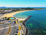
Williamstown Beach is backed by the Esplanade, making it a very accessible beach. The Williamstown Swimming and Surf Life Saving Club is located at the western end just north of the breakwater. The beach is 550 metres long and faces due south. It receives waves during strong southerlies. These waves have built a wide, sandy beach fronted by an attached bar that widens to the west. At low tide, it can be a 100 metre wade before you can swim off the bar, so best at high tide.
Diving and Snorkelling at Williamstown Beach Breakwater
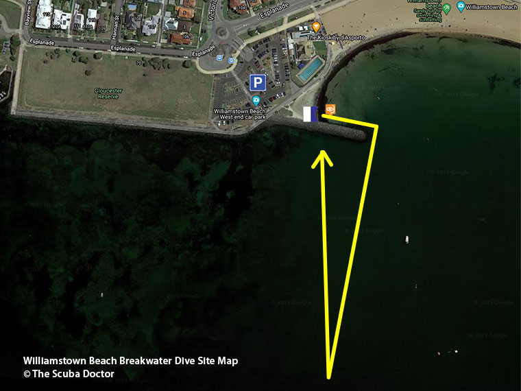
It can get very shallow the more west you head so the best strategy is to enter via Williamstown Beach just east of the breakwater and work your way along and around the breakwater and then head south. You will see more than if you head out into the more open area to the west of the breakwater.
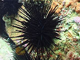
There are dozens of Shorthead Seahorse if you pay close attention to the weeds, Southern Blue-ringed Octopus, many Five-armed Cushion Star (among other kinds) and tonnes of sea urchins, so check before you grab onto anything.
There are also short tailed nudibranchs, Decorator Crabs and heaps of Southern Cardinalfish (especially at night). Old Wives, Southern Bobtail Squid (aka Southern Dumpling Squid), Stingarees, Southern Fiddler Ray (aka Banjo Shark), Clingfish and Southern Pygmy Leatherjacket have also been seen.
Beware of fishing lines from fisherman that cast off from the groyne (breakwater). Always take a dive knife and/or line cutter. This is the beach entry, whilst a set of steps leading directly into the water are on the western side of the groyne.
See also, Williamstown Beach in "Shore Dives of Victoria" by Ian Lewis, 3rd edition page 74.
Location: Esplanade, Williamstown, Victoria 3016
MELWAY Ref: Page 55 A11
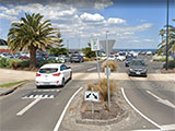
Parking: There is a large car parking area to the west of the Williamstown Swimming and Surf Life Saving Club, at the southern end of Victoria Street, Williamstown. Of course, getting a car park is problematic on busy days in Summer. Before gearing up check out the water. If you see lots of white water, head on home.
Facilities: Toilets open until about 9-10 pm near the surf life saving club, parking machine takes credit card.
Warning: Always go with a buddy and carry a dive knife. Make sure you tow a dive buoy with dive flag.
Entry/Exit: Shore beach entry at the western end of Williamstown Beach, or entry via steps near break water. Short walk to either entry from car park.
Ideal Conditions: There is little background swell in this part of Port Phillip — the water is calm when the wind is still. In moderate winds the waves are choppy and under 0.5 metre. Best with light to moderate offshore northerly to easterly winds, or light onshore south-easterly to north-westerly winds. Avoid after rains due to the rain runoff reducing viability. Best dived at high tide as this allows snorkellers better access. See WillyWeather (Williamstown Beach) as a guide for the tide times and the height of the tide.
Divers have the opportunity to catch Sea Urchin at this dive site. Remember your catch bag, dive gloves and Victorian Recreational Fishing Licence. Please abide by all current fishing regulations if you intend to catch Sea Urchin.
See article-catching-sea-urchin for practical Sea Urchin catching advice from The Scuba Doctor, and melbourne-sea-urchin-dives for other dive sites where you can catch Sea Urchin near Melbourne.
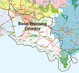
Traditional Owners — This dive site is in the traditional Country of the Boon Wurrung / Bunurong people of the Kulin Nation. This truly ancient Country includes parts of Port Phillip, from the Werribee River in the north-west, down to Wilson's Promontory in the south-east, including the Mornington Peninsula, French Island and Phillip Island, plus Western Port. We wish to acknowledge the Boon Wurrung as Traditional Owners. We pay respect to their Ancestors and their Elders, past, present and emerging. We acknowledge Bunjil the Creator Spirit of this beautiful land, who travels as an eagle, and Waarn, who protects the waterways and travels as a crow, and thank them for continuing to watch over this Country today and beyond.
Williamstown Beach Breakwater Location Map
Latitude: 37° 52.097′ S (37.868282° S / 37° 52′ 5.82″ S)
Longitude: 144° 53.358′ E (144.889295° E / 144° 53′ 21.46″ E)
Datum: WGS84 |
Google Map
| Get directions
Added: 2012-07-22 09:00:00 GMT, Last updated: 2022-04-17 16:36:45 GMT
Source: Google Earth
Nearest Neighbour: Williamstown Beach Rotunda, 428 m, bearing 94°, E
Williamstown, Port Phillip.
Depth: 2 to 5 m.
[ Top ]
DISCLAIMER: No claim is made by The Scuba Doctor as to the accuracy of the dive site coordinates listed here. Should anyone decide to use these GPS marks to locate and dive on a site, they do so entirely at their own risk. Always verify against other sources.
The marks come from numerous sources including commercial operators, independent dive clubs, reference works, and active divers. Some are known to be accurate, while others may not be. Some GPS marks may even have come from maps using the AGD66 datum, and thus may need be converted to the WGS84 datum. To distinguish between the possible accuracy of the dive site marks, we've tried to give each mark a source of GPS, Google Earth, or unknown.
Copyright © 2005-2022 by The Scuba Doctor Australia, ABN 88 116 755 170. All rights reserved.
tel. +61 3 5985 1700 :: email. diveshop@scubadoctor.com.au :: Web site by it'sTechnical 2022





![Halcyon Infinity 30lb System [SS Small Backplate] Halcyon Infinity 30lb System [SS Small Backplate]](/diveshop/images/halcyon/Halcyon-Evolve-Wing.jpg)


