Navigation
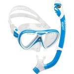
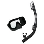
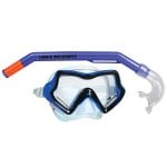
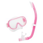
Kids are snorkellers too! Your child deserves the same considerations with their equipment as mum and dad. Theses junior mask and snorkel packages are designed specifically for kids with budget conscious parents. Our mask and snorkel sets are of the same quality as our adult sets and packages. They are not your toy store sets. These junior mask and snorkel sets are manufactured with the same quality as their adult versions.
Wyrallah
![]() Wreck Dive |
Wreck Dive | ![]() Boat access
Boat access
![]()
![]()
![]()
Iron Hulled Steamer | Max Depth: 13 m (43 ft)
Level: Open Water and beyond.
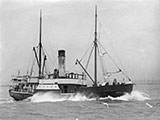
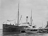
The Wyrallah (aka Wyralla and Whyrallah) sank with the loss of six lives at Port Phillip Heads after a collision with the SS Dilkera, on 8 April 1924, while on a voyage from Melbourne to Gippsland Lakes.
Diving the Wyrallah Shipwreck
The remains of the Wyrallah were rediscovered in the 1970s by divers, Alan Farman and Gordon Baker, while recovering a snagged cray pot for a local fisherman.
The Wyrallah is located in the middle of The Rip, and in the fairway of huge ships. Given the degree of difficulty of the site, combined with the short window of opportunity for diving, it's rarely dived.
Bass Strait Warning: Always keep an eye on sea conditions throughout any shore or boat dive in Bass Strait on Victoria's coastline. Please read the warnings on the web page diving-in-bass-strait before diving or snorkelling this site.
The Rip & Tides Warning: Always keep an eye on sea conditions throughout any shore or boat dive within "The Rip" (aka "The Heads"). This is a dangerous stretch of water, where Bass Straight meets Port Phillip, which has claimed many ships and lives. Please read the warnings on the web page diving-the-rip before diving or snorkelling this site.
Wyrallah Shipwreck History — Built in 1867
The Wyrallah was a schooner rigged, steel twin screw steamer of 302 tons, built in 1867, by Mort's Dock & Engineering Co, of Balmain, NSW. The vessel was built on a length of 140 ft (43 m), a breadth of 22.3 ft (6.8 m) and a depth of 13.2 ft (4.02 m).
Built for the northern rivers of NSW trade, and chartered for other services at times: e.g. Esperance-Albany mail service; New Caledonia; coal from Newcastle to Bairnsdale.
The Wyrallah was later owned by the Gippsland Steamers Pty. Ltd., and used exclusively in the Gippsland Lakes to Melbourne trade.
Wyrallah Sinking — Wrecked 8 April 1924
On 8 April 1924, the steamer Wyrallah was on its usual run to the Gippsland Lakes from Melbourne, with 2 passengers and 13 crew, under the command of Captain Richard Bracken, when it collided with the SS Dilkera with the loss of six lives.
Travelling at 6 knots at 10.20 p.m., the Wyrallah was nearly cut in half by Dilkera, which was travelling at full speed. The Wyrallah sank within 10 minutes. Searchlights from Fort Queenscliff trained on the area in search for victims and salvage.
The Wyrallah's master was blamed by Court of Marine Inquiry — his first command. Primary cause was determined as the the Wyrallah being on wrong side of the channel. The master of the Wyrallah was suspended for 12 months. The Master of the Dilkera censured for omitting to render upmost assistance after the collision.
The lifeboat had taken two hours to arrive. Court recommended that the lifeboat (oar and sail), be replaced by a motorboat.
Robert G. Menzies, later to become Australia's longest serving Prime Minister, represented the Wyrallah's owners as a junior counsel at the Inquiry.
See also, Heritage Council Victoria: Wyrallah, and
Australian National Shipwreck Database: Wyrallah.
Heritage Warning: Any shipwreck or shipwreck relic that is 75 years or older is protected by legislation. Other items of maritime heritage 75 years or older are also protected by legislation. Activities such as digging for bottles, coins or other artefacts that involve the disturbance of archaeological sites may be in breach of the legislation, and penalties may apply. The legislation requires the mandatory reporting to Heritage Victoria as soon as practicable of any archaeological site that is identified. See Maritime heritage. Anyone with information about looting or stolen artefacts should call Heritage Victoria on (03) 7022 6390, or send an email to heritage.victoria@delwp.vic.gov.au.
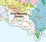
Traditional Owners — This dive site is in the traditional Country of the Boon Wurrung / Bunurong people of the Kulin Nation. This truly ancient Country includes parts of Port Phillip, from the Werribee River in the north-west, down to Wilson's Promontory in the south-east, including the Mornington Peninsula, French Island and Phillip Island, plus Western Port. We wish to acknowledge the Boon Wurrung as Traditional Owners. We pay respect to their Ancestors and their Elders, past, present and emerging. We acknowledge Bunjil the Creator Spirit of this beautiful land, who travels as an eagle, and Waarn, who protects the waterways and travels as a crow, and thank them for continuing to watch over this Country today and beyond.
Wyrallah Location Map
Latitude: 38° 18.130′ S (38.302167° S / 38° 18′ 7.8″ S)
Longitude: 144° 37.930′ E (144.632167° E / 144° 37′ 55.8″ E)
Datum: WGS84 |
Google Map
Added: 2012-07-22 09:00:00 GMT, Last updated: 2022-04-30 06:57:59 GMT
Source: Book - Shipwrecks Around Port Phillip Heads GPS (verified)
Nearest Neighbour: Rip Bank, 367 m, bearing 96°, E
Port Phillip Heads.
Steel hull, 206 ton.
Depth: 13 m.
[ Top ]
DISCLAIMER: No claim is made by The Scuba Doctor as to the accuracy of the dive site coordinates listed here. Should anyone decide to use these GPS marks to locate and dive on a site, they do so entirely at their own risk. Always verify against other sources.
The marks come from numerous sources including commercial operators, independent dive clubs, reference works, and active divers. Some are known to be accurate, while others may not be. Some GPS marks may even have come from maps using the AGD66 datum, and thus may need be converted to the WGS84 datum. To distinguish between the possible accuracy of the dive site marks, we've tried to give each mark a source of GPS, Google Earth, or unknown.
Copyright © 2005-2022 by The Scuba Doctor Australia, ABN 88 116 755 170. All rights reserved.
tel. +61 3 5985 1700 :: email. diveshop@scubadoctor.com.au :: Web site by it'sTechnical 2022






![Halcyon Infinity 30lb System [SS Small Backplate] Halcyon Infinity 30lb System [SS Small Backplate]](/diveshop/images/halcyon/Halcyon-Evolve-Wing.jpg)


