Navigation
The Scuba Doctor has a great range of premium quality equipment suited for cave, wreck and other overhead environment penetration diving.
Foggy Reef
![]() Wall Dive |
Wall Dive | ![]() Boat access
Boat access
![]()
![]()
![]()
![]()
![]()
Depth: 8 m (26 ft) to 30 m (98 ft)
Level: Open Water and beyond.
At the very Southern end of the Lonsdale wall system sits Foggy Reef. As you may have guessed this site was named as the fog rolled and this amazing part of the wall was found.
The top of the reef is around 8 m (26 ft). Swimming north to east from the shot you will find the edge wall, dropping over the wall you can descend to around 25 m (82 ft). From this point, if you follow the wall to the south it will curve around to the east.
About 20 m (66 ft) from where you go over the edge there is a huge old admiralty anchor embedded in the wall. You will need to look carefully though as it is encrusted with the same colourful growth as the wall.
Directly opposite this site lying in the sand are two old cannons. Unfortunately, the sand movement in this area means that sometimes the cannons are buried. After you have had a look around, turn back the way you came and follow the wall north for the rest of your dive.
All sections of the wall in this area are heavily encrusted in a big variety of marine invertebrates, including soft coral, gorgonians, and sponges. Check out the amazing overhangs and undercuts for the colourful and prolific growth. It also goes without saying to note the fish and marine life attracted to this terrain.
Foggy Reef is a boat dive for the experienced diver, who must keep both weather and tidal conditions at the forefront of their dive plan. When diving this area always have an exit plan. Many divers have found themselves a long way away from their boat and safety due to poor planning.
The Rip & Tides Warning: Always keep an eye on sea conditions throughout any shore or boat dive within "The Rip" (aka "The Heads"). This is a dangerous stretch of water, where Bass Straight meets Port Phillip, which has claimed many ships and lives. Please read the warnings on the web page diving-the-rip before diving or snorkelling this site.
Lonsdale Wall
This dive site is one of many on Lonsdale Wall, located just inside The Heads on the Lonsdale side of Port Philip — one of Australia's premier dive locations. Lonsdale Wall is one side of an underwater canyon formed by the old Yarra River as it flowed out to sea through the plains, carving steep-walled edges out of soft rock sides. Between the end of the last Ice Age around 8000 BCE and around 6000 BCE, the sea-level rose to drown what was then the lower reaches of the Yarra River. Thus the canyon formed by the river near what is now The Heads, or The Rip, was flooded creating the Lonsdale Wall, North Wall and Nepean Wall areas. Lonsdale Wall extends for one kilometre, providing many spectacular dive sites. An almost vertical drop characterises Lonsdale Wall with the wall starting as shallow as 8 m (26 ft) metres deep in places and sometimes dropping down to well over 60 m (197 ft) deep. See also, Port of Melbourne Rip Map — Oblique seabed image of The Heads produced by hydrographic surveys.
Port Phillip Heads Marine National Park
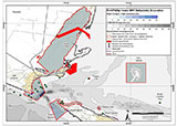
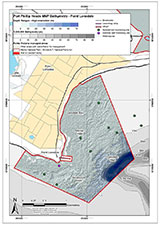
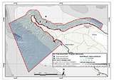
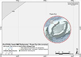
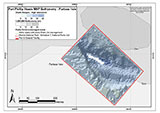
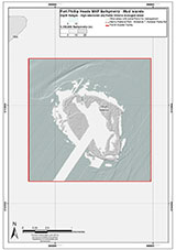
This site lies in the Port Phillip Heads Marine National Park. The park is made up of six separate marine areas around the southern end of Port Phillip: Swan Bay, Mud Islands, Point Lonsdale, Point Nepean, Popes Eye, and Portsea Hole.
Thirty-one of the 120 shipwrecks known to have occurred within a 10 nautical mile radius of Port Phillip Heads are thought to be within the Port Phillip Heads Marine National Park in Point Lonsdale and Point Nepean.
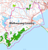
Aboriginal tradition indicates that the Bellarine Peninsula side of the Port Phillip Heads Marine National Park is part of Country of the Wathaurung people, and the Mornington Peninsula side, including Mud Islands, is part of Country of the Boon Wurrung people.
See also, Parks Victoria: Port Phillip Heads Marine National Park,
Park Note: Port Phillip Heads Marine National Park,
Port Phillip Heads Marine National Park - Map,
Divers Guide - Port Phillip Heads Marine National Park,
Port Phillip Heads Marine National Park Identification Booklet, and
Taxonomic Toolkit for the Marine Life of Port Phillip Bay.
You are not permitted to carry a spear gun while snorkelling or scuba diving in Port Phillip Heads Marine National Park.
Finding the Foggy Reef
Over the years we've been provided with different GPS marks for the Foggy Reef. The GPS marks we know of in circulation for the Foggy Reef are:
- Divers Guide - Port Phillip Heads Marine National Park
Latitude: 38° 17.624′ S (38.293732° S / 38° 17′ 37.44″ S)
Longitude: 144° 37.528′ E (144.625467° E / 144° 37′ 31.68″ E) - Geoff Rodda:
Latitude: 38° 17.629′ S (38.293816666667° S / 38° 17′ 37.74″ S)
Longitude: 144° 37.544′ E (144.62573333333° E / 144° 37′ 32.64″ E)
25 m, bearing 112°, ESE
Traditional Owners — This dive site is in the traditional Country of the Wathaurong (Wadda-Warrung) people of the Kulin Nation. This truly ancient Country includes the coastline of Port Phillip, from the Werribee River in the north-east, the Bellarine Peninsula, and down to Cape Otway in the south-west. We wish to acknowledge the Wathaurong as Traditional Owners. We pay respect to their Ancestors and their Elders, past, present and emerging. We acknowledge Bunjil the Creator Spirit of this beautiful land, who travels as an eagle, and Waarn, who protects the waterways and travels as a crow, and thank them for continuing to watch over this Country today and beyond.
Foggy Reef Location Map
Latitude: 38° 17.624′ S (38.293732° S / 38° 17′ 37.44″ S)
Longitude: 144° 37.528′ E (144.625467° E / 144° 37′ 31.68″ E)
Datum: WGS84 |
Google Map
Added: 2012-07-22 09:00:00 GMT, Last updated: 2022-05-07 23:50:23 GMT
Source: Divers Guide - Port Phillip Heads Marine National Park
Nearest Neighbour: The Cave, 35 m, bearing 90°, E
Port Phillip Heads Marine National Park.
Depth: 8 to 30 m.
Dive only on: SWF, SWE.
[ Top ]
DISCLAIMER: No claim is made by The Scuba Doctor as to the accuracy of the dive site coordinates listed here. Should anyone decide to use these GPS marks to locate and dive on a site, they do so entirely at their own risk. Always verify against other sources.
The marks come from numerous sources including commercial operators, independent dive clubs, reference works, and active divers. Some are known to be accurate, while others may not be. Some GPS marks may even have come from maps using the AGD66 datum, and thus may need be converted to the WGS84 datum. To distinguish between the possible accuracy of the dive site marks, we've tried to give each mark a source of GPS, Google Earth, or unknown.
Copyright © 2005-2022 by The Scuba Doctor Australia, ABN 88 116 755 170. All rights reserved.
tel. +61 3 5985 1700 :: email. diveshop@scubadoctor.com.au :: Web site by it'sTechnical 2022










![Halcyon Infinity 30lb System [SS Small Backplate] Halcyon Infinity 30lb System [SS Small Backplate]](/diveshop/images/halcyon/Halcyon-Evolve-Wing.jpg)


