Navigation
Whatever type of dive you enjoy the most, there is a specific type of footwear to suit you. If you're a commercial diver or a cave diver you would some safety boots with a non-slip sole, however, if you are a warm water sport diver then wetsuit boots might be the right choice.
Portsea Hole
![]() Wall Dive |
Wall Dive | ![]() Boat access
Boat access
![]()
![]()
![]()
![]()
![]()
Depth: 12 m (39 ft) to 33 m (108 ft)
Level: Open Water and beyond.
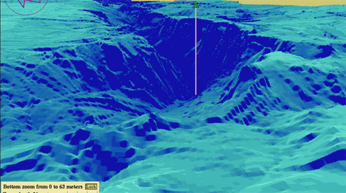
Portsea Hole is a popular dive site inside Port Phillip about 500 m (1,640 ft) to the North-East from Portsea Pier in a sunken remnant secion of the drowned valley of the Yarra River. The surrounding seabed marks the top of Portsea Hole at 12 m (39 ft) and to the North there is a vertical wall approximately 75 m (246 ft) long which drops to sand at 27 m (89 ft), then into a sand bowl which bottoms at 33 m (108 ft).
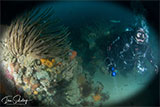
Portsea Hole | Credit: OzMarineBoy
Portsea Hole is a remnant section of the Yarra River with calcarenite vertical reef. Its moderately exposed, vertical and sloping reef is orientated east in a natural amphitheatre. It consists of rocky ledges and outcrops on the western side of a sandy bowl or hole. At the top of the hole, there is a large flat area with very low steps (0.5 m) and a few rock bommies. This area is covered by patches of sand and algae. In the hole, there is a narrow strip of vertical reef wall and ledges at 22 m (72 ft) depth, approximately 2 m (6.56 ft) high and 20 m (66 ft) long, which supports mostly sessile invertebrates. There is also a small area of a rocky outcrop at 27 m (89 ft) depth interspersed with sand. On the wall, algae grow on horizontal reef surfaces and are limited by low light from the overhanging ledges.
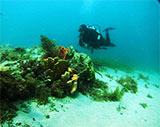
Portsea Hole is characterised by diverse and abundant fish assemblages as well as a rich benthic community of marine invertebrates, encrusting algae, sponges and soft corals. The wall comprises small overhangs, which are home to a vast array of invertebrate life and fish, in particular the beautiful Southern Blue Devil. On the top of the hole, there are several rock bommies that host hundreds of fish of many species.
Portsea Hole is a slack water dive from a dive boat. It's a dive for the more experienced diver who has had sound experience diving in tidal situations. It is imperative that you know the state of the tides to make this both a successful and safe diving experience.
Vertical sections of Portsea Hole support a high abundance and diversity of sessile invertebrates, including sixteen different types of sponges such as arborescent, flabellate, encrusting and massive sponges. Massive ruffled sponges can be particularly abundant on the reef. The relative dominance of sponges can change over time.
Portsea Hole has a high abundance and diversity of fish species including Barber Perch, Southern Hulafish and Silver Sweep. Other commonly seen fish species include the Southern Blue Devil, Butterfly Perch, Jackass Morwong, Gurnards and Bluespotted Goatfish.
Portsea Hole has moderate exposure to waves and currents. It is best dived at slack water. You might also like to take a look at the nearby Portsea Hole Wreck.
Portsea Hole is is a very popular boat dive site for recreational scuba diving activities. Many Melbourne divers have had their first taste of scuba diving from a boat here. Dive charter operators regularly schedule dives where they head out from Portsea and/or Queenscliff to Portsea Hole. Private dive boats usually launch at the Sorrento Boat Ramp or the Queenscliff Boat Ramp. The marine park area that surrounds Portsea Hole is small, covering only 10 hectares. It's marked by four lit yellow special mark buoys at each of its corners.
See also Wikipedia: Portsea Hole, and
Parks Victoria: Portsea Hole.
Port Phillip Heads Marine National Park
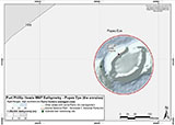
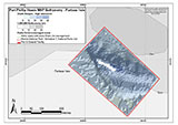
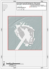
This site lies in the Port Phillip Heads Marine National Park. The park is made up of six separate marine areas around the southern end of Port Phillip: Swan Bay, Mud Islands, Point Lonsdale, Point Nepean, Popes Eye, and Portsea Hole.
Thirty-one of the 120 shipwrecks known to have occurred within a 10 nautical mile radius of Port Phillip Heads are thought to be within the Port Phillip Heads Marine National Park in Point Lonsdale and Point Nepean.
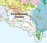
Aboriginal tradition indicates that the Bellarine Peninsula side of the Port Phillip Heads Marine National Park is part of Country of the Wathaurung people, and the Mornington Peninsula side, including Mud Islands, is part of Country of the Boon Wurrung people.
See also, Parks Victoria: Port Phillip Heads Marine National Park,
Park Note: Port Phillip Heads Marine National Park,
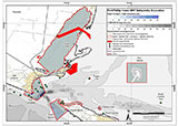
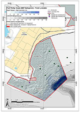
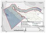
Port Phillip Heads Marine National Park - Map,
Divers Guide - Port Phillip Heads Marine National Park,
Port Phillip Heads Marine National Park Identification Booklet, and
Taxonomic Toolkit for the Marine Life of Port Phillip Bay.
You are not permitted to carry a spear gun while snorkelling or scuba diving in Port Phillip Heads Marine National Park.
Traditional Owners — This dive site is in the traditional Country of the Boon Wurrung / Bunurong people of the Kulin Nation. This truly ancient Country includes parts of Port Phillip, from the Werribee River in the north-west, down to Wilson's Promontory in the south-east, including the Mornington Peninsula, French Island and Phillip Island, plus Western Port. We wish to acknowledge the Boon Wurrung as Traditional Owners. We pay respect to their Ancestors and their Elders, past, present and emerging. We acknowledge Bunjil the Creator Spirit of this beautiful land, who travels as an eagle, and Waarn, who protects the waterways and travels as a crow, and thank them for continuing to watch over this Country today and beyond.
Portsea Hole Location Map
Latitude: 38° 18.684′ S (38.3114° S / 38° 18′ 41.04″ S)
Longitude: 144° 42.651′ E (144.71085° E / 144° 42′ 39.06″ E)
Datum: WGS84 |
Google Map
Added: 2012-07-22 09:00:00 GMT, Last updated: 2022-05-08 00:23:19 GMT
Source: GPS
Nearest Neighbour: Portsea Hole Wreck, 36 m, bearing 336°, NNW
Port Phillip Heads Marine National Park.
Depth: 12 to 33 m.
Dive only on: SWF, SWE.
Mean water temp - summer: 18.4°C.
Mean water temp - winter: 12.5°C.
[ Top ]
DISCLAIMER: No claim is made by The Scuba Doctor as to the accuracy of the dive site coordinates listed here. Should anyone decide to use these GPS marks to locate and dive on a site, they do so entirely at their own risk. Always verify against other sources.
The marks come from numerous sources including commercial operators, independent dive clubs, reference works, and active divers. Some are known to be accurate, while others may not be. Some GPS marks may even have come from maps using the AGD66 datum, and thus may need be converted to the WGS84 datum. To distinguish between the possible accuracy of the dive site marks, we've tried to give each mark a source of GPS, Google Earth, or unknown.
Copyright © 2005-2022 by The Scuba Doctor Australia, ABN 88 116 755 170. All rights reserved.
tel. +61 3 5985 1700 :: email. diveshop@scubadoctor.com.au :: Web site by it'sTechnical 2022









![Halcyon Infinity 30lb System [SS Small Backplate] Halcyon Infinity 30lb System [SS Small Backplate]](/diveshop/images/halcyon/Halcyon-Evolve-Wing.jpg)


