Navigation
Using the correct scuba diving cylinder is just as important to a diver's success and safety as how they configure their gear. A diver may go to an enormous effort to insure every hose, reel and accessory is exactly right only to 'drop the ball' by making the wrong cylinder choice.
The Scuba Doctor dive shop brings you scuba cylinders from the leading cylinder manufacturers in the world — Faber and Catalina — so you can not only get it done, but can get it done right.
No cylinder is perfect for every diver, or every diving situation. The Scuba Doctor offers the most complete selection of cylinders in the industry, allowing you to choose what is best for your unique needs.
All cylinders from The Scuba Doctor are suitable for nitrox service (i.e. up to 40% oxygen), visually inspected and shipped with a current hydrostatic date (except where indicated).
Australian Standards
In Australia, scuba Tanks must be tested every year (12 months). We always ship cylinders with a current hydro test date. Due to manufacturing and import cycles, the popular sizes of cylinders typically have a factory hydro date less than 12 months old. However less popular sizes of cylinders may have a factory hydro date up to 24 months old as these are manufactured and imported less frequently.
As per the Australian Standards, the cylinders and valves we sell are for Imperial 0.750-14 NPSM (3/4 NPS) neck threads, NOT Metric M25 neck threads, and the valves have overpressure relief devices (burst discs). (Cylinders with Metric M25 neck threads do not comply with Australian Standards.)
The Faber steel cylinders have ISO 9809-1 markings. The Catalina aluminium cylinders have DOT-3AL2957 markings. All of these cyliners comply with Australian Standrads and are suitable for use in Australia. They may, or may not, meet the standards applicable in other coutries.
Choosing Your Scuba Cylinder/Tank
Scuba diving cylinders (USA: tanks, UK: bottles) are awkward and heavy, and if you fall down with one on you'll be lying on your back flailing your arms and legs in the air like a turtle flipped on it's shell.
Without scuba cylinders you can never be like that same turtle 'flying' gracefully through the water, experiencing a world that almost defies explanation.
Like all scuba gear, choosing a scuba diving cylinder/tank/bottle takes more thought and planning than just walking into a dive shop and grabbing the first thing you see.
There are a few different kinds of cylinders, each with their own pros and cons. Plus, not all diving cylinders can be used for all types of diving. The video below may help you to chose which dive cylinder is best for your needs.
Types of Scuba Diving Cylinders
Steel Scuba Cylinders
Steel scuba cylinders have been around since the start of scuba diving, while aluminium diving cylinders came into use in the 1970s. Steel scuba cylinders are typically more expensive than the same capacity aluminium cylinders.
A steel diving cylinder is a lot tougher than an aluminium one, making it less likely to pit or dent. If properly cared for it will last longer than an aluminium cylinder. However, steel rusts with exposure to moisture and thus needs more careful care.
Because steel is stronger it can be handle higher pressures with a thinner wall thickness, making a steel cylinder smaller and lighter than an aluminium one of similar capacity.
Also If you want to use higher pressures (e.g. 300 bar), you will need to use a DIN valve which may make it hard to get refills depending on where you're diving.
Most technical divers use steel scuba cylinders, but they can be a good cylinder for regular recreational scuba diving too. The most common size is a 232 bar, standard 12.2 litre steel cylinder, but many women and those who use less air often prefer a lighter and smaller 10.5 litre cylinder.
Steel cylinders are more negatively buoyant than equivalent aluminium cylinders and only become less negatively buoyant as they are emptied. Thus they are popular in cold/temperate water areas where thick wetsuits and drysuits are used, because a steel cylinder means you can carry less weight on your weight belt.
Aluminium Scuba Cylinders
Aluminium scuba cylinders came into use in the 1970s and are the most common scuba cylinders you'll find in tropical waters for recreational diving. Many dive shop, boat and resort operations use them worldwide.
The most common size used for diving is the aluminium 80 cubic foot (11.1 litre), but they can be smaller or larger depending on what they're meant to be used for.
For example, a bail out or pony bottle is much smaller than a standard size aluminium 80.
Aluminium cylinders being made of a softer, lighter material have thicker walls, making them larger and heavier than steel cylinders of the same capacity. Aluminium cylinders are relatively inexpensive and thus a good choice for most recreational scuba divers.
One downside of the aluminium scuba diving cylinders is that most go from being negatively buoyant to positively buoyant as they empty during the dive, so most divers wear a few extra kilograms (or pounds) of weight to compensate for this. There are a few models of aluminium cylinders that are built specifically to eliminate this problem, but like everything else, the more features it has, the more expensive it is.
Typically aluminium cylinders are certified for use at a working pressure of 200 to 210 bar. But some newer ones are available rated to nearly 230 bar. Again, these cylinders are more expensive and heavier.
Things To Consider When Buying Scuba Diving Cylinders
Here are a few other things to consider before buying.
- Length/height of the cylinder. Is it so long it bumps your butt and the back of your head at the same time?
- Weight of the cylinder. Is it too heavy for you to handle comfortably?
- Type of diving. Do you technical dive or not?
- If it's steel, is it a low pressure (LP) steel cylinder (e.g. 232 bar), or a high pressure (HP) one (e.g. 300 bar)?
- Does it have a DIN valve, or more common A-clamp/Yoke valve, or a valve that can be converted from DIN to Yoke using an insert?
- If it's a used cylinder, when was it last visually inspected or hydro tested?
Our Recommendations
When purchasing scuba cylinders, the long-term advantages of steel's excellent buoyancy characteristics and long life make it the best choice for most divers, but especially those in cold and temperate waters. Choose a 232 bar steel tank size that meets your needs when it is under filled, putting an end to short fill concerns. For most divers this will be a 12.2 litre (100 cubic foot) cylinder, but some may prefer the smaller 10.5 litre (85 cubic foot) cylinder.
If your budget is tight, then aluminium cylinders initially costs significantly less. If going with an aluminium cylinder, avoid paints, and choose the brushed finish.
For both steel and aluminium cylinders you should choose a convertible valve having a DIN outlet with K (yoke) insert, often described as a 'DIN/K' valve. (That's why we provide this as our standard offering.).
Remember, the standard 207 bar aluminium 11.1 litre (80 cubic foot) capacity cylinder with a K valve is not a "one-size-fits-all" tank. Making the right cylinder choice can significantly improve your diving enjoyment. Please use this list as a guide when reviewing scuba diving cylinders and you should be able to find the right cylinder/tank to last you for years of diving.
For more help buying the best diving cylinder (Tank / Bottle) for you, please see our Buying a Scuba Cylinder guide.
The Scuba Doctor dive shop is your best source for scuba diving cylinders.
Landing Bay
![]() Reef Dive |
Reef Dive | ![]() Boat access
Boat access
![]()
![]()
![]()
![]()
Depth: 2 m (6.56 ft) to 10 m (33 ft)
Level: Open Water and beyond.
The Landing Bay (aka Dinghy Cove) dive site lies on the northern side of Lady Julia Percy Island. It's the only place that provides practical human access to the top of the island. (Seals can't get up here, they use Prop Bay.) It's not legal to land on the island without a permit.
There are significant archaeological sites in and above Landing Bay. The bay shallows up from 8–10 metres to the pebble beach. Being on the lee side of the island, the bottom here and along the northern face is siltier than elsewhere. Landing Bay and the adjacent shoreline to the west is more easily accessed because of the protection, but there is not the wow factor of the more exposed sections.
Lady Julia Percy Island
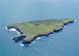
Lady Julia Percy Island (also known by its Aboriginal name Deen Maar) has to be one of the most incredible diving destinations in Victoria. Ringed by cliffs, with a flat treeless top, the 1.33 square kilometre (329 acres) island is owned by the seals.The island lies 12 kilometres south-south-west of Yambuk, and 22 kilometres south-west of Port Fairy. Lady Julia Percy Island is about 2 kilometres in length by 1 kilometre wide, comprising a plateau in height from 32–46 metres above sea level, surrounded by cliffs, rock platforms and reefs. Access to Lady Julia Percy Island itself is restricted, and landing is by permit only.
The diversity of marine life, crystal clear water (frequently), rock walls, caves, sand flats, and boulder fields all combine to make this place just stunning. Dolphin, southern elephant seals, Australian sea lions and even killer whales have been observed here. The island can have a particularly ominous feel to it, particularly on an overcast day, but on the right day it is just paradise above and below the water.
Lady Julia Percy Island is famous as the home to the largest colony of Australian Fur Seals in the Southern Hemisphere, and infamous for large Great White Sharks. The sheer number of seals can be a little overwhelming (sight sound and smell), but they are just a part of the wildlife attraction. Mention Lady Julia Percy Island and everyone immediately thinks of sharks, but as any honest abalone diver will tell you, sightings are rare, and they don't eat much anyway.
This island is home to breeding little penguins (2000 pairs), common diving-petrels (1000 pairs), fairy prions (1000 pairs), and short-tailed shearwaters (15,000 pairs). There are also peregrine falcon and sooty oyster catchers. A number of small but unusual plant species survive in the caves in the cliff walls.
Diving Lady Julia Percy Island
Diving at Lady Julia Percy Island is often restricted to the northern or leeward side. The broken bottom and varying depths make this a very interesting dive area.
With the exception of North East Reef, the best underwater scenery is generally found close in to the cliffs. The best terrain generally lies within a 40 metre radius of the island's cliffs, where depths will range from 1 to 20 metres. Whilst some sections are more interesting than others, none will disappoint!
On very good, calm days when you can dive in front, on the ocean side, of the island it becomes simply amazing. There is a very big drop-off across the front of the island, 50 to 70 metres offshore. This drop-off descends from 10 metres to 40 metres deep.
There is at least one very large cathedral-like cave near the base of the drop-off at the south-west end of the island. In the waters on the western side of Lady Julia Percy Island in Prop Bay lies pieces of the RAAF Avro Anson AW-878 aircraft wreck which crashed there on Tuesday, 15 February 1944.
Lady Julia Percy Island is a wonderful dive site but you have to take into account the possibility of shark attacks. Diving here should be avoided during the summer seal pupping season as that can marginally raise the shark attack risk. It's recommended to use a Shark Shield when diving near the island.
Access is by boat from the Port Fairy, Griffiths Street Boat Ramp. Best dived in good conditions with a low swell with light north or northerly winds. You're also a long way from port if the conditions turn and the sea cuts up rough. See WillyWeather (Lady Julia Percy Island) as a guide for the tide times and the height of the tide.
Dive sites at Lady Julia Percy Island include:
- Avro Anson AW-878 — aircraft wreck in Prop Bay.
- Haystack— reef in Prop Bay.
- Prop Bay Bommie
- Blowhole, Lady Julia Percy Island — Thunder Point at the south-east end of the island.
- Bobs Rock — 4.2 kilometres from the south-east point of island.
- Leopard Seal Reef — southern side of island.
- Channel Bay — southern side of island.
- First Cave — Cape Frederick at the north-eastern tip of island.
- North East Reef — 250 metres from the north-east tip of island.
- Landing Bay — northern, leeward, side of island.
- Lady Julia Percy Island — northern, leeward, side of island.
Lady Julia Percy Island History
Lady Julia Percy Island is Australia's only submarine volcano formed some seven million years ago. When lava erupts underwater a typical type of lava called pillow lava occurs. These are tube like structures where the interaction with water forms a crust on the outside and molten lava continues to flow inside. It is Australia's only off-shore volcano and the only large basalt island off the coast of western Victoria.
Deen Maar was well known to the Gunditjmara people. It is believed that the spirits of the dead were conveyed across the sea to the island from a cave called Tarnwirring ("the flowing of the wind") at the top of a rocky sea cliff. The island was also known as Tirngoona, meaning "where the sun go away longa night".
The island was given the name "Lady Julia's Island" in 1800 by Lt James Grant after either the wife or daughter of Hugh Percy, 2nd Duke of Northumberland. In 1802 Matthew Flinders expanded the name to Lady Julia Percy's Island as he sailed past on his ship the Investigator. Also in 1802, Nicolas Baudin sailed past the island in his ship the Geographe, and recorded the island as "Ile aux Alouettes", a name that has not persisted.
During the early 19th century, sealing took place with sealing gangs living on the island often for months at a time. There are two graves on the island — one of a sealer buried in 1822, and one of a man named Hardman buried in 1828 by Captain Wishart of the Fairy. Guano was mined on the island for fertiliser until 1861, being transported to Port Fairy in barges.
In January 1936 a scientific expedition from Melbourne University's McCoy Society visited the island for six weeks and carried out a comprehensive ecological survey.
The local Gunditjmara people have a spiritual, traditional and contemporary connection to Deen Maar (Lady Julia Percy Island). This land is the traditional home of the Peek Whurrong speakers of the Dhauwurdwurung (Gunditj Mara) Nation and is of special cultural significance to local Aboriginal people. Bunjil, the Creator, left this world from Deen Maar, and the adjoining mainland and wetlands are also of great spiritual significance.
Divers have the opportunity to catch Abalone at this dive site. Remember your catch bag, legal abalone tool, current Victorian Recreational Fishing Licence, and abalone measure. Please abide by all current fishing regulations if you intend to catch abalone.
See article-catching-abalone for practical abalone hunting advice from The Scuba Doctor, plus melbourne-abalone-dives for a list of other Abalone dive sites near Melbourne.
Divers have the opportunity to catch Southern Rock Lobster (aka Crayfish) at this dive site. Remember your catch bag, current Victorian Recreational Fishing Licence, rock lobster measure, and cray tags. Once you get back to the dive boat, or shore, make sure you clip the tail and tag your Crayfish as per Fisheries requirements. Please abide by all current fishing regulations if you intend to catch crays. See article-catching-crayfish for practical cray hunting advice from The Scuba Doctor, plus melbourne-cray-dives for a list of other crayfish dive sites near Melbourne. For tips on cooking your Crays, please see article-cooking-crayfish.
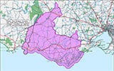
Traditional Owners — This dive site is in the traditional Country of the Eastern Maar people of south-western Victoria between the Shaw and Eumerella Rivers and from Yambuk in the south to beyond Lake Linlithgow in the north. This truly ancient Country extends as far north as Ararat and encompasses the coastal townships of Port Fairy in the west, Warrnambool, Peterborough, Port Campbell, Apollo Bay, Lorne, and Airies Inlet in the east, including the Great Ocean Road area. It also stretches 100 metres out to sea from low tide and therefore includes the iconic Twelve Apostles. "Eastern Maar" is a name adopted by the people who identify as Maar, Eastern Gunditjmara, Tjap Wurrung, Peek Whurrong, Kirrae Whurrung, Kuurn Kopan Noot and/or Yarro waetch (Tooram Tribe) amongst others. We wish to acknowledge the Eastern Maar as Traditional Owners. We pay respect to their Ancestors and their Elders, past, present and emerging.
Landing Bay Location Map
Latitude: 38° 24.717′ S (38.411953° S / 38° 24′ 43.03″ S)
Longitude: 142° 0.532′ E (142.00887° E / 142° 0′ 31.93″ E)
Datum: WGS84 |
Google Map
Added: 2021-07-13 20:10:34 GMT, Last updated: 2022-05-18 10:12:33 GMT
Source: Peter Ronald GPS
Nearest Neighbour: First Cave, 476 m, bearing 95°, E
Lady Julia Percy Island, Discovery Coast.
Depth: 2 to 10 m.
[ Top ]
DISCLAIMER: No claim is made by The Scuba Doctor as to the accuracy of the dive site coordinates listed here. Should anyone decide to use these GPS marks to locate and dive on a site, they do so entirely at their own risk. Always verify against other sources.
The marks come from numerous sources including commercial operators, independent dive clubs, reference works, and active divers. Some are known to be accurate, while others may not be. Some GPS marks may even have come from maps using the AGD66 datum, and thus may need be converted to the WGS84 datum. To distinguish between the possible accuracy of the dive site marks, we've tried to give each mark a source of GPS, Google Earth, or unknown.
Copyright © 2005-2022 by The Scuba Doctor Australia, ABN 88 116 755 170. All rights reserved.
tel. +61 3 5985 1700 :: email. diveshop@scubadoctor.com.au :: Web site by it'sTechnical 2022







![Halcyon Infinity 30lb System [SS Small Backplate] Halcyon Infinity 30lb System [SS Small Backplate]](/diveshop/images/halcyon/Halcyon-Evolve-Wing.jpg)


