Navigation
The Scuba Doctor stocks a wide range of accessories for backplate, harness and wing diving setups.
North Point, Lawrence Rocks
![]() Reef Dive |
Reef Dive | ![]() Boat access
Boat access
![]()
![]()
![]()
![]()
![]()
Depth: 2 m (6.56 ft) to 12 m (39 ft)
Level: Open Water and beyond.
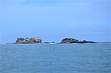
The North Point dive site lies in the lee of Lawrence Rocks. It's a boulder ridge extending off the northern end of Lawrence Rocks, tumbling down to a sand ledge at 10–12 metres on the south-east edge. Sponges are a feature here and the boulder crevices provide excellent habitat for molluscs and crustaceans.
Lawrence Rocks
Lawrence Rocks are a group of two rocky islets, 6.8 ha and 1.5 ha in area, with an associated reef, 2.4 km south-east of Point Danger, and about 6 km south-east of the city of Portland, on Victoria's Discovery Coast. Geologically, the group is formed from the remnants of an extinct volcano.
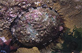
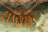
This dive location is one of Portland's best with stunning natural architecture, abundant marine life and kelp forests. Underwater there are walls, terraces, caverns, boulder holes, larva tubes and amphitheatres teeming with temperate marine life including abundant numbers of abalone and Southern Rock Lobster (aka Crayfish). Cray pots are often set around the rocks so take care and watch for lines.
In the more sheltered areas in 5–12 metres of water, giant kelp forests provide shelter for huge schools of juvenile fish and colourful invertebrates at the base. The northern side of Lawrence Rocks rises from about 24 metres, but the thin ledge around the island can drop into depths of as much as 45 metres on each side, with 70-metre depths being found on the exposed side. These deeper reef sections are noted for colourful sponge gardens, big schools of pelagic fish and delicate invertebrate animals. Large schools of yellowtail kingfish visit during the summer months and huge southern tuna are also often sighted.
Lawrence Rocks are used as a haul-out site by Australian Fur Seals. Seal hunting was conducted on the island in the 19th century. Dolphins and seals are regularly seen in large numbers and use the shallow larva tubes. Southern Right Whales are regular visitors each spring as they give birth to their calves.
Inside the many underwater caverns there is an incredible array of invertebrate life, including delicate soft corals and colourful gorgonian fans.
Diving Lawrence Rocks
The Lawrence Rocks area will take several dives to cover properly, and local divers have several favourite spots.
On the eastern side of Lawrence Rocks is The Nursery where there are four large caves at 14 metres. One is known as The Cockpit, which has a slot in the roof leading to a small chamber above. It can be entered by divers in suitable weather and can hold up to four divers at a time.
Latitude: 38° 24.280′ S (38.404667° S / 38° 24′ 16.8″ S)
Longitude: 141° 40.260′ E (141.671° E / 141° 40′ 15.6″ E)
North Point lies in the lee of Lawrence Rocks. It's a boulder ridge extending off the northern end of Lawrence Rocks.
Latitude: 38° 24.225′ S (38.403755° S / 38° 24′ 13.52″ S)
Longitude: 141° 40.004′ E (141.666738° E / 141° 40′ 0.26″ E)
The Saddle is a gully that cuts through the centre of the rocks, but can only be entered in very calm weather with very low swell.
Latitude: 38° 24.331′ S (38.40551° S / 38° 24′ 19.84″ S)
Longitude: 141° 40.082′ E (141.668035° E / 141° 40′ 4.93″ E)
Another area is called The Harbour and is a series of gutters, ledges and swim throughs in 7–18 metres that boasts prolific fish life.
Latitude: 38° 24.514′ S (38.408564° S / 38° 24′ 30.83″ S)
Longitude: 141° 40.136′ E (141.668938° E / 141° 40′ 8.18″ E)
The wreck of the Emily S is situated only a short distance northeast from the northern end of Lawrence Rocks.
Access is by boat, taking about 20 minutes from the Portland Harbour, Lee Breakwater Road North Ramp or the Portland Harbour, Lee Breakwater Road South Ramp.
Even dive sites on the usually more sheltered lee side of Lawrence Rocks, like The Cockpit, are still very weather dependant. Best dived in good conditions with a low swell with light north or northerly winds. See WillyWeather (Lawrence Rocks) as a guide for the tide times and the height of the tide.
In winter the visibility at Lawrence Rocks can exceed an incredible 40 metres.
Lawrence Rocks supports the largest colony of gannets in Australia, as well as breeding colonies of other seabirds. Species that use the area include the Little Penguin, Fairy Prion, and Common Diving Petrel.
Lawrence Rocks History
The islets were sighted by Lieutenant James Grant on 5 December 1800 from the survey brig HMS Lady Nelson and named Lawrence Islands after Captain Effingham Lawrence.
Divers have the opportunity to catch Abalone at this dive site. Remember your catch bag, legal abalone tool, current Victorian Recreational Fishing Licence, and abalone measure. Please abide by all current fishing regulations if you intend to catch abalone.
See article-catching-abalone for practical abalone hunting advice from The Scuba Doctor, plus melbourne-abalone-dives for a list of other Abalone dive sites near Melbourne.
Divers have the opportunity to catch Southern Rock Lobster (aka Crayfish) at this dive site. Remember your catch bag, current Victorian Recreational Fishing Licence, rock lobster measure, and cray tags. Once you get back to the dive boat, or shore, make sure you clip the tail and tag your Crayfish as per Fisheries requirements. Please abide by all current fishing regulations if you intend to catch crays. See article-catching-crayfish for practical cray hunting advice from The Scuba Doctor, plus melbourne-cray-dives for a list of other crayfish dive sites near Melbourne. For tips on cooking your Crays, please see article-cooking-crayfish.
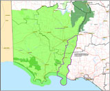
Traditional Owners — This dive site is in the traditional Country of the Gunditjmara people of far south-western Victoria which continues over the state border into a small part of south-east South Australia and is bordered by the Glenelg River to the west and the Wannon River in the north. This truly ancient Country extends 100 metres out to sea from low tide and also includes Deen Maar (aka Lady Julia Percy Island) where the Gunditjmara believe the spirits of their dead travel to wait to be reborn. We wish to acknowledge the Gunditjmara as Traditional Owners. We pay respect to their Ancestors and their Elders, past, present and emerging.
North Point, Lawrence Rocks Location Map
Latitude: 38° 24.225′ S (38.403755° S / 38° 24′ 13.52″ S)
Longitude: 141° 40.004′ E (141.666738° E / 141° 40′ 0.26″ E)
Datum: WGS84 |
Google Map
Added: 2021-07-23 13:24:30 GMT, Last updated: 2022-03-27 17:19:15 GMT
Source: GPS (verified)
Nearest Neighbour: The Saddle, Lawrence Rocks, 226 m, bearing 149°, SSE
Portland, Discovery Coast.
Depth: 2 to 12 m.
[ Top ]
DISCLAIMER: No claim is made by The Scuba Doctor as to the accuracy of the dive site coordinates listed here. Should anyone decide to use these GPS marks to locate and dive on a site, they do so entirely at their own risk. Always verify against other sources.
The marks come from numerous sources including commercial operators, independent dive clubs, reference works, and active divers. Some are known to be accurate, while others may not be. Some GPS marks may even have come from maps using the AGD66 datum, and thus may need be converted to the WGS84 datum. To distinguish between the possible accuracy of the dive site marks, we've tried to give each mark a source of GPS, Google Earth, or unknown.
Copyright © 2005-2022 by The Scuba Doctor Australia, ABN 88 116 755 170. All rights reserved.
tel. +61 3 5985 1700 :: email. diveshop@scubadoctor.com.au :: Web site by it'sTechnical 2022





![Halcyon Infinity 30lb System [SS Small Backplate] Halcyon Infinity 30lb System [SS Small Backplate]](/diveshop/images/halcyon/Halcyon-Evolve-Wing.jpg)


