Navigation
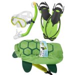
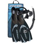
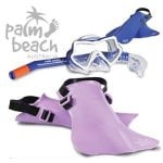
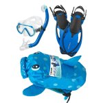
Imagine taking your child on an amazing snorkelling adventure. It is like discovering a whole new world with them. The packages in this category come complete with mask, snorkel and fins to help turn your child's imagination into reality. These sets are not the poor quality child gear that is commonly found in toy stores. They are manufactured with the same quality and love as their adult counterparts we offer at The Scuba Doctor. It should be noted that with respect to ordering, that sizes should be chosen with the child's current size requirement and choosing something that they will "grow into" is not advised. We want the best experience for your kids and you want them to both excel and enjoy with whatever they choose to do in life. Introducing them to the excitement and wonder of the world beneath the waves broadens their horizons. Who knows? You might just end up with the next Jacques Cousteau or Sylvia Earle?
Number Sixteen
![]() Shore Dive |
Shore Dive | ![]() Shore access
Shore access
![]()
![]()
![]()
![]()
![]()
Depth: 5 m (16 ft)
Level: Advanced Open Water and beyond
Number Sixteen Beach (aka Number 16 Beach) is a back beach of Rye on the Mornington Peninsula. There is a large gorge called 'The Divide' cut into the cliffs to the north-west of Number Sixteen Beach.
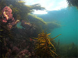
To the west of Number Sixteen Beach there is a series of undercut ledges and gullies dropping off a wide platform, and access is straight off the edge.
This area consists of a series of low ledges and gullies off the edge of the sea terrace. There are interesting undercuts full of fish. The platform has many wave-worn crevices, some of which are big enough for a diver to enter and contain blowholes exiting at the surface. They are very dangerous and a freak wave can force you through and against the rocks in a potentially fatal way. Those snorkellers and divers wanting to explore further can head around to 'The Divide'.
A rock formation known as 'The Dragon's Head' lies onshore and is popular with photographers. The shipwreck of the Craigburn lies just offshore.
Location: Rye, Victoria 3941
MELWAY Ref: Page 167 J10
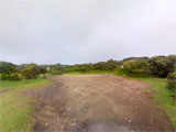
Parking: From Canterbury Jetty Road, Rye continue on to Tasman Drive and follow this coastal extension. Where Marcia Avenue intersects with Tasman Drive, turn right into the Number Sixteen Access Road. There is a car park at the end. From the car park you take the track east where you'll eventually come to steps that descend to the Number Sixteen Beach.
Entry/Exit: From Number Sixteen Beach.
The whole area is very exposed to southerly swells and very calm conditions are required for safe diving. See WillyWeather (No. 16 Beach) as a guide for the tide times and the height of the tide.
See also, "Number Sixteen" in "Shore Dives of Victoria" by Ian Lewis, 3rd edition pages 120–121.
Back Beach Warning: Always keep an eye on sea conditions throughout any dive on the Back Beaches of the Mornington Peninsula. Please read the warnings on the web page diving-the-back-beaches before diving or snorkelling this site.
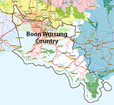
Traditional Owners — This dive site is in the traditional Country of the Boon Wurrung / Bunurong people of the Kulin Nation. This truly ancient Country includes parts of Port Phillip, from the Werribee River in the north-west, down to Wilson's Promontory in the south-east, including the Mornington Peninsula, French Island and Phillip Island, plus Western Port. We wish to acknowledge the Boon Wurrung as Traditional Owners. We pay respect to their Ancestors and their Elders, past, present and emerging. We acknowledge Bunjil the Creator Spirit of this beautiful land, who travels as an eagle, and Waarn, who protects the waterways and travels as a crow, and thank them for continuing to watch over this Country today and beyond.
Number Sixteen Location Map
Latitude: 38° 23.567′ S (38.392783° S / 38° 23′ 34.02″ S)
Longitude: 144° 47.369′ E (144.789483° E / 144° 47′ 22.14″ E)
Datum: WGS84 |
Google Map
| Get directions
Added: 2012-07-22 09:00:00 GMT, Last updated: 2022-03-27 16:29:21 GMT
Source: Google Earth
Nearest Neighbour: Craigburn, 373 m, bearing 238°, WSW
Rye, Back Beaches, Mornington Peninsula.
Depth: 5 m.
[ Top ]
DISCLAIMER: No claim is made by The Scuba Doctor as to the accuracy of the dive site coordinates listed here. Should anyone decide to use these GPS marks to locate and dive on a site, they do so entirely at their own risk. Always verify against other sources.
The marks come from numerous sources including commercial operators, independent dive clubs, reference works, and active divers. Some are known to be accurate, while others may not be. Some GPS marks may even have come from maps using the AGD66 datum, and thus may need be converted to the WGS84 datum. To distinguish between the possible accuracy of the dive site marks, we've tried to give each mark a source of GPS, Google Earth, or unknown.
Copyright © 2005-2022 by The Scuba Doctor Australia, ABN 88 116 755 170. All rights reserved.
tel. +61 3 5985 1700 :: email. diveshop@scubadoctor.com.au :: Web site by it'sTechnical 2022








![Halcyon Infinity 30lb System [SS Small Backplate] Halcyon Infinity 30lb System [SS Small Backplate]](/diveshop/images/halcyon/Halcyon-Evolve-Wing.jpg)


