Navigation
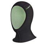
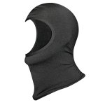
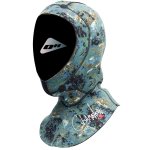
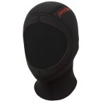
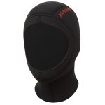
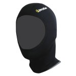
The Scuba Doctor stocks a large range of spearfishing hoods. Spear fishing hoods are important as they keep you warm and protect you from harmful jellyfish and other stingers.
If your head is warmed by a wetsuit hood then the rest of your body will also be much warmer. Spearfishing hoods also provide protection from dangerous jellyfish. If you are wearing a wetsuit hood it will protect your head from being stung.
Rye Scallop Beds
![]() Drift Dive |
Drift Dive | ![]() Boat access
Boat access
![]()
![]()
![]()
![]()
![]()
Depth: 10 m (33 ft) to 17 m (56 ft)
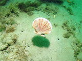
The goal on a drift dive at the Rye Scallop Beds is to enable enough ground to be covered to ensure you can fill your catch bag with great big fat juicy scallops. The scallop beds move around a little, and there is no guarantee you will see scallops straight away. But rest assured you will see them.
In Summer the scallops can generally be found in the areas nearby with depths ranging from 14 metres to 17 metres. The scallops like the cooler deeper water in summer.
In Winter the scallops are typically found in the areas nearby with depths ranging for 10 metres to 15 metres. The move into shallower waters for added warmth in winter.
Typically you would head out to this dive site from the Rye Boat Ramp and head west. The dive site is midway between Blairgowrie Pier and Rye Pier, just out from the Tyrone Boat Ramp in the Whitecliffs area. The bottom is flat sand with Scallops, Stingrays, Sea Squirts, Flat Head, and Large Spider Crabs. (The crabs are not suitable for eating.)
Divers have the opportunity to catch a feed of Scallops (Pecten fumatus) at this dive site. Remember your catch bag and current Victorian Recreational Fishing Licence. Please abide by all current fishing regulations, such as the bag limit of 100 scallops each, if you intend to catch scallops. See melbourne-scallop-dives for a list of other scallop dive sites near Melbourne.
Safety Tip: We recommend you read our boat-diving-safety and dive-float-and-flag pages and use the described Cray/Drift Buoy Line Diver Freedom System when drift diving from a private boat for scallops.
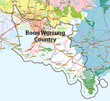
Traditional Owners — This dive site is in the traditional Country of the Boon Wurrung / Bunurong people of the Kulin Nation. This truly ancient Country includes parts of Port Phillip, from the Werribee River in the north-west, down to Wilson's Promontory in the south-east, including the Mornington Peninsula, French Island and Phillip Island, plus Western Port. We wish to acknowledge the Boon Wurrung as Traditional Owners. We pay respect to their Ancestors and their Elders, past, present and emerging. We acknowledge Bunjil the Creator Spirit of this beautiful land, who travels as an eagle, and Waarn, who protects the waterways and travels as a crow, and thank them for continuing to watch over this Country today and beyond.
Rye Scallop Beds Location Map
Latitude: 38° 20.812′ S (38.346867° S / 38° 20′ 48.72″ S)
Longitude: 144° 47.684′ E (144.794733° E / 144° 47′ 41.04″ E)
Datum: WGS84 |
Google Map
Added: 2019-02-18 00:16:00 GMT, Last updated: 2021-05-15 08:19:59 GMT
Source: GPS
Nearest Neighbour: Geoffs Scallop Hole, 1,373 m, bearing 174°, S
Depth: 10 to 17 m.
[ Top ]
DISCLAIMER: No claim is made by The Scuba Doctor as to the accuracy of the dive site coordinates listed here. Should anyone decide to use these GPS marks to locate and dive on a site, they do so entirely at their own risk. Always verify against other sources.
The marks come from numerous sources including commercial operators, independent dive clubs, reference works, and active divers. Some are known to be accurate, while others may not be. Some GPS marks may even have come from maps using the AGD66 datum, and thus may need be converted to the WGS84 datum. To distinguish between the possible accuracy of the dive site marks, we've tried to give each mark a source of GPS, Google Earth, or unknown.
Copyright © 2005-2022 by The Scuba Doctor Australia, ABN 88 116 755 170. All rights reserved.
tel. +61 3 5985 1700 :: email. diveshop@scubadoctor.com.au :: Web site by it'sTechnical 2022






![Halcyon Infinity 30lb System [SS Small Backplate] Halcyon Infinity 30lb System [SS Small Backplate]](/diveshop/images/halcyon/Halcyon-Evolve-Wing.jpg)


