Navigation
Commercial Diving Harnesses and Backpacks by Northern Diver provide safety and toughness to the Commercial Diving Industry. Made with high-quality nylon webbing, these harnesses are able to withstand many years of rugged commercial diving abuse.
Stingray Bay
![]() Shore Dive |
Shore Dive | ![]() Shore access
Shore access
![]()
![]()
![]()
![]()
![]()
Depth: 4 m (13 ft) to 12 m (39 ft)
Level: Open Water and beyond.
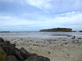
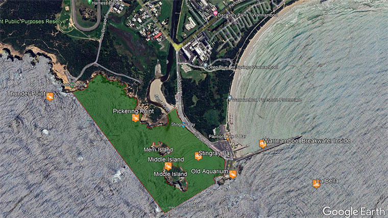
Stingray Bay (aka Breakwater Bay and The Horseshoe) is a shore diving and snorkelling site in a sheltered bay with shallow waters at the mouth of the Merri River in the lee of Middle Island. It lies on the Shipwreck Coast of Victoria and is part of the Merri Marine Sanctuary south-west of Warrnambool, located between the Harbour Breakwater and Thunder Point Coastal Reserve. It's a no-take area.
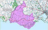
Merri Marine Sanctuary is a protected no-take zone that includes Stingray Bay. See the Merri Marine Sanctuary Map.
Diving and Snorkelling at Stingray Bay
Stingray Bay and surrounding reef are exceptional areas for underwater photography. There is a popular swimming beach too. The bay is more sheltered than other sites in this region. The reef areas feature kelp forests, swim throughs and a varying variety of fish and invertebrates.
The sandy bottom of much of Stingray Bay is home to stingrays and flathead. There are fringe reefs on either side and at the end of the bay, leading out to the Southern Ocean.
The kelp forest is amazing in Stingray Bay, stretching from where the reef starts on the left, across the end to the right side of the bay, which is the inside of Middle Island (aka Penguin Island).
Stingray Bay lies within the Merri Marine Sanctuary, so it's a no take zone. Look but don't take. The crayfish are so calm, they sit at the front of their ledges, happy to see divers take a photo or two.
The main area to dive at Stingray Bay is immediately behind the rocks extending from breakwater rock. Beneath the surface of the water, a spectacular array of marine plants and animals thrive including Sea Sweep, and Bigbelly Seahorse (aka Pot Belly Seahorse). Bottlenose Dolphins and Australian Fur Seals are regular visitors to Merri Marine Sanctuary. Keep an eye out for them as you explore the shore. Draughtboard Shark and Southern Eagle Rays are also common.
One of the most fascinating creatures you may discover here is the curious and charismatic Giant Australian Cuttlefish. Large and generally solitary, they tend to hide in caves and amongst seaweed during the day, but if you manage to find one, patient observation will be rewarded. The Giant Cuttlefish is a masterful quick-change artist, able to adjust its skin colouration in a split second to match its surroundings.
Location: Viaduct Road, Warrnambool, Victoria 3280
Parking: Park along the western side of Viaduct Road, near the first set of steps closest to the concrete wall (i.e southern end of the parking). Before gearing up check out the water. If you see lots of white water, head on home.
Entry/Exit: Take the steps down onto the beach and enter the water.
Ideal Conditions: Stingray Bay must be dived in calm conditions with light offshore north to north-east winds. Any onshore southerly to westerly winds make this site treacherous. You also require very low swell and low tide. See WillyWeather (Merri River Entrance) as a guide for the tide times and the height of the tide.
{{sally-watson}} {{merri-marine-sanctuary}}Traditional Owners — This dive site is in the traditional Country of the Eastern Maar people of south-western Victoria between the Shaw and Eumerella Rivers and from Yambuk in the south to beyond Lake Linlithgow in the north. This truly ancient Country extends as far north as Ararat and encompasses the coastal townships of Port Fairy in the west, Warrnambool, Peterborough, Port Campbell, Apollo Bay, Lorne, and Airies Inlet in the east, including the Great Ocean Road area. It also stretches 100 metres out to sea from low tide and therefore includes the iconic Twelve Apostles. "Eastern Maar" is a name adopted by the people who identify as Maar, Eastern Gunditjmara, Tjap Wurrung, Peek Whurrong, Kirrae Whurrung, Kuurn Kopan Noot and/or Yarro waetch (Tooram Tribe) amongst others. We wish to acknowledge the Eastern Maar as Traditional Owners. We pay respect to their Ancestors and their Elders, past, present and emerging.
Stingray Bay Location Map
Latitude: 38° 24.165′ S (38.40275° S / 38° 24′ 9.9″ S)
Longitude: 142° 28.406′ E (142.473433° E / 142° 28′ 24.36″ E)
Datum: WGS84 |
Google Map
| Get directions
Added: 2021-06-05 16:59:26 GMT, Last updated: 2022-05-25 05:46:23 GMT
Source: Google Earth
Nearest Neighbour: Middle Island, 189 m, bearing 251°, WSW
Merri Marine Sanctuary.
Warrnambool, Shipwreck Coast.
Depth: 4 to 12 m.
[ Top ]
DISCLAIMER: No claim is made by The Scuba Doctor as to the accuracy of the dive site coordinates listed here. Should anyone decide to use these GPS marks to locate and dive on a site, they do so entirely at their own risk. Always verify against other sources.
The marks come from numerous sources including commercial operators, independent dive clubs, reference works, and active divers. Some are known to be accurate, while others may not be. Some GPS marks may even have come from maps using the AGD66 datum, and thus may need be converted to the WGS84 datum. To distinguish between the possible accuracy of the dive site marks, we've tried to give each mark a source of GPS, Google Earth, or unknown.
Copyright © 2005-2022 by The Scuba Doctor Australia, ABN 88 116 755 170. All rights reserved.
tel. +61 3 5985 1700 :: email. diveshop@scubadoctor.com.au :: Web site by it'sTechnical 2022







![Halcyon Infinity 30lb System [SS Small Backplate] Halcyon Infinity 30lb System [SS Small Backplate]](/diveshop/images/halcyon/Halcyon-Evolve-Wing.jpg)


