Navigation
All of the accessories, plus care and maintenance items you'll need for your diving wetsuit are available from The Scuba Doctor at everyday low prices.
Table Rock, Ricketts Point
![]() Shore Dive |
Shore Dive | ![]() Shore access
Shore access
![]()
![]()
![]()
![]()
![]()
![]()
Depth: 1 m (3.28 ft) to 6 m (20 ft)
Level: Open Water and beyond.
Table Rock, Ricketts Point, is a popular diving and snorkelling site suited to intermediate and advanced snorkellers. It's located off Beach Road opposite Rennison Street, Beaumaris, within the 115 hectare Ricketts Point Marine Sanctuary in north-eastern Port Phillip. Table Rock faces south-west into Watkins Bay, and lies between Ricketts Point and Beaumaris Life Saving Club to the north-west, and Table Rock Point and Beaumaris Sea Scouts Jetty to the south-east.
Table Rock is a great site for night dive enthusiasts. It's so close to the city, thus very convenient for those living in Melbourne. Great for getting back in the water, a night dive after work, or just an excuse to get wet!
Diving and Snorkelling at Table Rock, Ricketts Point
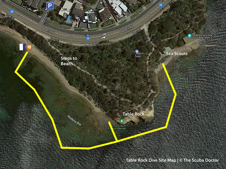
Enter the water just north-west of the base of the steps and enter the water into Watkins Bay. Head out and pick up the intertidal edge of Table Rock. Proceed around Table Rock and stop to look at the cave-like structure under the rock itself. This makes for an interesting outing. You can proceed around to Beaumaris Sea Scouts Jetty. From there, you can either dive or snorkel back to the entry point, or exit and walk back along Beach Road to Rennison Street, Beaumaris.
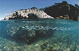
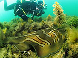
There is plenty of interesting reef marine life including Dusky Morwong, Eastern Australian Salmon, Moonlighters, Old Wives, Port Jackson Shark, Scalyfin, Smooth Stingrays, Southern Eagle Rays, Southern Fiddler Ray (aka Banjo Shark), Tasmanian Blennies, Zebrafish, and sea urchin. The deeper water sections result in sightings of larger fish at times.
Location: Beach Road, Beaumaris, Victoria 3193
MELWAY Ref: Page 86 D10
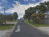
Parking: Park in Rennison Street, Beaumaris, and carefully cross Beach Road. There is no beachside parking, so please be careful crossing Beach Road. Before gearing up check out the water. If you see lots of white water, head on home.
Facilities: There are public toilets on the eastern side of Table Rock Point.
Warning: Always go with a buddy and carry a dive knife. Make sure you tow a dive buoy with dive flag.
Entry/Exit: Carefully cross Beach Road and start down the Bay Trail to the east of Rennison Street. About 30 metres along the trail there are steps leading down to the beach. Descend the steps to the beach and then head north-west on the beach to find a suitable entry point. The exit point is to return to this entry point, or head around Table Rock Point to exit at Beaumaris Sea Scouts Jetty. Some people have been known to do the dive in reverse by entering at Sea Scouts Jetty and exiting at Watkins Bay.
Ideal Conditions: Table Rock is best dived with offshore light north-westerly to north-easterly winds. Avoid diving with moderate to strong onshore south-easterly to south-westerly winds. Just before the high tide will give the clearest water. See WillyWeather (Table Rock Point) as a guide for the tide times and the height of the tide.
Ricketts Point Marine Sanctuary
This dive site is located within Ricketts Point Marine Sanctuary. There are actually a number of diving and snorkelling sites here including:
- McGregor Rock, Quiet Corner (Melway Map 85 K6)
- Banksia Point (Melway Map 86 B7)
- Tea House Reef North / Beaumaris Yacht Club (Melway Map 86 B8)
- Tea House Reef South / Beaumaris Yacht Club (Melway Map 86 B8)
- Tea House Bay (Melways 86 C9)
- Middle Reef (aka North Arm Reef) (Melways Map 86 C9)
- Triangle Reef, Ricketts Point (Melway Map 86 C9)
- Table Rock, Ricketts Point (Melway Map 86 D10)
- Sea Scouts Jetty (Melways 86 E9)
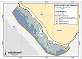
Ricketts Point Marine Sanctuary is on the north-east coast of Port Phillip and is approximately 20 km from Melbourne CBD. It abuts the Bayside City Council Foreshore Reserve from Table Rock Point in Beaumaris to Quiet Corner in Black Rock. It extends from the high water mark to approximately 450 m offshore.
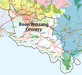
Aboriginal tradition indicates that the sanctuary is part of Country of Boon Wurrung people.
See also Beaumaris Yacht Club Webcam,
Parks Victoria: Rickett's Point Marine Sanctuary,
Park Note: Ricketts Point Marine Sanctuary — December 2003,
Marine Care Rickett's Point,
Marine Care Ricketts Point Fish Identification Chart,
Snorkelling Bayside: An Introduction to Snorkelling in the Ricketts Point Marine Sanctuary and Nearby Waters,
Ricketts Point Marine Sanctuary Visitor Guide by Parks Victoria — March 2019,
Ricketts Point Marine Sanctuary Management Plan — November 2005,
The Urban Sanctuary. Algae and Marine Invertebrates of Ricketts Point Marine Sanctuary,
iNaturalist Ricketts Point Check List,
Taxonomic Toolkit for the Marine Life of Port Phillip Bay,
How To Assess Visibility Before Heading To Snorkel Sites In Port Phillip / Western Port — by Simon Mustoe, 20 January 2022,
snorkelling-intertidal-zone.
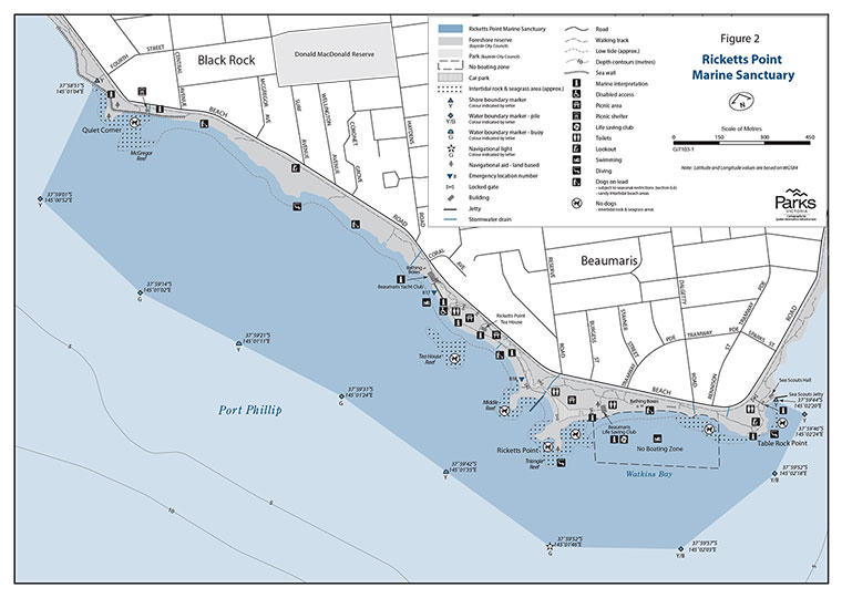
Ricketts Point Marine Sanctuary Map | Source: Parks Victoria — Ricketts Point Marine Sanctuary Management Plan, November 2005, page 67
You are not permitted to carry a spear gun while snorkelling or scuba diving in Ricketts Point Marine Sanctuary.
Traditional Owners — This dive site is in the traditional Country of the Boon Wurrung / Bunurong people of the Kulin Nation. This truly ancient Country includes parts of Port Phillip, from the Werribee River in the north-west, down to Wilson's Promontory in the south-east, including the Mornington Peninsula, French Island and Phillip Island, plus Western Port. We wish to acknowledge the Boon Wurrung as Traditional Owners. We pay respect to their Ancestors and their Elders, past, present and emerging. We acknowledge Bunjil the Creator Spirit of this beautiful land, who travels as an eagle, and Waarn, who protects the waterways and travels as a crow, and thank them for continuing to watch over this Country today and beyond.
Table Rock, Ricketts Point Location Map
Latitude: 37° 59.733′ S (37.995558° S / 37° 59′ 44.01″ S)
Longitude: 145° 2.189′ E (145.036491° E / 145° 2′ 11.37″ E)
Datum: WGS84 |
Google Map
| Get directions
Added: 2012-07-22 09:00:00 GMT, Last updated: 2022-04-20 03:03:27 GMT
Source: Google Earth
Nearest Neighbour: Sea Scouts Jetty, 226 m, bearing 87°, E
Ricketts Point Marine Sanctuary.
Beaumaris, Bayside, Port Phillip.
Depth: 1 to 6 m.
[ Top ]
DISCLAIMER: No claim is made by The Scuba Doctor as to the accuracy of the dive site coordinates listed here. Should anyone decide to use these GPS marks to locate and dive on a site, they do so entirely at their own risk. Always verify against other sources.
The marks come from numerous sources including commercial operators, independent dive clubs, reference works, and active divers. Some are known to be accurate, while others may not be. Some GPS marks may even have come from maps using the AGD66 datum, and thus may need be converted to the WGS84 datum. To distinguish between the possible accuracy of the dive site marks, we've tried to give each mark a source of GPS, Google Earth, or unknown.
Copyright © 2005-2022 by The Scuba Doctor Australia, ABN 88 116 755 170. All rights reserved.
tel. +61 3 5985 1700 :: email. diveshop@scubadoctor.com.au :: Web site by it'sTechnical 2022








![Halcyon Infinity 30lb System [SS Small Backplate] Halcyon Infinity 30lb System [SS Small Backplate]](/diveshop/images/halcyon/Halcyon-Evolve-Wing.jpg)


