Navigation
Whatever type of dive you enjoy the most, there is a specific type of footwear to suit you. If you're a commercial diver or a cave diver you would some safety boots with a non-slip sole, however, if you are a warm water sport diver then wetsuit boots might be the right choice.
The Springs, Lonsdale Bay
![]() Shore Dive |
Shore Dive | ![]() Shore access
Shore access
![]()
![]()
![]()
![]()
![]()
![]()
![]()
Depth: 0 m (0 ft) to 5 m (16 ft)
Level: Open Water and beyond.
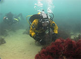
The Springs (aka Springs Beach and Springs Reef) is an interesting diving and snorkelling location at the end of Lawrence Road, Point Lonsdale on the Bellarine Peninsula facing south-east into Lonsdale Bay, Port Phillip. There is a convenient car park and it's a short distance to the water. Offshore from here is an expanse of shallow reef with a few big bommies and good fish life.
If diving from a boat, the GPS marks are:
Latitude: 38° 16.609′ S (38.276815° S / 38° 16′ 36.53″ S)
Longitude: 144° 37.343′ E (144.62238167° E / 144° 37′ 20.57″ E)
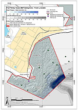
This site lies at the northerly end of the Point Lonsdale Section of the Port Phillip Heads Marine National Park. It is a major reef system that runs out from the shore for 300 plus metres to the South East and stretches across the tide stream as it flows inwards and outwards. As a result, it can be dived either from a boat or from the shore especially on the ebb tide. During this period the diver can drop below the lip of the reef and swim in relatively current free water.
The reef is split into two sections in which the inner reef is separated from the longer outer section by a small channel of about 30 metres. Just ensure that you maintain your direction for if you veer off your course and miss the reef you will have hectares of Sea Nymph, Amphibolus antarctica, meadows to swim over. Both reefs have a narrow ledge on the South West side stretching the whole length of them.
Do not be surprised to come across large Wobbegong Sharks resting under these ledges, they often share this space with a plethora of fish life. This is a great little shallow water dive for the more in-experienced diver. But always remember to have an exit plan as with the tides running here you can end up quite a great distance from where you entered the water.
As the site is sheltered and has only mild currents, it's often used as a training dive site. Pretty undiveable with any waves. Best done at high tide for extra depth.
Location: Corner Lawrence Road & Bowen Road, Point Lonsdale, Victoria 3225
MELWAY Ref: Page 500 A2
Beach Marker: 5B
Warning: The Springs is subject to a lot of boat and PWC traffic. Always take a dive float with a dive flag. Always go with a buddy and be extremely careful of the tidal flow.
See WillyWeather (Springs Beach) as a guide for the tide times and the height of the tide.
The Rip & Tides Warning: Always keep an eye on sea conditions throughout any shore or boat dive within "The Rip" (aka "The Heads"). This is a dangerous stretch of water, where Bass Straight meets Port Phillip, which has claimed many ships and lives. Please read the warnings on the web page diving-the-rip before diving or snorkelling this site.
Port Phillip Heads Marine National Park
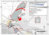
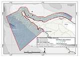
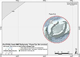
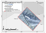
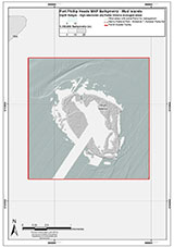
This site lies in the Port Phillip Heads Marine National Park. The park is made up of six separate marine areas around the southern end of Port Phillip: Swan Bay, Mud Islands, Point Lonsdale, Point Nepean, Popes Eye, and Portsea Hole.
Thirty-one of the 120 shipwrecks known to have occurred within a 10 nautical mile radius of Port Phillip Heads are thought to be within the Port Phillip Heads Marine National Park in Point Lonsdale and Point Nepean.
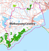
Aboriginal tradition indicates that the Bellarine Peninsula side of the Port Phillip Heads Marine National Park is part of Country of the Wathaurung people, and the Mornington Peninsula side, including Mud Islands, is part of Country of the Boon Wurrung people.
See also, Parks Victoria: Port Phillip Heads Marine National Park,
Park Note: Port Phillip Heads Marine National Park,
Port Phillip Heads Marine National Park - Map,
Divers Guide - Port Phillip Heads Marine National Park,
Port Phillip Heads Marine National Park Identification Booklet, and
Taxonomic Toolkit for the Marine Life of Port Phillip Bay.
You are not permitted to carry a spear gun while snorkelling or scuba diving in Port Phillip Heads Marine National Park.
Traditional Owners — This dive site is in the traditional Country of the Wathaurong (Wadda-Warrung) people of the Kulin Nation. This truly ancient Country includes the coastline of Port Phillip, from the Werribee River in the north-east, the Bellarine Peninsula, and down to Cape Otway in the south-west. We wish to acknowledge the Wathaurong as Traditional Owners. We pay respect to their Ancestors and their Elders, past, present and emerging. We acknowledge Bunjil the Creator Spirit of this beautiful land, who travels as an eagle, and Waarn, who protects the waterways and travels as a crow, and thank them for continuing to watch over this Country today and beyond.
The Springs, Lonsdale Bay Location Map
Latitude: 38° 16.565′ S (38.276083° S / 38° 16′ 33.9″ S)
Longitude: 144° 37.212′ E (144.6202° E / 144° 37′ 12.72″ E)
Datum: WGS84 |
Google Map
| Get directions
Added: 2012-07-22 09:00:00 GMT, Last updated: 2022-04-07 17:14:00 GMT
Source: Google Earth
Nearest Neighbour: Narrows Beach, 1,027 m, bearing 71°, ENE
Point Lonsdale, Bellarine Peninsula.
Depth: 0 to 5 m.
[ Top ]
DISCLAIMER: No claim is made by The Scuba Doctor as to the accuracy of the dive site coordinates listed here. Should anyone decide to use these GPS marks to locate and dive on a site, they do so entirely at their own risk. Always verify against other sources.
The marks come from numerous sources including commercial operators, independent dive clubs, reference works, and active divers. Some are known to be accurate, while others may not be. Some GPS marks may even have come from maps using the AGD66 datum, and thus may need be converted to the WGS84 datum. To distinguish between the possible accuracy of the dive site marks, we've tried to give each mark a source of GPS, Google Earth, or unknown.
Copyright © 2005-2022 by The Scuba Doctor Australia, ABN 88 116 755 170. All rights reserved.
tel. +61 3 5985 1700 :: email. diveshop@scubadoctor.com.au :: Web site by it'sTechnical 2022






![Halcyon Infinity 30lb System [SS Small Backplate] Halcyon Infinity 30lb System [SS Small Backplate]](/diveshop/images/halcyon/Halcyon-Evolve-Wing.jpg)


