Navigation
Time
![]() Wreck Dive |
Wreck Dive | ![]() Boat access
Boat access
![]()
![]()
![]()
![]()
![]()
Steel Screw Cargo Steamer | Max Depth: 8 m (26 ft)
Level: Open Water and beyond.
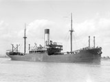
The Time (aka SS Time) shipwreck lies midway along the northern side of Nepean Reef, Port Phillip Heads. The wreck was visible until the early 1960s when during a storm it slid off the northern side of Nepean reef and broke up.
Diving the Time Shipwreck
The Time shipwreck lies on an west-east axis among reef gullies, sand and kelp. The stern end of the Time is towards Point Nepean and the bow towads Campbell Rock. The Time wreck dive site is dominated by two huge boilers lying in the middle of the wreck remains. Wreckage is scatter over a wide area as a result of blasting by divers and the poundng by the sea.
This site must be dived in extremely calm conditions at slack water. The area is prone to unexpected ocean swells.
The Rip & Tides Warning: Always keep an eye on sea conditions throughout any shore or boat dive within "The Rip" (aka "The Heads"). This is a dangerous stretch of water, where Bass Straight meets Port Phillip, which has claimed many ships and lives. Please read the warnings on the web page diving-the-rip before diving or snorkelling this site.
Time Shipwreck History — Built in 1913
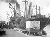
The SS Time was a steel screw cargo steamer of 3,322 tons gross, built in 1913, by J. Priestman & Co., in Sunderland, England and launched in January 1913. The Time had the dimensions of 340 ft (104 m) long, with a beam of 48.3 ft (15 m), and a depth of 21.8 ft (6.64 m).
The Time had two decks, two masts, an elliptical stern, a cellular double bottom, and 6 cemented bulkheads. Its four cylinder expansion steam engine and three multiple multi tubular boilers produced 442.5 net horsepower, supplied to its single screw. The Time had a top speed of 12 knots (22 kpm).
The Time was built by Australian Steamships Pty Ltd (Howard Smith & Co.) to replace their earlier steamer Time, of 1,669 registred tons, which struck a reef near Cape Martin, at 10.30 p.m. on Friday 13 January 1911, about a mile and a half off the shore at Beachport, South Australia.Time Sinking — Wrecked 23 August 1949
The SS Time left Sydney on 19 August 1949 under the command of Captain William McClenaghan bound for Melbourne with 41 crew.
At 3:10 a.m. on 26 August 1949, the Time was near its destination and steaming at 11 knots through The Rip in the white sector of the Lonsdale light, in moderate conditions with an ebb tide. Soon after this the second officer warned Captain McClenaghan that they were in the red danger sector of the light and the Captain ordered the engine's full astern. The Captain then ordered 'hard to starboard' in an attempt to head the vessel out to sea, then 'hard to port' to check the swing to starboard, but there was no respect response to the helm on this occasion and at 3:20 a.m. the ebb tide drifted theTime onto Nepean Reef.
The Queenscliff lifeboat was quickly on the scene at 4:00 a.m. and stood by for the next 13 hours, eventually taking off all of the crew at 5:30 p.m. and landing them safely at Queenscliff. The crew of the time later donated £35 to start a fund for the purchase of a modern lifeboat as a sign of their appreciation for the efforts of the lifeboat crew.
Two Queenscliff fishermen purchased the wreck for £950 pounds (insured value £30,000) and its timber cargo and made a handsome profit. The cargo and most fittings of value were recovered.
The derelict hull of the Time remainded a landmark at The Heads for more than 10 years until it was blasted to remove it for the purpose of shooting the 'Submarine entering The Heads' scene from the film of Neville Shute's book 'On the Beach'. The take of this scene was never used in the film.
See also, Heritage Council Victoria: SS Time, and
Australian National Shipwreck Database: S.S. Time.
Heritage Warning: Any shipwreck or shipwreck relic that is 75 years or older is protected by legislation. Other items of maritime heritage 75 years or older are also protected by legislation. Activities such as digging for bottles, coins or other artefacts that involve the disturbance of archaeological sites may be in breach of the legislation, and penalties may apply. The legislation requires the mandatory reporting to Heritage Victoria as soon as practicable of any archaeological site that is identified. See Maritime heritage. Anyone with information about looting or stolen artefacts should call Heritage Victoria on (03) 7022 6390, or send an email to heritage.victoria@delwp.vic.gov.au.
Port Phillip Heads Marine National Park
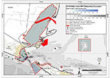
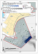
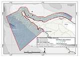
This site lies in the Port Phillip Heads Marine National Park. The park is made up of six separate marine areas around the southern end of Port Phillip: Swan Bay, Mud Islands, Point Lonsdale, Point Nepean, Popes Eye, and Portsea Hole.
Thirty-one of the 120 shipwrecks known to have occurred within a 10 nautical mile radius of Port Phillip Heads are thought to be within the Port Phillip Heads Marine National Park in Point Lonsdale and Point Nepean.
Aboriginal tradition indicates that the Bellarine Peninsula side of the Port Phillip Heads Marine National Park is part of Country of the Wathaurung people, and the Mornington Peninsula side, including Mud Islands, is part of Country of the Boon Wurrung people.
See also, Parks Victoria: Port Phillip Heads Marine National Park,
Park Note: Port Phillip Heads Marine National Park,
Port Phillip Heads Marine National Park - Map,
Divers Guide - Port Phillip Heads Marine National Park,
Port Phillip Heads Marine National Park Identification Booklet, and
Taxonomic Toolkit for the Marine Life of Port Phillip Bay.
You are not permitted to carry a spear gun while snorkelling or scuba diving in Port Phillip Heads Marine National Park.
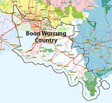
Traditional Owners — This dive site is in the traditional Country of the Boon Wurrung / Bunurong people of the Kulin Nation. This truly ancient Country includes parts of Port Phillip, from the Werribee River in the north-west, down to Wilson's Promontory in the south-east, including the Mornington Peninsula, French Island and Phillip Island, plus Western Port. We wish to acknowledge the Boon Wurrung as Traditional Owners. We pay respect to their Ancestors and their Elders, past, present and emerging. We acknowledge Bunjil the Creator Spirit of this beautiful land, who travels as an eagle, and Waarn, who protects the waterways and travels as a crow, and thank them for continuing to watch over this Country today and beyond.
Time Location Map
Latitude: 38° 17.993′ S (38.299883° S / 38° 17′ 59.58″ S)
Longitude: 144° 38.698′ E (144.644967° E / 144° 38′ 41.88″ E)
Datum: WGS84 |
Google Map
Added: 2012-07-22 09:00:00 GMT, Last updated: 2022-05-16 07:13:13 GMT
Source: Book - Shipwrecks Around Port Phillip Heads GPS (verified)
Nearest Neighbour: Nepean Reef, 0 m, bearing 0°, N
Steel Screw Cargo Steamer, 3316 ton.
Sunk: 27 August 1949.
Port Phillip Heads Marine National Park.
Depth: 5 to 8 m.
[ Top ]
DISCLAIMER: No claim is made by The Scuba Doctor as to the accuracy of the dive site coordinates listed here. Should anyone decide to use these GPS marks to locate and dive on a site, they do so entirely at their own risk. Always verify against other sources.
The marks come from numerous sources including commercial operators, independent dive clubs, reference works, and active divers. Some are known to be accurate, while others may not be. Some GPS marks may even have come from maps using the AGD66 datum, and thus may need be converted to the WGS84 datum. To distinguish between the possible accuracy of the dive site marks, we've tried to give each mark a source of GPS, Google Earth, or unknown.
Copyright © 2005-2022 by The Scuba Doctor Australia, ABN 88 116 755 170. All rights reserved.
tel. +61 3 5985 1700 :: email. diveshop@scubadoctor.com.au :: Web site by it'sTechnical 2022







![Halcyon Infinity 30lb System [SS Small Backplate] Halcyon Infinity 30lb System [SS Small Backplate]](/diveshop/images/halcyon/Halcyon-Evolve-Wing.jpg)


