Navigation
YCW Beach
![]() Reef Dive |
Reef Dive | ![]() Shore access
Shore access
![]()
![]()
![]()
![]()
![]()
Depth: 2 m (6.56 ft) to 14 m (46 ft)
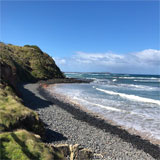
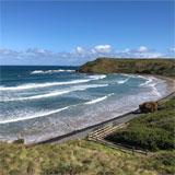
YCW Beach on Phillip Island is named after the Young Catholic Workers Camp, which lies on the grassy bluffs immediately behind the beach. The 400 metre stretch of combles down to a sandy beach features gentle waves and rock pools.
The YCW Beach faces south-east, with basalt headlands and rock platforms at each end, and a 400 metre long sand beach in between them. The beach receives waves averaging 1 m and usually has a beach that is awash at high tide. The waves then break over a narrow cobble beach between the sand and the backing 10 to 30 metre high bluffs. In contrast, at low tide the beach is wide, low and shallow, with rips running out against each head.
From the beach entry you would typically venture east to explore the reef structures of Smith's Point. The weed-covered shallows hold small swim throughs, crevices and over hangs with good fish life. Blue Devils, Port Jackson Sharks, Draughtboard Sharks, Boarfish, and Old Wife are common.
You can also head west to explore the rock platforms under the basalt headland there.
Location: Smiths Beach, Phillip Island, Victoria 3922
MELWAY Ref: Page 732 A7
Emergency Beach Location: A8
Parking: Beachcomber Avenue, Phillip Island runs south to the YCW Camp and a large car park on the 20 metre bluffs behind the eastern end of YCW Beach. YCW Beach amenities include change rooms, toilets with accessible washrooms and gravel car parking. Meals and snacks are available nearby at the local store — the perfect stop after all the underwater adventures. The beach is accessible by stairs from the car park.
Entry/Exit: The best entry and exit point is out from the steps down to YCW Beach from the car park. It's at the eastern end next to Smith's Point.
Ideal Conditions: The beach faces south so best dived with an offshore northerly wind. Best at high tide. See WillyWeather (Smiths Beach) as a guide for the tide times and the height of the tide. Beware of strong currents and conditions quickly turning bad.
See also, Smith's Beach and Smith's Point in "Shore Dives of Victoria" by Ian Lewis, 3rd edition page 145.
Bass Strait Warning: Always keep an eye on sea conditions throughout any shore or boat dive in Bass Strait on Victoria's coastline. Please read the warnings on the web page diving-in-bass-strait before diving or snorkelling this site.
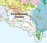
Traditional Owners — This dive site is in the traditional Country of the Boon Wurrung / Bunurong people of the Kulin Nation. This truly ancient Country includes parts of Port Phillip, from the Werribee River in the north-west, down to Wilson's Promontory in the south-east, including the Mornington Peninsula, French Island and Phillip Island, plus Western Port. We wish to acknowledge the Boon Wurrung as Traditional Owners. We pay respect to their Ancestors and their Elders, past, present and emerging. We acknowledge Bunjil the Creator Spirit of this beautiful land, who travels as an eagle, and Waarn, who protects the waterways and travels as a crow, and thank them for continuing to watch over this Country today and beyond.
YCW Beach Location Map
Latitude: 38° 30.282′ S (38.504708° S / 38° 30′ 16.95″ S)
Longitude: 145° 15.012′ E (145.250192° E / 145° 15′ 0.69″ E)
Datum: WGS84 |
Google Map
| Get directions
Added: 2022-03-14 12:28:01 GMT, Last updated: 2022-03-14 15:04:19 GMT
Source: Google Earth
Nearest Neighbour: Smiths Beach, 861 m, bearing 106°, ESE
Phillip Island.
Depth: 2 to 14 m.
[ Top ]
DISCLAIMER: No claim is made by The Scuba Doctor as to the accuracy of the dive site coordinates listed here. Should anyone decide to use these GPS marks to locate and dive on a site, they do so entirely at their own risk. Always verify against other sources.
The marks come from numerous sources including commercial operators, independent dive clubs, reference works, and active divers. Some are known to be accurate, while others may not be. Some GPS marks may even have come from maps using the AGD66 datum, and thus may need be converted to the WGS84 datum. To distinguish between the possible accuracy of the dive site marks, we've tried to give each mark a source of GPS, Google Earth, or unknown.
Copyright © 2005-2022 by The Scuba Doctor Australia, ABN 88 116 755 170. All rights reserved.
tel. +61 3 5985 1700 :: email. diveshop@scubadoctor.com.au :: Web site by it'sTechnical 2022








![Halcyon Infinity 30lb System [SS Small Backplate] Halcyon Infinity 30lb System [SS Small Backplate]](/diveshop/images/halcyon/Halcyon-Evolve-Wing.jpg)


