Navigation
Get the gear to fish for crayfish, rock lobsters, abalone and scallops right here at The Scuba Doctor.
Depending on where you are in Australia, there are different regulations that apply. You need to make sure that you comply wish them.
Size requirements are very important. It is essential to have a gauge on you while lobstering or fishing for abalone. Remember, that once a lobster or abalone is placed in a catch bag, it is considered to be in possession. So be careful about the size of your catch. Also, do not keep female lobsters bearing eggs, they must be released unharmed.
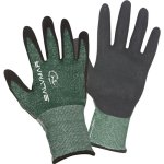
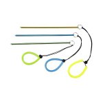
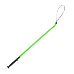
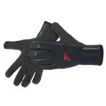
Now that you know some of the rules, its time to gear up! Check out our selection of scuba gear, diving gloves, catch bags, snares and tickle sticks. Get proper training before using any of these products. Be sure to follow diving safety rules, manufacturer instructions and warnings. Whatever you do, follow the regulations and be safe.
Adieu
![]() Wreck Dive |
Wreck Dive | ![]() Boat access
Boat access
![]()
![]()
![]()
Two-Masted Wooden Ketch | Max Depth: 3 m (9.84 ft)
Level: Open Water and beyond.
The Adieu was a wooden ketch used in the lime trade on Port Phillip. The shipwreck lies in very shallow water near Rye and has protected status.
Ideal Conditions:
Southerly winds and high tide. Not diveable in strong Northerly winds. Though the high tide is ideal, you are able to dive this site on any tide.
See WillyWeather (Rye Pier) as a guide for the tide times and the height of the tide.
Weather Required: The following winds will be okay: Northerly <15 knots, Westerly <15 knots, Southerly <15 knots, Easterly <25 knots. Not current prone. Better at high tide to get more depth.
Adieu Shipwreck History
The Adieu was a two-masted wooden ketch built in 1877, for owner John Bennes by William Jarman, and launched from Gravelly Beach, River Tamar, Tasmania. The Adieu was 15 t (17 s-ton) with dimensions of 38.9 ft (12 m) length, 13.8 ft (4.21 m) breadth and 5.5 ft (1.68 m) depth.
Two years after being launched the Adieu was sold to Melbourne interests, registered in April 1879, and used in the lime trade on Port Phillip. The vessel was owned by David Inverarity of Melbourne at the time of its loss.
Adieu Sinking
Captained by the owner David Inverarity, the Adieu was wrecked in the Lime Channel near Rye during a storm on 3 September 1882 and became a total wreck. She had bags of lime on board when she got into trouble. The crew appear to have thrown the cargo overboard in an attempt to save her and the solidified bags of Lime sit about 150 metres from the wreck.
See also Heritage Council Victoria: Adieu, and
Australian National Shipwreck Database: Adieu.
The Adieu is listed with Heritage Victoria as a ship of historical significance.
Finding the Adieu Shipwreck
The GPS marks for this dive site are taken from the Australasian Underwater Cultural Heritage Database and are likely to be very inaccurate. If you have verified GPS marks, please pass them on to us.
Rye Pier Shipwrecks
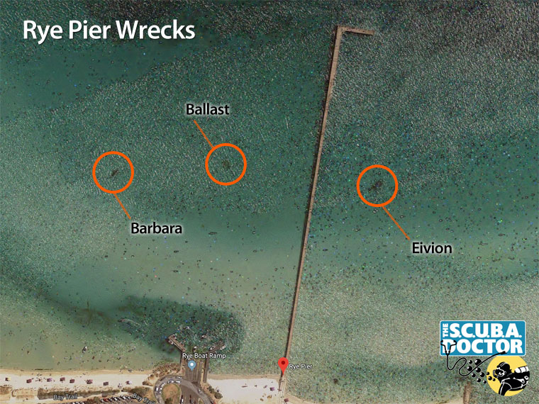
Eivion: The wreck of the Eivion lies to the east of Rye Pier, in about 2 metres of water. It can be spotted from up on the pier (about halfway) as a dark patch. It is often home to many nudibranchs and rays. You can find shrimp and a variety of small fish. Something nice to change things up or to head to on a second dive.
There are also two dark patches on the eastern side of Rye Pier clearly visible on Google Earth. Both sites lie on a clear sandy seabed with a maximum depth of 3 metres. Both sites are accessible via the shore or the pier as well as by boat. Both sites are heavily overgrown with weed, making it difficult to distinguish features.
The patch closest to the west side of Rye Pier is at
Latitude: 38° 22.010′ S (38.3668332° S / 38° 22′ 0.6″ S)
Longitude: 144° 49.293′ E (144.82155° E / 144° 49′ 17.58″ E)
.
146 m, bearing 237°, WSW
This appears to be a mound of basalt rocks (not dressed) and is typical of a ballast mound from a ship.
Barbara: The second patch, further to the west, is the shipwreck remains of the wooden schooner Barbara. The remains consist of some frames and planking and a small pile of green rounded ballast stones. From the size and shape of the frames.
Caution: Care needs to be taken if you plan to visit the sites of these shipwrecks, especially those west of Rye Pier, offshore from the Rye Boat Ramp. These are high traffic boating areas. For your own safety, you must use a surface dive float and dive flag.
The sand in this part of Port Phillip is highly mobile and there may be more of the wreck underneath the seabed.
Historical accounts of shipwrecks at Rye inform us that four wrecks have occurred in the vicinity of Rye Pier.
- Barbara: schooner, built at Exeter River Tamar, Tasmania, 1841, 39.3’ x 10.8’ x 5.5’ (feet), 16 tons. Owned by Capt. G. W. Cole. Totally wrecked at White Cliffs (Rye), 6 August, 1852.
- Opossum, cutter, carvel built, Macquarie Harbour, Tasmania, 1827, 36.2’ x 10.8’ x 6.4’ (feet), 19 tons. Totally wrecked White Cliffs ca 1853.
- Adieu: ketch, built at Gravelly Beach, Tasmania, 1877, 38.9’ x 13.8’ x 5.5’ (feet), 15 tons, owned by David Inverarity, totally wrecked below Rye, 3 September, 1882.
- Eivion: ketch, built Williamstown, 1886, 27 tons, 65.8’ x 16.2’ x 4.2’ (feet), previously owned by Benjamin Stenniken. Totally wrecked in the vicinity of Rye Pier 4–5 December, 1921.
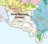
Traditional Owners — This dive site is in the traditional Country of the Boon Wurrung / Bunurong people of the Kulin Nation. This truly ancient Country includes parts of Port Phillip, from the Werribee River in the north-west, down to Wilson's Promontory in the south-east, including the Mornington Peninsula, French Island and Phillip Island, plus Western Port. We wish to acknowledge the Boon Wurrung as Traditional Owners. We pay respect to their Ancestors and their Elders, past, present and emerging. We acknowledge Bunjil the Creator Spirit of this beautiful land, who travels as an eagle, and Waarn, who protects the waterways and travels as a crow, and thank them for continuing to watch over this Country today and beyond.
Adieu Location Map
Latitude: 38° 19.800′ S (38.33° S / 38° 19′ 48″ S)
Longitude: 144° 50.100′ E (144.835° E / 144° 50′ 6″ E)
Datum: WGS84 |
Google Map
Added: 2022-01-02 19:20:32 GMT, Last updated: 2022-04-29 14:42:38 GMT
Source: Australasian Underwater Cultural Heritage Database (approximate location only)
Nearest Neighbour: Rye Scallop Drift, 1,367 m, bearing 106°, ESE
Wooden Ketch.
Built: Gravelly Beach, Tasmania, 1877.
Sunk: 3 September 1882.
Rye, Mornington Peninsula, Port Phillip.
Depth: 3 m.
[ Top ]
DISCLAIMER: No claim is made by The Scuba Doctor as to the accuracy of the dive site coordinates listed here. Should anyone decide to use these GPS marks to locate and dive on a site, they do so entirely at their own risk. Always verify against other sources.
The marks come from numerous sources including commercial operators, independent dive clubs, reference works, and active divers. Some are known to be accurate, while others may not be. Some GPS marks may even have come from maps using the AGD66 datum, and thus may need be converted to the WGS84 datum. To distinguish between the possible accuracy of the dive site marks, we've tried to give each mark a source of GPS, Google Earth, or unknown.
Copyright © 2005-2022 by The Scuba Doctor Australia, ABN 88 116 755 170. All rights reserved.
tel. +61 3 5985 1700 :: email. diveshop@scubadoctor.com.au :: Web site by it'sTechnical 2022









![Halcyon Infinity 30lb System [SS Small Backplate] Halcyon Infinity 30lb System [SS Small Backplate]](/diveshop/images/halcyon/Halcyon-Evolve-Wing.jpg)


