Navigation
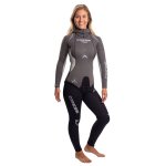
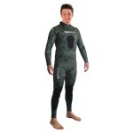
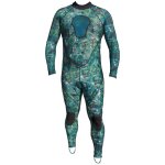
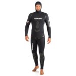
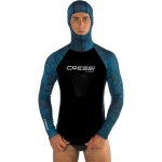
Experienced freedivers prefer to use wetsuits designed specifically for freediving. Desirable traits in a freediving wetsuit include:
- Close fitting: Freedivers usually prefer custom fit wetsuits for a close fit.
- Two-piece: Most freediving wetsuits have an integrated hood and a two-piece suit including a 'long john' or high trousers and separate jacket.
- No zipper: to minimise water circulation
- Material: Freedivers prefer open cell neoprene for warmth and mobility, but it is more fragile than the standard closed-cell neoprene used in scuba diving wetsuits! To don a freediving wetsuit without damaging it, it is best to make it wet (without soap) before putting it on!
Black Boy
![]() Wreck Dive |
Wreck Dive | ![]() Shore access
Shore access
![]()
![]()
![]()
![]()
![]()
Iron Screw Steamer Tug | Max Depth: 10 m (33 ft)
Level: Open Water and beyond.
The history of the Black Boy shipwreck is linked with that of the George Roper. The steam screw tug was assisting in the salvage of cargo from the George Roper on 8 July 1883 when several big swells slammed the tug onto the George Roper. The skipper tried to move away but a line fouled the Black Boy's propeller. She was swept onto a nearby reef, broke up and sank.
Diving the Black Boy Shipwreck
The Black Boy lies east of the George Roper, just off the southern tip of Mushroom Rock. The hull is overturned and the remains of machinery and fittings can be seen.
The remains of the Black Boy lie on the bottom in shallow water to the north of the outer reef of Point Lonsdale. It's broken in two with the bow pointing to the south, with the stern laying just to the north with its engine, propeller and stern, still relatively intact and laying at right angles to the bow.
The site of the Black Boy is more exposed to The Rip's tidal currents than the George Roper and Holyhead. Best dived in very calm conditions, with no swell, on slack water ebb or ebb tide.
See WillyWeather (Rip Bank) as a guide for the tide times and the height of the tide.
The Rip & Tides Warning: Always keep an eye on sea conditions throughout any shore or boat dive within "The Rip" (aka "The Heads"). This is a dangerous stretch of water, where Bass Straight meets Port Phillip, which has claimed many ships and lives. Please read the warnings on the web page diving-the-rip before diving or snorkelling this site.
Bass Strait Warning: Always keep an eye on sea conditions throughout any shore or boat dive in Bass Strait on Victoria's coastline. Please read the warnings on the web page diving-in-bass-strait before diving or snorkelling this site.
Black Boy Shipwreck History — Built in 1857
The Black Boy was an iron screw steamer of 66 tons, built in 1857, by John Scott & Co., in Greenock, Scotland, on the dimensions of 81.5 ft (25 m) in length, a breadth of 15 ft (4.57 m) and a depth of 7.9 ft (2.41 m). The vessel was clincher built and was fitted with two direct acting steam engines of 15 horsepower, with two cylinders, of 14 inches in diameter with 16 inch stroke.
The Black Boy was initially owned by Messrs Curtis, Harvey & Co., who used it as a lighter at their works in Glenlean, Holy Loch, and to carry gunpowder from London to Wales.
The Black Boy was schooner rigged for its voyage out from the United Kingdom in 1875. It was purchased by James Deane of Williamstown to be used in the towing trade. The vessel then underwent an extensive refit, with the mass being removed, the old boilers replaced, the engine's overhauled and a new four bladed propeller fitted.
For many years the steamer was used for towing and other works around Port Phillip. As a result of the large sailing ship George Roper going ashore on Point Lonsdale, the Black Boy was engaged to help in salvaging cargo from the wrecked vessel.
Black Boy Sinking — Wrecked 8 July 1883
The Black Boy was chartered for twenty pounds a day by the 'George Roper Syndicate' to be employed in salvage of the George Roper, which was wrecked on 4 July 1883, when it was accidentally towed into the Lonsdale Reef by the steam tug Williams (also known as James Deane} in dense fog.
In fine weather and smooth seas on 6 July 1883, under the command of Captain Stafford, the Black Boy had already successfully unloaded about 30 tons of cargo at the Queenscliff Wharf, consisting of printing paper, softgoods and bath bricks. It was also used to tow the kethches Nith and Agnes to the site to salvage cargo.
On 8 July 1883, a groundswell had set in, making the recovery operation more difficult. In heavy seas and moored along the port side of the George Roper the gang of workers and crews successfully retrieved about 40 tons of softgoods and general merchandise, off the ship's boats, a long 13 inch hawser, the sails and other miscellaneous items. Captain Stafford was alternatively steaming ahead and astern to maintain control and prevent the Black Boy from breaking away from its mooring lines in the pitching seas. Suddenly the mast of the Black Boy was caught in the mizzen braces of the George Roper and was broken away in a triangle of timber and rigging causing much confusion and difficulty.
The decision was made to abandon the salvage effort because of the perilous conditions, when a towline became entangled in the propeller and rudder of the Black Boy just as the crew were casting away the fore and aft mooring lines to depart. Some reports say the rope remained entangled in the propeller, another says the rudder was broken in two.
At the same time a 'nasty sea' hit the Black Boy and struck the George Roper heavily. The Black Boy's funnel was torn off, again caught by the mizzen braces of the George Roper. Then the Black Boy was swept helplessly around the stern of the George Roper and was caught in the strong six knot flood tide heading straight for the exposed outer reef of Point Lonsdale. It was here just after 12 noon on 8 July 1883, that the Black Boy struck the southern tip of Mushroom Rock, east of George Roper.
The Black Boy was rolling dangerously in the surf with seas breaking over the stern. At low tide the Black Boy was seen to be high and dry wedged between two or three pinnacles on 'a relatively square bed of rock'. The 12 men aboard, consisting of the crew and 'lumpers' were lucky to escape with their lives and were finally rescued by the lifeboat at 3:00 p.m. when the tide changed, under the watchful eyes of hundreds of spectators gathered on Point Lonsdale to witness the excitement.
On 12 July 1883, the Black Boy sold at auction and the same evening was 'struck by a high high rolling wave, and knocked completely over the reef into deep water, where she at once floundered'. It was also reported to have been 'forced over the reef into about 12 feet of water, turning completely around, with her bows to the reef'.
See also, Heritage Council Victoria: Black Boy,
Australian National Shipwreck Database: Black Boy, and
The Lonsdale Wrecks in "Shore Dives of Victoria" by Ian Lewis, 3rd edition pages 54–55.
Heritage Warning: Any shipwreck or shipwreck relic that is 75 years or older is protected by legislation. Other items of maritime heritage 75 years or older are also protected by legislation. Activities such as digging for bottles, coins or other artefacts that involve the disturbance of archaeological sites may be in breach of the legislation, and penalties may apply. The legislation requires the mandatory reporting to Heritage Victoria as soon as practicable of any archaeological site that is identified. See Maritime heritage. Anyone with information about looting or stolen artefacts should call Heritage Victoria on (03) 7022 6390, or send an email to heritage.victoria@delwp.vic.gov.au.
Port Phillip Heads Marine National Park
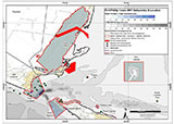
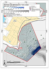
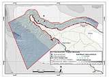
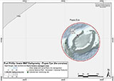
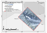
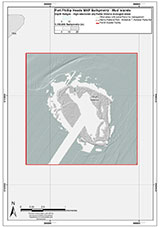
This site lies in the Port Phillip Heads Marine National Park. The park is made up of six separate marine areas around the southern end of Port Phillip: Swan Bay, Mud Islands, Point Lonsdale, Point Nepean, Popes Eye, and Portsea Hole.
Thirty-one of the 120 shipwrecks known to have occurred within a 10 nautical mile radius of Port Phillip Heads are thought to be within the Port Phillip Heads Marine National Park in Point Lonsdale and Point Nepean.
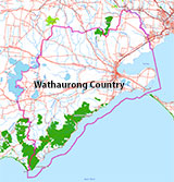
Aboriginal tradition indicates that the Bellarine Peninsula side of the Port Phillip Heads Marine National Park is part of Country of the Wathaurung people, and the Mornington Peninsula side, including Mud Islands, is part of Country of the Boon Wurrung people.
See also, Parks Victoria: Port Phillip Heads Marine National Park,
Park Note: Port Phillip Heads Marine National Park,
Port Phillip Heads Marine National Park - Map,
Divers Guide - Port Phillip Heads Marine National Park,
Port Phillip Heads Marine National Park Identification Booklet, and
Taxonomic Toolkit for the Marine Life of Port Phillip Bay.
You are not permitted to carry a spear gun while snorkelling or scuba diving in Port Phillip Heads Marine National Park.
Traditional Owners — This dive site is in the traditional Country of the Wathaurong (Wadda-Warrung) people of the Kulin Nation. This truly ancient Country includes the coastline of Port Phillip, from the Werribee River in the north-east, the Bellarine Peninsula, and down to Cape Otway in the south-west. We wish to acknowledge the Wathaurong as Traditional Owners. We pay respect to their Ancestors and their Elders, past, present and emerging. We acknowledge Bunjil the Creator Spirit of this beautiful land, who travels as an eagle, and Waarn, who protects the waterways and travels as a crow, and thank them for continuing to watch over this Country today and beyond.
Black Boy Location Map
Latitude: 38° 17.735′ S (38.295583° S / 38° 17′ 44.1″ S)
Longitude: 144° 36.978′ E (144.6163° E / 144° 36′ 58.68″ E)
Datum: WGS84 |
Google Map
| Get directions
Added: 2012-07-22 09:00:00 GMT, Last updated: 2022-05-04 04:05:25 GMT
Source: Book - Shipwrecks Around Port Phillip Heads GPS (verified)
Nearest Neighbour: Holyhead, 104 m, bearing 290°, WNW
Iron Screw Steamer Tug, 66 ton.
Built: Greenock, Scotland, 1857.
Sunk: 8 July 1883.
Port Phillip Heads.
Depth: 3 to 10 m.
Dive only on: SWE, Ebb.
[ Top ]
DISCLAIMER: No claim is made by The Scuba Doctor as to the accuracy of the dive site coordinates listed here. Should anyone decide to use these GPS marks to locate and dive on a site, they do so entirely at their own risk. Always verify against other sources.
The marks come from numerous sources including commercial operators, independent dive clubs, reference works, and active divers. Some are known to be accurate, while others may not be. Some GPS marks may even have come from maps using the AGD66 datum, and thus may need be converted to the WGS84 datum. To distinguish between the possible accuracy of the dive site marks, we've tried to give each mark a source of GPS, Google Earth, or unknown.
Copyright © 2005-2022 by The Scuba Doctor Australia, ABN 88 116 755 170. All rights reserved.
tel. +61 3 5985 1700 :: email. diveshop@scubadoctor.com.au :: Web site by it'sTechnical 2022




![Halcyon Infinity 30lb System [SS Small Backplate] Halcyon Infinity 30lb System [SS Small Backplate]](/diveshop/images/halcyon/Halcyon-Evolve-Wing.jpg)


