Navigation
The Scuba Doctor has swimming caps that are made of the best silicone and latex available in the current swim market place. Swim caps are an essential for all swimmers from beginners and professional competitors. Buy swim caps online with The Scuba Doctor for the best brands and selection.
George Roper
![]() Wreck Dive |
Wreck Dive | ![]() Shore access
Shore access
![]()
![]()
![]()
![]()
![]()
![]()
Four-Masted Iron Barque | Max Depth: 6 m (20 ft)
Level: Open Water and beyond.
The George Roper was on its maiden voyage to Port Phillip when it ran onto rocks off Point Lonsdale. The ship was loaded with a valuable cargo worth £10,000 including iron railings for use in railway construction, malt, distilled liquors, drapery and dynamite.
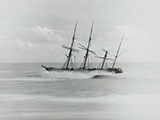
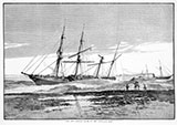
George Roper looked a magnificent sight, stranded on the reef with its sails intact, and it drew quite a crowd of onlookers. Knowledge that the ship's cargo was still on board also lured scavengers. Some prospective looters camped on the beach at Buckley's Cave to wait for the first opportunity to sneak on board the ship, or to pick up cargo which might eventually wash ashore as the ship broke up.
The George Roper was a four-masted iron sailing barque built to carry cargo. The vessel was shipwrecked on its maiden voyage, and now lies in shallow water and is accessible to adventurous divers and snorkellers.
The George Roper is archaeologically and historically significant as an example of a large, fast, international trader built especially for the Australian run.
Diving and Snorkelling the George Roper Shipwreck
The George Roper lies in shallow water, 4 m (13 ft) to 6 m (20 ft), with its bow facing into Point Lonsdale Reef. The 66-ton steamer Black Boy, used in the salvage of the vessel, lies nearby.
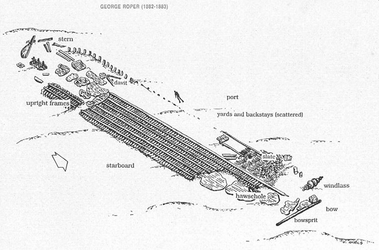
The wreck of the George Roper extends for over 83 m (272 ft) from the large anchor winch at the bow to the rudder which lies seaward of the Lonsdale Reef.
The lower portion of the hull, below the bilge line, lies semi-intact with the ship's keelson, side keelsons and bilge keelsons clearly visible for most of the wreck's length. At the bow, one of the ship's large winches is offset to the port side of the wreck. A hawse hole can be seen among the hull plating on the starboard side of the vessel.
Parts of the rigging such as masts, yards, backstays and deadeyes lie among the hull remains. A lifting davit lies at the stern with a bollard and bit nearby. Divers should also be able to see the rudder standing upright towards the port side of the wreck.
Fragments of cargo including slate, ceramic pieces and clay pipes are strewn about the wreck.
The remnants of iron and other debris around the wreck have become home to many different species of reef fish. The wreck has also been colonised by masses of kelp and other seaweed, making this a very colourful wreck dive.
This is a tidal site and best dived at slack water at the end of the ebb tide.
See WillyWeather (Rip Bank) as a guide for the tide times and the height of the tide.
Bass Strait Warning: Always keep an eye on sea conditions throughout any shore or boat dive in Bass Strait on Victoria's coastline. Please read the warnings on the web page diving-in-bass-strait before diving or snorkelling this site.
The Rip & Tides Warning: Always keep an eye on sea conditions throughout any shore or boat dive within "The Rip" (aka "The Heads"). This is a dangerous stretch of water, where Bass Straight meets Port Phillip, which has claimed many ships and lives. Please read the warnings on the web page diving-the-rip before diving or snorkelling this site.
George Roper Shipwreck History — Built in 1883
The George Roper was a four-masted iron barque of 2,033 l-ton (2,066 t), built in 1882, for W.T. Dickson and Son in the W.H. Potter and Son shipyard in Liverpool, England. The vessel was built on a length of 301.7 ft (92 m), a beam of 39.1 ft (12 m), and a depth of 23.6 ft (7.19 m).
The George Roper was specifically designed for fast sailing and bringing large consignments of cargo to Australia. The vessel had a new innovation for that era with the positioning of its bridge deck amidships.
The George Roper was launched on 10 February 1883, and almost immediately was struck by the steamer Bentinc. The damage to George Roper was a 17 foot gap from the taffrail to near the waterline, and repairs had to be made before its voyage to Melbourne.
George Roper Sinking — First and Final Voyage — 4 July 1883
The George Roper left Liverpool bound for Melbourne, on 4 April 1883, with a crew of 31 under the command of Captain John Ward, on its maiden voyage. It was carrying soft goods, draperies, household items, spirits, dynamite, and 1,400 tons of steel rails for the Victorian Government. The George Roper had an uneventful and speedy trip out to Australia, reaching Cape Otway in 82 days.On Wednesday 4 July 1883, the George Roper was met by headwinds in Bass Strait, about eight miles off Port Phillip Heads, and was taken under tow by the steam tug Williams with Pilot Gifford in charge. Conditions suddenly worsened, and the Williams had veered too far west in a heavy fog. Both the Williams and the George Roper struck Lonsdale Reef on 4 July 1883, with the tug making water so fast that it had to go up the Bay at once for repairs.
As the fog lifted, it was discovered that the George Roper was stranded in one of the most dangerous and inaccessible parts of the reef, immediately opposite the green light at Point Lonsdale. Attempts to float the George Roper off the reef failed. The barque's captain and crew were transferred to Albatross and taken to Queenscliff.
After two days, the underwriters sold the wreck at auction to a Melbourne syndicate. After recovering considerable cargo, the syndicate sold the wreck to a Geelong syndicate which continued to recover cargo for some months. On 26 August, the George Roper finally broke up and sunk.
The tug Black Boy, one of the vessels commissioned to salvage George Roper, also hit the reef after its trailing cable became entangled in its propeller. The crew of the Black Boy was saved, but the tug sunk.
See also, Heritage Council Victoria: George Roper,
Australian National Shipwreck Database: George Roper,
Dive Information Sheet: George Roper (1882-1883), and
The Lonsdale Wrecks in "Shore Dives of Victoria" by Ian Lewis, 3rd edition pages 54–55.
This vessel is one of the many historic shipwrecks included in Victoria's shipwreck-discovery-trail. Qualified divers can explore the wrecks of old wooden clippers, iron steamships and cargo and passenger vessels located along the coast and in Port Phillip. Some of these wreck dives are suitable for beginners, even snorkellers, while other wrecks require the skills and experience of advanced divers.
Heritage Warning: Any shipwreck or shipwreck relic that is 75 years or older is protected by legislation. Other items of maritime heritage 75 years or older are also protected by legislation. Activities such as digging for bottles, coins or other artefacts that involve the disturbance of archaeological sites may be in breach of the legislation, and penalties may apply. The legislation requires the mandatory reporting to Heritage Victoria as soon as practicable of any archaeological site that is identified. See Maritime heritage. Anyone with information about looting or stolen artefacts should call Heritage Victoria on (03) 7022 6390, or send an email to heritage.victoria@delwp.vic.gov.au.
Port Phillip Heads Marine National Park
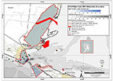
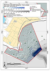
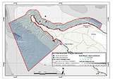
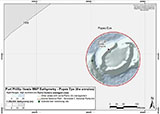
This site lies in the Port Phillip Heads Marine National Park. The park is made up of six separate marine areas around the southern end of Port Phillip: Swan Bay, Mud Islands, Point Lonsdale, Point Nepean, Popes Eye, and Portsea Hole.
Thirty-one of the 120 shipwrecks known to have occurred within a 10 nautical mile radius of Port Phillip Heads are thought to be within the Port Phillip Heads Marine National Park in Point Lonsdale and Point Nepean.
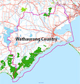
Aboriginal tradition indicates that the Bellarine Peninsula side of the Port Phillip Heads Marine National Park is part of Country of the Wathaurung people, and the Mornington Peninsula side, including Mud Islands, is part of Country of the Boon Wurrung people.
See also, Parks Victoria: Port Phillip Heads Marine National Park,
Park Note: Port Phillip Heads Marine National Park,
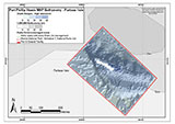
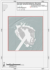
Port Phillip Heads Marine National Park - Map,
Divers Guide - Port Phillip Heads Marine National Park,
Port Phillip Heads Marine National Park Identification Booklet, and
Taxonomic Toolkit for the Marine Life of Port Phillip Bay.
You are not permitted to carry a spear gun while snorkelling or scuba diving in Port Phillip Heads Marine National Park.
Traditional Owners — This dive site is in the traditional Country of the Wathaurong (Wadda-Warrung) people of the Kulin Nation. This truly ancient Country includes the coastline of Port Phillip, from the Werribee River in the north-east, the Bellarine Peninsula, and down to Cape Otway in the south-west. We wish to acknowledge the Wathaurong as Traditional Owners. We pay respect to their Ancestors and their Elders, past, present and emerging. We acknowledge Bunjil the Creator Spirit of this beautiful land, who travels as an eagle, and Waarn, who protects the waterways and travels as a crow, and thank them for continuing to watch over this Country today and beyond.
George Roper Location Map
Latitude: 38° 17.700′ S (38.295° S / 38° 17′ 42″ S)
Longitude: 144° 36.901′ E (144.615017° E / 144° 36′ 54.06″ E)
Datum: WGS84 |
Google Map
| Get directions
Added: 2012-07-22 09:00:00 GMT, Last updated: 2022-05-14 09:55:23 GMT
Source: Book - Shipwrecks Around Port Phillip Heads GPS (verified)
Nearest Neighbour: Holyhead, 31 m, bearing 152°, SSE
Four-Masted Iron Barque, 2033 ton.
Built: Liverpool, England, 1882.
Dive only on: SWE, Ebb.
Sunk: 4 July 1883.
Port Phillip Heads Marine National Park.
Depth: 4 to 6 m.
[ Top ]
DISCLAIMER: No claim is made by The Scuba Doctor as to the accuracy of the dive site coordinates listed here. Should anyone decide to use these GPS marks to locate and dive on a site, they do so entirely at their own risk. Always verify against other sources.
The marks come from numerous sources including commercial operators, independent dive clubs, reference works, and active divers. Some are known to be accurate, while others may not be. Some GPS marks may even have come from maps using the AGD66 datum, and thus may need be converted to the WGS84 datum. To distinguish between the possible accuracy of the dive site marks, we've tried to give each mark a source of GPS, Google Earth, or unknown.
Copyright © 2005-2022 by The Scuba Doctor Australia, ABN 88 116 755 170. All rights reserved.
tel. +61 3 5985 1700 :: email. diveshop@scubadoctor.com.au :: Web site by it'sTechnical 2022



![Halcyon Infinity 30lb System [SS Small Backplate] Halcyon Infinity 30lb System [SS Small Backplate]](/diveshop/images/halcyon/Halcyon-Evolve-Wing.jpg)


