Collendina Beach
![]() Reef Dive |
Reef Dive | ![]() Shore access
Shore access
![]()
![]()
![]()
![]()
![]()
![]()
![]()
Depth: 2 m (6.56 ft) to 14 m (46 ft)
Level: Open Water and beyond.
The Collendina Beach diving and snorkelling site lies towards the western end of Collendina Beach, Ocean Grove on Victoria's Barwon Coast facing into Bass Strait. On a very calm day with no wind and no swell it is an amazing snorkelling and diving site for experienced practitioners to explore.
Collendina Beach occupies most of the open bay between Point Lonsdale (to the east) and Barwon Heads (to the west) on the Barwon Coast. It is 6 kilometre long, extending from the reefs west of Point Lonsdale Beach to 1 kilometre west of the Collendina Beach car park. The only public access is at the car park, together with tracks over the foredune from the caravan park. The beach faces south-south-east and for the most part is backed by 10 to 20 metre high, vegetated dunes, with a few blowouts. It receives waves averaging between 1 and 1.5 metre, which break over a wide, low gradient surf zone and occasional reefs and rocks. Persistent rips occur every 250 metres, with some permanent rips against the more prominent reefs. During bigger seas, waves break on outer, deeper reefs.
Be careful on this beach as there are usually deep rip holes and strong currents along the beach. Unless conditions are ideal, stay inshore on the attached section of the bars and well clear of the rips and reefs.
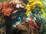
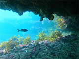
The Collendina Reefs (aka Breakers Reefs) are the most interesting things to see at Collendina Beach. The reefs lie due south from the beach, up to 400 metres offshore. Lots of gullies, overhangs and sea caves teeming with life. Marine species to be found here include squid, Bluethroat Wrasse, Gulf Wobbegong Shark, Port Jackson Shark, Smooth Stingrays, and Maori Octopus.
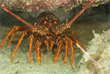
Southern Rock Lobster (aka Crayfish) and abalone can sometimes be found out around the offshore reefs.
The Collendina Beach diving and snorkelling site makes for exhilarating snorkelling and diving when conditions permit.
Location: Ocean Grove, Victoria 3226
MELWAY Ref: Page 498 E2
Beach Marker: 6W
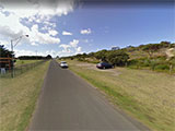
Parking: At Ocean Grove on the access track off Bonnyvale Road to the Collendina Caravan Park, there is parking and a beach access track at Collendina beach marker 6W on the Buckley Park Foreshore Reserve.
Also, there is parking on the Buckley Park Foreshore Reserve at beach marker 7W on Ocean Throughway, near the corner with Bonnyvale Road (opposite a milk bar on the northern side of the road). There are public toilets, picnic area/tables, and beach access steps.
Entry/Exit: Head down onto the beach and take a look at the conditions. If you see lots of white water, head on home. If conditions are just right, gear up, walk back down onto the beach and enter the water from Collendina Beach.
Warning: Collendina Beach is a highly hazardous beach dominated by rocks, reefs and strong rips. Always go with a buddy and be extremely careful. Experienced divers and snorkellers only.
Ideal Conditions: Only attempt to dive or snorkel here if conditions are very calm with little wind, flat seas, and no swell. The beach faces faces south, so light offshore north-westerly to north-easterly winds can be acceptable. See WillyWeather (Smiths Beach) as a guide for the tide times and the height of the tide.
Bass Strait Warning: Always keep an eye on sea conditions throughout any shore or boat dive in Bass Strait on Victoria's coastline. Please read the warnings on the web page diving-in-bass-strait before diving or snorkelling this site.
Divers have the opportunity to catch Abalone at this dive site. Remember your catch bag, legal abalone tool, current Victorian Recreational Fishing Licence, and abalone measure. Please abide by all current fishing regulations if you intend to catch abalone.
See article-catching-abalone for practical abalone hunting advice from The Scuba Doctor, plus melbourne-abalone-dives for a list of other Abalone dive sites near Melbourne.
Divers have the opportunity to catch Southern Rock Lobster (aka Crayfish) at this dive site. Remember your catch bag, current Victorian Recreational Fishing Licence, rock lobster measure, and cray tags. Once you get back to the dive boat, or shore, make sure you clip the tail and tag your Crayfish as per Fisheries requirements. Please abide by all current fishing regulations if you intend to catch crays. See article-catching-crayfish for practical cray hunting advice from The Scuba Doctor, plus melbourne-cray-dives for a list of other crayfish dive sites near Melbourne. For tips on cooking your Crays, please see article-cooking-crayfish.
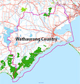
Traditional Owners — This dive site is in the traditional Country of the Wathaurong (Wadda-Warrung) people of the Kulin Nation. This truly ancient Country includes the coastline of Port Phillip, from the Werribee River in the north-east, the Bellarine Peninsula, and down to Cape Otway in the south-west. We wish to acknowledge the Wathaurong as Traditional Owners. We pay respect to their Ancestors and their Elders, past, present and emerging. We acknowledge Bunjil the Creator Spirit of this beautiful land, who travels as an eagle, and Waarn, who protects the waterways and travels as a crow, and thank them for continuing to watch over this Country today and beyond.
Collendina Beach Location Map
Latitude: 38° 16.432′ S (38.273867° S / 38° 16′ 25.92″ S)
Longitude: 144° 33.111′ E (144.551851° E / 144° 33′ 6.66″ E)
Datum: WGS84 |
Google Map
| Get directions
Added: 2022-04-03 21:59:35 GMT, Last updated: 2022-04-29 12:45:05 GMT
Source: Google Earth
Nearest Neighbour: Buckley Park Reef, 1,072 m, bearing 193°, SSW
Ocean Grove, Barwon Coast.
Depth: 2 to 14 m.
[ Top ]
DISCLAIMER: No claim is made by The Scuba Doctor as to the accuracy of the dive site coordinates listed here. Should anyone decide to use these GPS marks to locate and dive on a site, they do so entirely at their own risk. Always verify against other sources.
The marks come from numerous sources including commercial operators, independent dive clubs, reference works, and active divers. Some are known to be accurate, while others may not be. Some GPS marks may even have come from maps using the AGD66 datum, and thus may need be converted to the WGS84 datum. To distinguish between the possible accuracy of the dive site marks, we've tried to give each mark a source of GPS, Google Earth, or unknown.

