Navigation
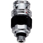
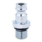
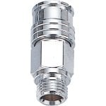
The Scuba Doctor offers a large variety of low pressure (LP) quick disconnect adaptors for recreational, technical, rebreather, sidemount and commercial diving applications.
There are a number of different quick disconnect connection types used by different brands for different purposes. It's essential that you select the right one for your intended purpose.
Reminder: The actual configuration of an adaptor is a mirror image of its use. A 3/8"-24 UNF FEMALE port requires a 3/8"-24 UNF MALE adaptor etc. In technical diving operations where many fittings may get co-mingled, be sure that all adaptor combinations can accommodate the intended flows and pressures.
Looking for a particular fitting you don't see here? Let us know and we'll see if we can order it for you.
We reserve the right to limit order quantities to less than 10 pieces because our supply is appropriate for the demands of individual divers, but not bulk orders. Large volume bulk orders will NOT qualify for our free shipping promotion.
Edinburgh Castle
![]() Wreck Dive |
Wreck Dive | ![]() Boat access
Boat access
![]()
![]()
![]()
Three-Masted Iron Barque | Max Depth: 5 m (16 ft)
Level: Open Water and beyond.
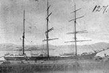
The Edinburgh Castle shipwreck lies in Lady Bay, Warrnambool on the Shipwreck Coast of Victoria. Twenty ships are believed to have sunk in Warrnambool's Lady Bay, but only the wrecks of three, Edinburgh Castle, Free Trader and La Bella and have been discovered.
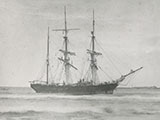
A mistake by the pilot resulted in the barque Edinburgh Castle going ashore on 15 January 1888 in calm weather in Lady Bay at Warrnambool. The vessel was loaded with cement for the new breakwater, and hopes were high that it could be refloated. However, it soon began to settle into the sand, and then broke up in subsequent rough weather.
Diving and Snorkelling the Edinburgh Castle Shipwreck
The wreck of the Edinburgh Castle was rediscovered by divers Peter Rowland and Colin Goodall in November 1985, almost 100 years after the hapless vessel went ashore. She lies two-thirds of the way around Lady Bay towards Hopkins River. The site is almost directly seaward of the path leading from Grannys Grave.
The wreck lies in 4 to 5 metres of water. The seafloor is a soft mobile sand that continuously covers and uncovers the wreck site.
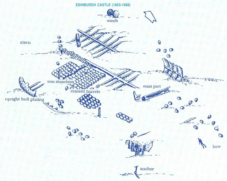
The Edinburgh Castle shipwreck lies broadside to the beach with the bow pointing south-east towards the river mouth. The wreck covers an area of 30 by 40 metres and includes scattered portions of the ship's hull along with the remains of the cargo.
A windlass and anchor indicate the position of the bow. A winch seen at the stern was probably used for shifting cargo or for handling the sails.
The remains of concrete cement barrels which the Edinburgh Castle was carrying when it sunk can also be seen. Over the years the sea has destroyed the wooden barrels but the cement inside has hardened producing perfect replicas of them.
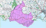
Shipwrecks of South-west Victoria | Source: Flagstaff Hill Maritime Museum
Divers should take considerable care as the site is prone to heavy surf and the surge is usually strong.
Launch at the the nearby Warrnambool (Lady Bay) boat ramp and head south past the end of the breakwater and then offshore. Beware of the surf zone. There are no underwater hazards but this region is extremely dangerous in any swell.
See WillyWeather (Lady Bay) as a guide for the tide times and the height of the tide.
{{southern-ocean-warning}}Edinburgh Castle Shipwreck History — Built in 1863
The Edinburgh Castle was a three-masted iron barque of 627 tons, built in 1863, by J G Lawrie of Glasgow, Scotland. The vessel had a length of 174.3 ft (53 m), a beam of 29.5 ft (8.99 m), and a depth of 18.7 ft (5.7 m).
In the period from 1863-1885 the vessel was under the ownership of Skinner & Co. of Glasgow, and made voyages between the Clyde, China and Singapore. In 1885 the vessel was owned by Gifford & Nicholson of Liverpool.
Edinburgh Castle Sinking — 15 January 1888
In 1887 Edinburgh Castle had passed to new owners, Gifford and Nicholson of Liverpool. The first journey of the ship under the command of Captain Darling for its new owners was to deliver a cargo of 4,900 barrels of concrete for construction of the Warrnambool breakwater.
The voyage from England was long and exhausting for the crew. The ship had struck rough weather for most of the journey including a hurricane in the Atlantic. One hundred and one days passed before the south coast of Australia was sighted on 13 January 1888. Edinburgh Castle was posted as overdue. But when news spread that the ship was approaching Lady Bay, a large crowd gathered to welcome the vessel to Warrnambool.
The Edinburgh Castle was on a voyage from Liverpool, England to Warrnambool with 6,000 casks of cement for the construction of the Warrnambool breakwater. She was under the command of Captain Darling. She arrived off Warrnambool 101 days out after an eventful voyage.
The vessel had entered Lady Bay and waited for the pilot to take it to anchorage. When the relieving Harbour Master, Pilot Carless boarded the vessel on 15 January 1888 at the entrance to Lady Bay to bring it to safe anchorage, it was 3/4 mile off the Eastern Beach and 1/4 mile off the leading lights. However the lighthouse keeper could see that the vessel was too close to shore. He signalled, "stand out running to danger", but the ship did not see the signals and continued on the same course.
When Edinburgh Castle was less than two kilometres from its destination and close to the Hopkins River, a squall blew-up. Pilot Carless tried to change the ship's direction, but it continued sailing toward shore. The ship tacked but did not come about. The sails filled again and the ship picked up speed grounding bow onto shore facing Hopkins River. The wind was from the north-west.
Two Government kedge anchors were put out astern, but had no effect and the ship settled rapidly in the sand 180 yards from shore. Casks of cement were thrown overboard to lighten the ship but to no avail. The stern anchors finally let go and the vessel bumped closer to the shore and appeared to go broadside.
The Edinburgh Castle lodged firmly in the sand. The cement barrels were thrown overboard to lighten the load. A distress call was telegraphed to the coastal steamer, Julia Percy, asking for assistance to pull Edinburgh Castle off the sandbar. The steamer arrived at 6.00 a.m. the next morning and spent several hours pulling on full steam but still could not budge the cargo ship.
As all rescue attempts had failed, the captain decided to take his crew off the ship. At the request of the captain, the first mate, seaman and local lighterman stayed on board. The weather was changing for the worse and the locals were worried about the safety of the three men on board. They brought rocket gear to the beach but as they prepared to fire a line across the ship, the men on board dropped a message in a bottle overboard saying they were quite comfortable on the ship.
During the night the weather worsened and this time, the three men sent out distress signals which were picked up by the lighthouse keeper. The rocket crew were alerted and rushed to the beach. Several rockets were fired across to the ship. A breeches buoy was attached to the third line and the men were hauled from the ship to safety.
By morning it was apparent that the ship was doomed. It had been driven in even closer to shore and waves were sweeping right over the ship's deck. That same morning, Edinburgh Castle was offered for auction in Melbourne as a "sound ship with all the fittings and in the best order". The ship fetched &pond;520 and the sale was completed before news reached the auction rooms that the ship was in fact a total wreck.
The Edinburgh Castle disaster was investigated by the Pilot Board and Pilot Carless was found guilty of an error of judgement. Despite the loss of the ship and all its fittings, the pilot was merely cautioned and warned to be more careful in the future.
See also, west-coast-shipwreck-trail,
Heritage Council Victoria: Edinburgh Castle, and
Dive Information Sheet: Edinburgh Castle (1863-1888).
This vessel is one of the many historic shipwrecks included in Victoria's shipwreck-discovery-trail. Qualified divers can explore the wrecks of old wooden clippers, iron steamships and cargo and passenger vessels located along the coast and in Port Phillip. Some of these wreck dives are suitable for beginners, even snorkellers, while other wrecks require the skills and experience of advanced divers.
Heritage Warning: Any shipwreck or shipwreck relic that is 75 years or older is protected by legislation. Other items of maritime heritage 75 years or older are also protected by legislation. Activities such as digging for bottles, coins or other artefacts that involve the disturbance of archaeological sites may be in breach of the legislation, and penalties may apply. The legislation requires the mandatory reporting to Heritage Victoria as soon as practicable of any archaeological site that is identified. See Maritime heritage. Anyone with information about looting or stolen artefacts should call Heritage Victoria on (03) 7022 6390, or send an email to heritage.victoria@delwp.vic.gov.au.
Finding the Edinburgh Castle Shipwreck
Over the years we've been provided with different GPS marks for the Edinburgh Castle. The GPS marks we know of in circulation for the Edinburgh Castle are:
- GPS (verified):
Latitude: 38° 23.953′ S (38.399220193723° S / 38° 23′ 57.19″ S)
Longitude: 142° 29.885′ E (142.4980801828° E / 142° 29′ 53.09″ E) - Unknown GPS:
Latitude: 38° 24.161′ S (38.40269° S / 38° 24′ 9.68″ S)
Longitude: 142° 30.049′ E (142.50081° E / 142° 30′ 2.92″ E)
453 m, bearing 148°, SSE
Traditional Owners — This dive site is in the traditional Country of the Eastern Maar people of south-western Victoria between the Shaw and Eumerella Rivers and from Yambuk in the south to beyond Lake Linlithgow in the north. This truly ancient Country extends as far north as Ararat and encompasses the coastal townships of Port Fairy in the west, Warrnambool, Peterborough, Port Campbell, Apollo Bay, Lorne, and Airies Inlet in the east, including the Great Ocean Road area. It also stretches 100 metres out to sea from low tide and therefore includes the iconic Twelve Apostles. "Eastern Maar" is a name adopted by the people who identify as Maar, Eastern Gunditjmara, Tjap Wurrung, Peek Whurrong, Kirrae Whurrung, Kuurn Kopan Noot and/or Yarro waetch (Tooram Tribe) amongst others. We wish to acknowledge the Eastern Maar as Traditional Owners. We pay respect to their Ancestors and their Elders, past, present and emerging.
Edinburgh Castle Location Map
Latitude: 38° 23.953′ S (38.39922° S / 38° 23′ 57.19″ S)
Longitude: 142° 29.885′ E (142.49808° E / 142° 29′ 53.09″ E)
Datum: WGS84 |
Google Map
Added: 2012-07-22 09:00:00 GMT, Last updated: 2022-05-23 19:19:14 GMT
Source: GPS (verified)
Nearest Neighbour: Hopkins Reef, 1,239 m, bearing 141°, SE
Three-Masted Iron Barque.
Built: Glasgow, Scotland, 1863.
Sunk: 15 January 1888.
Lady Bay, Warrnambool, Shipwreck Coast.
Depth: 5 m.
[ Top ]
DISCLAIMER: No claim is made by The Scuba Doctor as to the accuracy of the dive site coordinates listed here. Should anyone decide to use these GPS marks to locate and dive on a site, they do so entirely at their own risk. Always verify against other sources.
The marks come from numerous sources including commercial operators, independent dive clubs, reference works, and active divers. Some are known to be accurate, while others may not be. Some GPS marks may even have come from maps using the AGD66 datum, and thus may need be converted to the WGS84 datum. To distinguish between the possible accuracy of the dive site marks, we've tried to give each mark a source of GPS, Google Earth, or unknown.
Copyright © 2005-2022 by The Scuba Doctor Australia, ABN 88 116 755 170. All rights reserved.
tel. +61 3 5985 1700 :: email. diveshop@scubadoctor.com.au :: Web site by it'sTechnical 2022







![Halcyon Infinity 30lb System [SS Small Backplate] Halcyon Infinity 30lb System [SS Small Backplate]](/diveshop/images/halcyon/Halcyon-Evolve-Wing.jpg)


