Eliza Ramsden
![]() Wreck Dive |
Wreck Dive | ![]() Boat access
Boat access
![]()
![]()
![]()
![]()
![]()
Three-Masted Iron Barque | Max Depth: 22 m (72 ft)
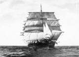
The Eliza Ramsden was only one year old when it ran aground on Corsair Rock, Point Nepean Reef. In its short career, she had made only one complete voyage.
The Eliza Ramsden, a three-masted iron sailing barque with a clipper bow, is one of Victoria's most spectacular shipwreck sites and thus has both recreational and educational significance. It is archaeologically significant as relics of cultural significance, including a small ship's bell, have been found on the site.
Diving the Eliza Ramsden Shipwreck
The wreck of the Eliza Ramsden was rediscovered by Queenscliff divers Col Ferrier, Alan Farman and Gordon Baker in the early 1970s.
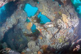
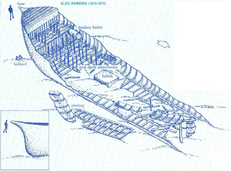
The Eliza Ramsden shipwreck lies upright and quite badly broken up, quite close to the South Channel in Port Phillip. She sits on the seabed facing east-west with her bow pointing to Police Point, Queenscliff in the west. The donkey boiler is still visible. The clipper bow was virtually intact until it collapsed in the 2010s.
The hull plating and some of the decking along the starboard side of the vessel is still in place. Much of the port side decking has collapsed, probably as a result of the explosives used to clear the site in the early 1960s. Inside the hull are many bluestone blocks, which the ship used for ballast.
The Eliza Ramsden is a great dive for Open Water divers, and also gives photographers ample time to capture that special wreck diving shot. The Eliza Ramsden has a great deal of marine life, including soft corals and bright yellow zoanthids. Common reef fish found around the wreck include Southern Blue Devil, Old Wives, boarfish, wrasse and Giant Australian Cuttlefish.
Deck supports, called stanchions, are still visible along with some small artefacts in the bow of the ship, however, they are covered over by gravel, shells and sand. There is a concrete plinth displaying a plaque with the details of the wreck on it.
This Eliza Ramsden site should be dived only at slack water and a shipping check with the Point Lonsdale Lighthouse must be conducted first. Because the wreck is so close to the shipping channels, charter boats often schedule dives on the Eliza Ramsden, but often have to move to different dive location due to shipping. Consider yourself very lucky if you actually get to dive on this shipwreck.
Diving the Eliza Ramsden Shipwreck in Port Phillip | © MDTV3
Ramsden Reef can be found nearby. It extends north-east from the stern for about 75 metres. On the reef can be found large Leatherjackets, Sweep, Trumpeter, Trevally and Blue Devilfish. Gorgonian corals and crayfish can also be found under the ledges. Ramsden Reef slopes at about a 60-degree angle down to a sandy bottom and undercut caves are present in parts.
Eliza Ramsden Shipwreck History — Built in 1874
The Eliza Ramsden was a three-masted iron sailing barque of 415 tons, built in 1874, by Barclay Currie & Co., in Whiteinch, Lanark County, Scotland. The Eliza Ramsden had an overall length of 151.6 ft (46 m) with a beam of 27 ft (8.23 m) and draught of 15.05 ft (4.59 m), giving a displacement weight of 415 t (457 s-ton).
The Eliza Ramsden was one of the early vessels to be constructed from iron. She had one deck, a round stern and a figurehead of a woman at the bow.
The Eliza Ramsden was regarded as the finest vessel of the Port of Melbourne in 1875, built for Melbourne businessman Samuel Ramsden and named after his wife. No expense was spared in constructing the first-class vessel. She cost £10,000.
The Eliza Ramsden was of a similar construction to the James Craig that was built during the same period. The James Craig has been restored and is operational as a tourist attraction in Sydney. She is one of only four operational Barques from the 19th Century still capable of sailing.
Eliza Ramsden Sinking — Wrecked 25 July 1875
The Eliza Ramsden was nearly a new vessel when she sank on Sunday 25 July 1875, having only made the passage from England to Melbourne, then with a cargo of wool to Boston and back again.
The Eliza Ramsden left Hobsons Bay (now Williamstown) at 1 p.m. on Saturday 24 July 1875, with a light fair wind. It was the start of a voyage in ballast from Melbourne to Newcastle, with one passenger and a crew of 13 under the command of Captain Steuart. At about 7 p.m., while going at the rate of seven knots aided by an ebb flood tide, the Eliza Ramsden ran aground on Corsair Rock. She at once fell over, and was by the ebb forced on to the inner portion of the reef, where she stuck fast, damaging herself seriously.
The sails were taken in and furled and the boats got out in readiness to take in the crew should the vessel break up. Rockets were fired and blue lights shown for assistance. The owner's son was the only passenger aboard with the 13 crew. The ship was evacuated by a lifeboat sent by the steam tug Warhawk when it was assessed that it would go down once the tide rose. Most personal effects were left on board and the 14 survivors taken to Queenscliff.
The cutter Ben Bolt's captain, Richard Legget together with Walter Shapter and another passing fisherman Batchellor, attempted to bring the Eliza Ramsden to Queenscliff. They boarded her on Sunday 25th July 1875. Shortly afterwards at about 2:30 a.m., the rising flood tide floated her free from Corsair Rock, however, the inflicted damage included the disabling of the rudder. The flood tide brought her back inside Port Phillip where she took on a great deal of water and sank where she lies upright today in the fairway of the South Channel about one mile north-east off Point Nepean. Although in thirteen fathoms of water, her topgallant masts were above water.
One of the crewmen of the Eliza Ramsden was Tom Pearce, soon to earn fame as the hero of the Loch Ard disaster some three years later in 1878. Eliza Ramsden's master Captain Steuart, although highly regarded, was found guilty of negligence and his certificate was cancelled for six months. Captain Steuart paid £1,000 for the salvage rights.
For many years the masts of the Eliza Ramsden shipwreck remained above sea level and as she was easily visible she wasn't considered a real danger to shipping. When her masts finally collapsed in the 1960s she was then deemed to pose a danger to vessels using the channel. The Eliza Ramsden masts were demolished with explosives to ensure that shipping traffic was not impeded.
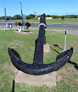
The anchor from the Eliza Ramsden is located at the front of the Queenscliffe Maritime Museum in Queenscliff.
See also, Heritage Council Victoria: Eliza Ramsden,
Australian National Shipwreck Database: Eliza Ramsden, and
Dive Information Sheet: Eliza Ramsden (1874-1875).
This vessel is one of the many historic shipwrecks included in Victoria's shipwreck-discovery-trail. Qualified divers can explore the wrecks of old wooden clippers, iron steamships and cargo and passenger vessels located along the coast and in Port Phillip. Some of these wreck dives are suitable for beginners, even snorkellers, while other wrecks require the skills and experience of advanced divers.
Heritage Warning: Any shipwreck or shipwreck relic that is 75 years or older is protected by legislation. Other items of maritime heritage 75 years or older are also protected by legislation. Activities such as digging for bottles, coins or other artefacts that involve the disturbance of archaeological sites may be in breach of the legislation, and penalties may apply. The legislation requires the mandatory reporting to Heritage Victoria as soon as practicable of any archaeological site that is identified. See Maritime heritage. Anyone with information about looting or stolen artefacts should call Heritage Victoria on (03) 7022 6390, or send an email to [email protected].
Finding the Eliza Ramsden Shipwreck
Over the years we've been provided with many GPS marks for the Eliza Ramsden. The GPS marks we know of in circulation for the Eliza Ramsden are:
- Book - Shipwrecks Around Port Phillip Heads GPS (verified):
Latitude: 38° 17.630′ S (38.293833° S / 38° 17′ 37.8″ S)
Longitude: 144° 40.435′ E (144.673917° E / 144° 40′ 26.1″ E) - Geoff Rodda:
Latitude: 38° 17.628′ S (38.2938° S / 38° 17′ 37.68″ S)
Longitude: 144° 40.442′ E (144.67403333333° E / 144° 40′ 26.52″ E)
11 m, bearing 70°, ENE - Dave Kelly:
Latitude: 38° 17.625′ S (38.29375° S / 38° 17′ 37.5″ S)
Longitude: 144° 40.439′ E (144.673983° E / 144° 40′ 26.34″ E)
11 m, bearing 31°, NNE
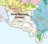
Traditional Owners — This dive site is in the traditional Country of the Boon Wurrung / Bunurong people of the Kulin Nation. This truly ancient Country includes parts of Port Phillip, from the Werribee River in the north-west, down to Wilson's Promontory in the south-east, including the Mornington Peninsula, French Island and Phillip Island, plus Western Port. We wish to acknowledge the Boon Wurrung as Traditional Owners. We pay respect to their Ancestors and their Elders, past, present and emerging. We acknowledge Bunjil the Creator Spirit of this beautiful land, who travels as an eagle, and Waarn, who protects the waterways and travels as a crow, and thank them for continuing to watch over this Country today and beyond.
Eliza Ramsden Location Map
Latitude: 38° 17.630′ S (38.293833° S / 38° 17′ 37.8″ S)
Longitude: 144° 40.435′ E (144.673917° E / 144° 40′ 26.1″ E)
Datum: WGS84 |
Google Map
Added: 2012-07-22 09:00:00 GMT, Last updated: 2022-05-18 11:03:33 GMT
Source: Book - Shipwrecks Around Port Phillip Heads GPS (verified)
Nearest Neighbour: Ramsden Reef, 75 m, bearing 48°, NE
Three-Masted Iron Barque, 515 ton.
Built: Glasgow, Scotland, 1874.
Sunk: 24 July 1875.
Depth: 14 to 22 m.
Portsea, Port Phillip.
Dive only on: SWF, SWE.
[ Top ]
DISCLAIMER: No claim is made by The Scuba Doctor as to the accuracy of the dive site coordinates listed here. Should anyone decide to use these GPS marks to locate and dive on a site, they do so entirely at their own risk. Always verify against other sources.
The marks come from numerous sources including commercial operators, independent dive clubs, reference works, and active divers. Some are known to be accurate, while others may not be. Some GPS marks may even have come from maps using the AGD66 datum, and thus may need be converted to the WGS84 datum. To distinguish between the possible accuracy of the dive site marks, we've tried to give each mark a source of GPS, Google Earth, or unknown.

