Formosa
![]() Wreck Dive |
Wreck Dive | ![]() Boat access
Boat access
![]()
![]()
![]()
Three-Masted Iron Schooner and Twin Screw Steamer | Max Depth: 9 m (30 ft)
Level: Open Water and beyond.
The Formosa (aka SS Formosa) was a combination iron hulled coaster, three-masted schooner and twin screw steamer, built in 1868. The Formosa lies at the Portsea Back Beach in Bass Strait, 3 miles east of Point Nepean,
Diving the Formosa Shipwreck
The Formosa shipwreck is shattered and spread over numerous gutters. The boilers and winches are still identifiable. It is often difficult to find when shifting sands cover its remains.
The Formosa shipwreck is on an extremely rough section of Point Nepean, plus difficult to dive. The wreck can only be dived in ideal conditions.
Back Beach Warning: Always keep an eye on sea conditions throughout any dive on the Back Beaches of the Mornington Peninsula. Please read the warnings on the web page diving-the-back-beaches before diving or snorkelling this site.
Bass Strait Warning: Always keep an eye on sea conditions throughout any shore or boat dive in Bass Strait on Victoria's coastline. Please read the warnings on the web page diving-in-bass-strait before diving or snorkelling this site.
Formosa Shipwreck History — Built in 1868
The Formosa was a twin steam engine, twin screw steamer, built in 1868, by Thomas B Seath & Co, Rutherglen, Glasgow. Gross Tonnage: 205, Net Tonnage: 173. Built on the dimensions of 137 ft (42 m) in length, with beam: 22.2 ft (6.77 m), and draught 8.33 ft (2.54 m).
Formosa Sinking — Wrecked 5 February 1869
The Formosa sailed on its maiden voyage from Clyde, Glasgow for Melbourne rigged as an auxiliary three-masted schooner with cargo of bottled ale, cast-iron pipes and general. Wrecked at Port Phillip Heads on 5 February 1869. The captain and pilots were both found to be at fault by a Board of Inquiry.
The Formosa is historically significant as a rare Australian example of the technical innovation of Thomas B. Seath's shipbuilding. The vessel has interpretive significance as an example of Rutherglen shipbuilding techniques and a historic shipwreck site. The archaeological significance still needs to be determined, however, there is potential for significant wreck remains to reveal further aspects of Seath's technical innovations and social life aboard vessels such as these.
See also, Heritage Council Victoria: Formosa, and,
Australian National Shipwreck Database: Formosa.
Heritage Warning: Any shipwreck or shipwreck relic that is 75 years or older is protected by legislation. Other items of maritime heritage 75 years or older are also protected by legislation. Activities such as digging for bottles, coins or other artefacts that involve the disturbance of archaeological sites may be in breach of the legislation, and penalties may apply. The legislation requires the mandatory reporting to Heritage Victoria as soon as practicable of any archaeological site that is identified. See Maritime heritage. Anyone with information about looting or stolen artefacts should call Heritage Victoria on (03) 7022 6390, or send an email to [email protected].
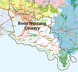
Traditional Owners — This dive site is in the traditional Country of the Boon Wurrung / Bunurong people of the Kulin Nation. This truly ancient Country includes parts of Port Phillip, from the Werribee River in the north-west, down to Wilson's Promontory in the south-east, including the Mornington Peninsula, French Island and Phillip Island, plus Western Port. We wish to acknowledge the Boon Wurrung as Traditional Owners. We pay respect to their Ancestors and their Elders, past, present and emerging. We acknowledge Bunjil the Creator Spirit of this beautiful land, who travels as an eagle, and Waarn, who protects the waterways and travels as a crow, and thank them for continuing to watch over this Country today and beyond.
Formosa Location Map
Latitude: 38° 19.639′ S (38.327318° S / 38° 19′ 38.34″ S)
Longitude: 144° 40.900′ E (144.68167° E / 144° 40′ 54.01″ E)
Datum: WGS84 |
Google Map
Added: 2012-07-22 09:00:00 GMT, Last updated: 2022-04-29 14:16:36 GMT
Source: GPS
Nearest Neighbour: Sierra Nevada, 580 m, bearing 118°, ESE
Twin Screw Steamer.
Built: Rutherglen, Scotland, 1868.
Sunk: 5 February 1869.
Depth: 9 m.
[ Top ]
DISCLAIMER: No claim is made by The Scuba Doctor as to the accuracy of the dive site coordinates listed here. Should anyone decide to use these GPS marks to locate and dive on a site, they do so entirely at their own risk. Always verify against other sources.
The marks come from numerous sources including commercial operators, independent dive clubs, reference works, and active divers. Some are known to be accurate, while others may not be. Some GPS marks may even have come from maps using the AGD66 datum, and thus may need be converted to the WGS84 datum. To distinguish between the possible accuracy of the dive site marks, we've tried to give each mark a source of GPS, Google Earth, or unknown.


