Grant Bay Reef
![]() Reef Dive |
Reef Dive | ![]() Boat access
Boat access
![]()
![]()
![]()
![]()
![]()
Depth: 5 m (16 ft) to 12 m (39 ft)
Level: Open Water and beyond.
Grant Bay Reef lies about 400 metres offshore, in the middle of Grant Bay, about eight kilometres south of Portland, on Victoria's Discovery Coast. The reef is south of the Portland aluminium smelter.
Grant Bay, also known as Crayfish Bay, is located between Point Danger to the east and Cape Sir William Grant to the west. Grant Bay faces south into the Southern Ocean.
Diving at Grant Bay Reef
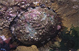
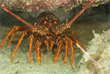
Grant Bay Reef has lots of interesting reef structure with plenty of great habitat for the marine life found here. It's a good hunting ground for abalone and crayfish.
Location: Grant Bay, Portland, Victoria 3305
Ideal Conditions: Grant Bay Reef is protected from offshore north-westerly to north-easterly winds. Moderate to strong easterly to southerly winds are not favourable at this location. Best dived in calm conditions with a low swell. See WillyWeather (Grant Bay) as a guide for the tide times and the height of the tide.
Grant Bay Reef ia accessed by boat from the Portland Harbour, Lee Breakwater Road North Ramp or the Portland Harbour, Lee Breakwater Road South Ramp.
{{southern-ocean-warning}}Divers have the opportunity to catch Abalone at this dive site. Remember your catch bag, legal abalone tool, current Victorian Recreational Fishing Licence, and abalone measure. Please abide by all current fishing regulations if you intend to catch abalone.
See article-catching-abalone for practical abalone hunting advice from The Scuba Doctor, plus melbourne-abalone-dives for a list of other Abalone dive sites near Melbourne.
Divers have the opportunity to catch Southern Rock Lobster (aka Crayfish) at this dive site. Remember your catch bag, current Victorian Recreational Fishing Licence, rock lobster measure, and cray tags. Once you get back to the dive boat, or shore, make sure you clip the tail and tag your Crayfish as per Fisheries requirements. Please abide by all current fishing regulations if you intend to catch crays. See article-catching-crayfish for practical cray hunting advice from The Scuba Doctor, plus melbourne-cray-dives for a list of other crayfish dive sites near Melbourne. For tips on cooking your Crays, please see article-cooking-crayfish.
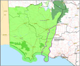
Traditional Owners — This dive site is in the traditional Country of the Gunditjmara people of far south-western Victoria which continues over the state border into a small part of south-east South Australia and is bordered by the Glenelg River to the west and the Wannon River in the north. This truly ancient Country extends 100 metres out to sea from low tide and also includes Deen Maar (aka Lady Julia Percy Island) where the Gunditjmara believe the spirits of their dead travel to wait to be reborn. We wish to acknowledge the Gunditjmara as Traditional Owners. We pay respect to their Ancestors and their Elders, past, present and emerging.
Grant Bay Reef Location Map
Latitude: 38° 23.776′ S (38.396267° S / 38° 23′ 46.56″ S)
Longitude: 141° 38.072′ E (141.63454° E / 141° 38′ 4.34″ E)
Datum: WGS84 |
Google Map
Added: 2022-05-23 14:13:07 GMT, Last updated: 2022-05-24 07:33:51 GMT
Source: GPS
Nearest Neighbour: Grant Bay Beach, 750 m, bearing 286°, WNW
Grant Bay, Portland, Discovery Coast.
Depth: 5 to 12 m.
[ Top ]
DISCLAIMER: No claim is made by The Scuba Doctor as to the accuracy of the dive site coordinates listed here. Should anyone decide to use these GPS marks to locate and dive on a site, they do so entirely at their own risk. Always verify against other sources.
The marks come from numerous sources including commercial operators, independent dive clubs, reference works, and active divers. Some are known to be accurate, while others may not be. Some GPS marks may even have come from maps using the AGD66 datum, and thus may need be converted to the WGS84 datum. To distinguish between the possible accuracy of the dive site marks, we've tried to give each mark a source of GPS, Google Earth, or unknown.


