Lagoon Pier
![]() Pier Dive |
Pier Dive | ![]() Shore access
Shore access
![]()
![]()
![]()
![]()
Depth: 1 m (3.28 ft) to 4 m (13 ft)
Level: Open Water and beyond.
Lagoon Pier is situated between Station Pier and Kerford Road Pier in Port Melbourne, roughly 20 minutes drive from the CBD. It was built in 1889 at the north-eastern end of Port Phillip, located on Beach Street, and is about 300 metres long. It's a great fishing location and popular with anglers.
It's a quirky little pier, much narrower than others around Hobson's Bay, with an interesting curve to it. Great for snorkelling.
Location: Port Melbourne
MELWAY Ref: Page 2J E8
Weather Required: Lagoon Pier faces south-west and can receive moderate waves during strong southerly winds. N, NE, NW and W winds should be ok, or light S, SW and E winds. Not sure if the dive site is affected by rain.
See WillyWeather (Lagoon Pier) as a guide for the tide times and the height of the tide.
Access: Short walk from the car park off Beach Street, opposite Esplanade East, between the Port Melbourne Yacht Club and the Port Melbourne Life Saving Club. Both clubs incorporate dressing rooms and kiosks. The car park is busy in summer.
Facilities: Parking and toilets.
Lagoon Pier History
Lagoon Pier was named because of the lagoon that ran a considerable way into Port Melbourne. It was gradually filled in by 1929. It's now a reserve (Lagoon Reserve and Edwards Reserve) and its extent is delineated by Esplanade East and Esplanade West.
Lagoon Pier was used by the Royal Australian Navy during WW2 as the Naval establishment HMAS Lonsdale (1 Beach Street) was located adjacent. HMAS Lonsdale was a naval training base built over the former lagoon. The base was decommissioned in the 1990s and the site is the high rise apartments.
Spearfishing is illegal within 30 metres of any pier or jetty and in Marine National Parks. See Spearfishing Laws.
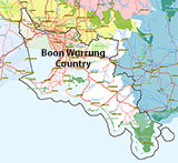
Traditional Owners — This dive site is in the traditional Country of the Boon Wurrung / Bunurong people of the Kulin Nation. This truly ancient Country includes parts of Port Phillip, from the Werribee River in the north-west, down to Wilson's Promontory in the south-east, including the Mornington Peninsula, French Island and Phillip Island, plus Western Port. We wish to acknowledge the Boon Wurrung as Traditional Owners. We pay respect to their Ancestors and their Elders, past, present and emerging. We acknowledge Bunjil the Creator Spirit of this beautiful land, who travels as an eagle, and Waarn, who protects the waterways and travels as a crow, and thank them for continuing to watch over this Country today and beyond.
Lagoon Pier Location Map
Latitude: 37° 50.694′ S (37.844908° S / 37° 50′ 41.67″ S)
Longitude: 144° 56.414′ E (144.940234° E / 144° 56′ 24.84″ E)
Datum: WGS84 |
Google Map
| Get directions
Added: 2021-07-17 23:52:30 GMT, Last updated: 2022-03-27 17:41:44 GMT
Source: Google Earth
Nearest Neighbour: Kerferd Road Pier, 1,069 m, bearing 120°, ESE
Port Melbourne, Bayside, Port Phillip.
Depth: 1 to 4 m.
[ Top ]
DISCLAIMER: No claim is made by The Scuba Doctor as to the accuracy of the dive site coordinates listed here. Should anyone decide to use these GPS marks to locate and dive on a site, they do so entirely at their own risk. Always verify against other sources.
The marks come from numerous sources including commercial operators, independent dive clubs, reference works, and active divers. Some are known to be accurate, while others may not be. Some GPS marks may even have come from maps using the AGD66 datum, and thus may need be converted to the WGS84 datum. To distinguish between the possible accuracy of the dive site marks, we've tried to give each mark a source of GPS, Google Earth, or unknown.


