Lightning
![]() Wreck Dive |
Wreck Dive | ![]() Shore access
Shore access
![]()
![]()
![]()
![]()
![]()
Three-Masted Wooden Clipper Ship | Max Depth: 5 m (16 ft)
Level: Open Water and beyond.
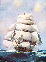
The Lightning shipwreck, which lies in Corio Bay, Geelong, is historically significant for being one of the fastest wooden ships ever built, the first clipper built in the USA for British owners and being the worst shipping disaster in Geelong's history. It spent its whole career carrying cargo and immigrants from England to Australia.
Protected from southerly and westerly winds. See WillyWeather (Cunningham Pier) as a guide for the tide times and the height of the tide.
Lightning Shipwreck History — Built in 1854
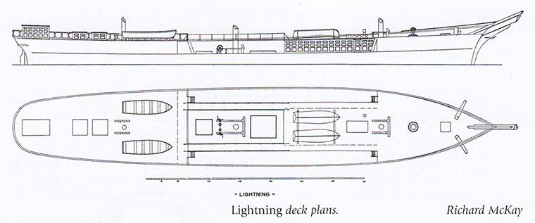
The Lightning was a three-masted wooden clipper ship of 2,084 l-ton (2,117 t), built in 1854, by Donald McKay, of Boston, Massachusetts, USA, on a length of 243 ft (74 m), a breadth of 42 ft (13 m) and a depth of 23 m (75 ft). It was the first clipper built in the USA for a British firm. At the time of its loss the vessel was owned by T Harrison and registered in Liverpool, United Kingdom.
Her poop was 92 feet long and her saloon 86 feet, while she had 8 feet under her beams tween decks a most unusual height for those days. Her stem raked boldly forward, The lines of the bow gradually becoming convex and blending with the sheer line and cut-water, while the only ornament was a full length figure of a beautiful young women holding a golden thunderbolt in her out stretched hand.
Lightning did a brief stint as a troop ship, taking British soldiers from England to India (in 87 days) to fight the 1857 Indian Mutiny.
In 1862, returning to Liverpool, the Lightning struck an uncharted rock in The Rip. No water entered vessel but, on arrival at Liverpool, a rock 6 feet long was found sticking through its timbers and beginning to work loose.
Under Captain 'Bully' Forbes, the Lightning made its first voyage to Australia in 77 days, and on its return voyage made it in a record 64 days. It had the dubious distinction of carrying, free of charge, early consignments of introduced animals, including rabbits, sent to Thomas Austin of Barwon Park, Winchelsea. The Lightning's entire life was spent on the Australian run carrying immigrants and cargo.
Lightning Sinking — 31 October 1869
The wreck of the Lightning caused by fire was the worst shipping calamity in Geelong's history. That a fire had broken out was discovered at about 1 a.m. on 31 October 1869. Water was pumped into lower hold in an attempt to douse it but the efforts of local volunteer fire brigades were unsuccessful. The blazing ship was towed away from the Yarra Street Wharf by James Deane's tug Resolute.
Attempts to scuttle the vessel by boring holes and cutting the outside planking also failed. The Volunteer Artillery had also been unsuccessful in attempts to sink the vessel to put out the fire. The wreck was finally removed with explosives. The Lighting finally sank at about 6 pm. Location about 200 yards from Wharf in 25 feet of water.
Geelong's Centenary celebrations included a re-enactment of burning of Lightning.
See also, Wikipedia: Lightning (clipper),
Heritage Council Victoria: Lightning, and
Australian National Shipwreck Database: Lightning.
Heritage Warning: Any shipwreck or shipwreck relic that is 75 years or older is protected by legislation. Other items of maritime heritage 75 years or older are also protected by legislation. Activities such as digging for bottles, coins or other artefacts that involve the disturbance of archaeological sites may be in breach of the legislation, and penalties may apply. The legislation requires the mandatory reporting to Heritage Victoria as soon as practicable of any archaeological site that is identified. See Maritime heritage. Anyone with information about looting or stolen artefacts should call Heritage Victoria on (03) 7022 6390, or send an email to [email protected].
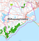
Traditional Owners — This dive site is in the traditional Country of the Wathaurong (Wadda-Warrung) people of the Kulin Nation. This truly ancient Country includes the coastline of Port Phillip, from the Werribee River in the north-east, the Bellarine Peninsula, and down to Cape Otway in the south-west. We wish to acknowledge the Wathaurong as Traditional Owners. We pay respect to their Ancestors and their Elders, past, present and emerging. We acknowledge Bunjil the Creator Spirit of this beautiful land, who travels as an eagle, and Waarn, who protects the waterways and travels as a crow, and thank them for continuing to watch over this Country today and beyond.
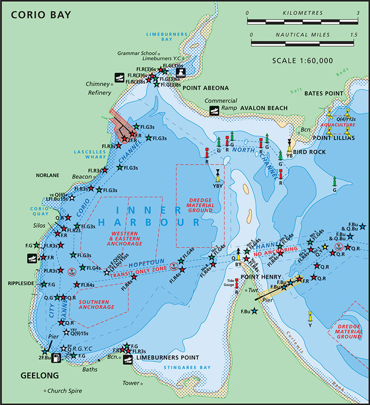
Lightning Location Map
Latitude: 38° 8.550′ S (38.1425° S / 38° 8′ 33″ S)
Longitude: 144° 21.906′ E (144.3651° E / 144° 21′ 54.36″ E)
Datum: WGS84 |
Google Map
| Get directions
Added: 2012-07-22 09:00:00 GMT, Last updated: 2022-04-30 22:30:19 GMT
Source: GPS
Nearest Neighbour: Cunningham Pier, Geelong, 266 m, bearing 276°, W
Three-Masted Wooden Clipper Ship.
Built: Boston, Massachusetts, 1854.
Lost: 31 October 1869.
Bellarine Peninsula, Corio Bay.
Depth: 2 to 5 m.
[ Top ]
DISCLAIMER: No claim is made by The Scuba Doctor as to the accuracy of the dive site coordinates listed here. Should anyone decide to use these GPS marks to locate and dive on a site, they do so entirely at their own risk. Always verify against other sources.
The marks come from numerous sources including commercial operators, independent dive clubs, reference works, and active divers. Some are known to be accurate, while others may not be. Some GPS marks may even have come from maps using the AGD66 datum, and thus may need be converted to the WGS84 datum. To distinguish between the possible accuracy of the dive site marks, we've tried to give each mark a source of GPS, Google Earth, or unknown.


