Mornington Pier
![]() Pier Dive |
Pier Dive | ![]() Shore access
Shore access
![]()
![]()
![]()
![]()
![]()
Depth: 1 m (3.28 ft) to 12 m (39 ft)
Level: Open Water and beyond.
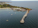
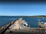
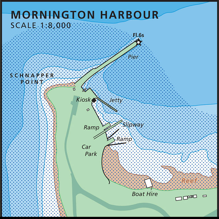
Mornington Pier (aka Mornington Jetty) is at Schnapper Point in Mornington, Victoria on the Mornington Peninsula, between Royal Beach (to the south) and Shire Hall Beach (to the south-east). The seawall and pier runs north-east some 200 metres from the rocky cliff forming Schnapper Point into Port Phillip. Mornington Pier is 70 km (70 minutes by car) south of the Melbourne CBD and is very popular with divers, snorkellers, underwater photographers, especially on days when the ocean sites of the Mornington Peninsula are blown out.
First built in the 1850s, Mornington Pier and Jetty is a regularly used dive training site and a relaxing after work night dive site for many Melbourne based divers. It's a site that is usually still diveable when the wind is up just a bit. But it's also a busy wharf and care needs to be taken when boats are active. Divers and snorkellers should stay away from the boats sheltering on the eastern side.
Diving and Snorkelling at Mornington Pier
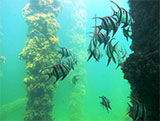
A whole variety of fish life here. Including Old Wives, Globefish, Decorator Crabs, Bigbelly Seahorse (aka Pot Belly Seahorse), Shorthead Seahorse, Starfish, Squid, Gurnards and other pylon dwelling creatures.
Mornington Pier Diving | Credit: David Bryant, Seapics
Varied bottom depending on the area which means you won't get bored as it is changing the whole dive. Lots of large ledges and boulders, to seagrass covered rocks to silty mud. Lots of growth on rocks under the pier.
Abounds with sponge life, Old Wives, Whiting, Giant Australian Cuttlefish, Moonlighters, Dusky Morwong, Decorator Crabs , small Shrimp, and plenty of other small marine life.
Do be mindful here of the fisherman. There are usually a lot of them and the lines are littered everywhere. Stay under the pier where possible to avoid fishing lines. Be sure to take a dive knife and/or line cutter just in case.
This is a great site for both day and night diving! The deepest of the piers on the Mornington Peninsula and well worth a visit. Depths can reach 12 metres out the end.
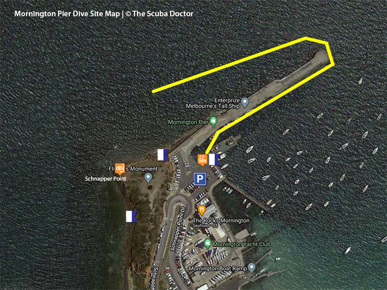
There is also a nice reef to the west of the pier you can follow along. To access it enter as you would for the pier and dive along the pier until the place where the new structure starts. Cross through the pier here and you can follow a small reef along the edge of Schnapper Point.
See also, Mornington Pier and Harbour in "Shore Dives of Victoria" by Ian Lewis, 3rd edition pages 93–95.
Location: Schnapper Point Drive, Mornington, Victoria 3931
MELWAY Ref: Page 104 D9
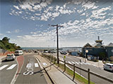
Parking: Normally plenty of good, free parking at the dive entry point at the end of Schnapper Point Drive. If the car park is full you could be up for a 200 metre plus walk from parking spots along Schnapper Point Drive. If the car park is empty, it can be just a 4 metre walk to the water.
Facilities: There is a cafe plus public toilet facilities at Mornington Pier. Picnic and toilet facilities are also available in the vicinity of Schnapper Point Park.
Entry/Exit: The best entry point is via a giant stride from the 3 metre high car park wall near the ladders. Alternatively, you can lower your dive gear onto the stone ledge of the small boat inlet.
The best exit point is via the stone ledge. Get your gear onto the ledge. Climb onto the ledge and get your gear onto the top of the wall. Then climb the wall. It's easier if you work together with your dive buddy. Some divers prefer to climb one of the high ladders.
When making your way to the pier from the entry/exit points it's best to swim on the surface, ideally with a SMB, as there can be quite a bit of boat traffic.
Ideal Conditions: Best with light to moderate south-westerly to easterly winds and high tide. Beware of strong northerly winds, westerly swells and boat traffic. See WillyWeather (Mornington) as a guide for the tide times and the height of the tide.
Mornington Pier is just a 40-minute drive from The Scuba Doctor Dive Shop. Please drop in and catch up with us before and/or after your dive.
Spearfishing is illegal within 30 metres of any pier or jetty and in Marine National Parks. See Spearfishing Laws.
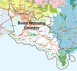
Traditional Owners — This dive site is in the traditional Country of the Boon Wurrung / Bunurong people of the Kulin Nation. This truly ancient Country includes parts of Port Phillip, from the Werribee River in the north-west, down to Wilson's Promontory in the south-east, including the Mornington Peninsula, French Island and Phillip Island, plus Western Port. We wish to acknowledge the Boon Wurrung as Traditional Owners. We pay respect to their Ancestors and their Elders, past, present and emerging. We acknowledge Bunjil the Creator Spirit of this beautiful land, who travels as an eagle, and Waarn, who protects the waterways and travels as a crow, and thank them for continuing to watch over this Country today and beyond.
Mornington Pier Location Map
Latitude: 38° 12.761′ S (38.212684° S / 38° 12′ 45.66″ S)
Longitude: 145° 2.016′ E (145.033593° E / 145° 2′ 0.93″ E)
Datum: WGS84 |
Google Map
| Get directions
Added: 2012-07-22 09:00:00 GMT, Last updated: 2022-04-15 14:04:39 GMT
Source: Google Earth
Nearest Neighbour: Schnapper Point, Mornington Pier, 96 m, bearing 263°, W
Mornington, Mornington Peninsula, Port Phillip.
Depth: 1 to 12 m.
[ Top ]
DISCLAIMER: No claim is made by The Scuba Doctor as to the accuracy of the dive site coordinates listed here. Should anyone decide to use these GPS marks to locate and dive on a site, they do so entirely at their own risk. Always verify against other sources.
The marks come from numerous sources including commercial operators, independent dive clubs, reference works, and active divers. Some are known to be accurate, while others may not be. Some GPS marks may even have come from maps using the AGD66 datum, and thus may need be converted to the WGS84 datum. To distinguish between the possible accuracy of the dive site marks, we've tried to give each mark a source of GPS, Google Earth, or unknown.

