Pioneer
![]() Wreck Dive |
Wreck Dive | ![]() Boat access
Boat access
![]()
![]()
![]()
![]()
Steel Steam Dredge | Max Depth: 50 m (164 ft) — Graveyard
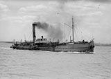
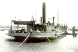
The Pioneer (aka SS Pioneer) was a steel steam driven pump sand dredge. She was built in Glasgow, Scotland for the Victorian Dept. of Board of Works in 1905.
The Pioneer was scuttled on 9 March 1950 in the Victorian Ships' Graveyard, Bass Strait.
Diving the Pioneer Shipwreck
There is limited penetration of the Pioneer along the sides, stern and bow of the shipwreck. Both propellers are still present.
Bass Strait Warning: Always keep an eye on sea conditions throughout any shore or boat dive in Bass Strait on Victoria's coastline. Please read the warnings on the web page diving-in-bass-strait before diving or snorkelling this site.
Pioneer Shipwreck History — Built in 1905
The Pioneer was a steel steam driven sand dredge of 543 tons gross, built in 1905, by Messrs. Ferguson Brothers, in Newark, Glasgow, Scotland. The overall length of the vessel was 170 ft (52 m), with a beam of 37.2 ft (11 m) and a draught of 10.3 ft (3.14 m). She was powered by a 68 horsepower steam engine.
After a voyage lasting 84 days, the Pioneer arrived in Port Phillip from Glasgow via Port Said, Colombo and Albany, WA, on Friday 4 August 1905.
The Pioneer worked on various dredging projects throughout Victoria, deepening the South Channel, Warrnambool Harbour, Lakes Entrance, Queenscliff, Half Moon Bay, Port Fairy and Portland to name a few.
In the 1840s, the Pioneer was scrapped, its main engine, pumps and other usable equipment was were installed in the new dredge, Pioneer II, that was being constructed.
Pioneer Sinking — Scuttled 9 March 1950
On Thursday 9 March 1950, the tug Swiftness with the Pioneer in tow, cleared Gellibrand Pile Light at 6:35 a.m., cleared Port Phillip Heads at 12:05 p.m. and set a course for the Victorian Ships' Graveyard, Bass Strait.
Once in position for scuttling, the powder moneys set the fuses. They were taken off the Pioneer at 2:03 p.m. and the first of three charges was fired. The Pioneer slowly disappeared underwater and was lost from view at 2:23 p.m. as it healed over and sank.
See also Wikipedia: SS Pioneer (1905),
Heritage Council Victoria: Pioneer, and
Australian National Shipwreck Database: Pioneer.
Heritage Warning: Any shipwreck or shipwreck relic that is 75 years or older is protected by legislation. Other items of maritime heritage 75 years or older are also protected by legislation. Activities such as digging for bottles, coins or other artefacts that involve the disturbance of archaeological sites may be in breach of the legislation, and penalties may apply. The legislation requires the mandatory reporting to Heritage Victoria as soon as practicable of any archaeological site that is identified. See Maritime heritage. Anyone with information about looting or stolen artefacts should call Heritage Victoria on (03) 7022 6390, or send an email to [email protected].
Finding the Pioneer Shipwreck
The GPS marks we know of in circulation for the Pioneer shipwreck are:
- Allie Beckhurst / Rowan Stevens:
Latitude: 38° 20.366′ S (38.339433° S / 38° 20′ 21.96″ S)
Longitude: 144° 26.378′ E (144.439633° E / 144° 26′ 22.68″ E) - Victoria's Ships' Graveyard:
Latitude: 38° 20.381′ S (38.33967833° S / 38° 20′ 22.84″ S)
Longitude: 144° 26.373′ E (144.43955833° E / 144° 26′ 22.41″ E)
28 m, bearing 193°, SSW - Australian National Shipwreck Database:
Latitude: 38° 20.400′ S (38.34° S / 38° 20′ 24″ S)
Longitude: 144° 26.400′ E (144.44° E / 144° 26′ 24″ E)
71 m, bearing 153°, SSE
Traditional Owners — This dive site does not lie in the acknowledged traditional Country of any first peoples of Australia.
Pioneer Location Map
Latitude: 38° 20.366′ S (38.339433° S / 38° 20′ 21.96″ S)
Longitude: 144° 26.378′ E (144.439633° E / 144° 26′ 22.68″ E)
Datum: WGS84 |
Google Map
Added: 2012-07-22 09:00:00 GMT, Last updated: 2022-05-13 01:02:12 GMT
Source: Allie Beckhurst GPS (verified)
Nearest Neighbour: H.C. Piggot, 528 m, bearing 181°, S
Steel Steam Dredge, 543 ton.
Built: Newark, Glasgow, Scotland, 1905.
Scuttled: 9 March 1950.
Victorian Ships' Graveyard, Bass Strait.
Depth: 46 to 50 m.
[ Top ]
DISCLAIMER: No claim is made by The Scuba Doctor as to the accuracy of the dive site coordinates listed here. Should anyone decide to use these GPS marks to locate and dive on a site, they do so entirely at their own risk. Always verify against other sources.
The marks come from numerous sources including commercial operators, independent dive clubs, reference works, and active divers. Some are known to be accurate, while others may not be. Some GPS marks may even have come from maps using the AGD66 datum, and thus may need be converted to the WGS84 datum. To distinguish between the possible accuracy of the dive site marks, we've tried to give each mark a source of GPS, Google Earth, or unknown.


