Goorangai
![]() Wreck Dive |
Wreck Dive | ![]() Boat access
Boat access
![]()
![]()
![]()
![]()
![]()
Steam Driven Auxiliary Minesweeper | Max Depth: 15 m (49 ft)
Level: Open Water and beyond.
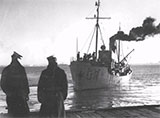
The Goorangai shipwreck (aka HMAS Goorangai, MV Goorangai) was an auxiliary minesweeper of the Royal Australian Navy (RAN). She is historically significant as the first Royal Australian Navy surface vessel lost with all hands, Australia's first naval loss of World War II, and the first Royal Australian Navy surface vessel lost in a war.
The entire ship's complement consisting of three officers and twenty-one sailors (twenty-four in total) were killed when the HMAS Goorangai was sunk in an accidental collision with MV Duntroon on 20 November 1940. Only six bodies were recovered, of which five were identified.
Diving the Goorangai Shipwreck
Blasting operations in January 1941 reduced the remains of the Goorangai to large and small sections of steel plating which protrude from the sandy seabed. A small cylindrical boiler (2 m x 3 m) is lying on the northern end of the site. Broken machinery and boiler sections are scattered around the site, and occasionally wartime relics can be seen.
What little remains is of little interest to wreck divers, with heavily overgrown wreckage, however, the fish life is generally prolific. The remains cover approximately 200 square metres of the seabed, and a considerable length of hull plating stands proud of the sand to a height of about two metres. The remains of the hull have been colonised by a diverse assemblage of colourful encrusting organisms, such as bryozoans, sponges and soft corals. This, in turn, provides an ideal habitat for both free-swimming and sedentary fauna, including many fish species, cuttlefish, sea horses, nudibranchs and starfish. The abundance and variety of marine life, in association with the shipwreck, makes the HMAS Goorangai a popular destination for sport divers.
The Goorangai lies in the South Channel and is subject to shipping, which also means anchoring is prohibited. Diving on slack water is a must.
Goorangai Shipwreck History — Built in 1919
The Goorangai was built in 1919, as a 'Castle' type steel single screw steamer, of 223 ton gross, based on a North Sea design, at the State Dockyard, in Newcastle, NSW, for the NSW Government. The overall length of the vessel was 117 ft (36 m), with a beam of 22.1 ft (6.74 m) and a draught of 13.8 ft (4.21 m). She was driven by a triple expansion steam engine of 68 horsepower.
The Goorangai was sold to Cam and Sons in 1926 and refitted as a fishing trawler.
At the start of World War II, the Goorangai was one of thirty-five privately owned vessels requisitioned by the Royal Australian Navy as auxiliary minesweepers. She was commissioned on 9 September 1939 as the HMAS Goorangai for service as an auxiliary minesweeper.
Goorangai carried three officers and 21 sailors, all of whom were Reservists. David McGregor, who had been skipper of Goorangai in her trawling days was an exception. He was persuaded to sign on by the RAN as Commanding Officer of HMAS Goorangai with the rank of Commissioned Warrant Officer.
Following the sinking of the SS Cambridge and MV City of Rayville in Bass Strait by German mines on 7 and 8 November 1940 respectively, three minesweepers including the HMAS Goorangai were ordered to the sweep the shipping lanes and approaches to Port Phillip, and within a fortnight were able to locate and destroy forty mines.
HMAS Goorangai Sinking — Collision 20 November 1940
The Goorangai had anchored off Queenscliff on the evening of 20 November 1940, however, a freshening southerly wind made the anchorage more exposed, so it was decided to move over to Portsea to gain more shelter, under the command of Warrant Officer David McGregor, RANR. As the Goorangai proceded across the South Channel without lights, at 8:37 p.m. on Wednesday 20 November 1940, she was struck forward of the funnel by the outward bound troopship MV Duntroon which was leaving for Sydney loaded with troops. The Goorangai was cut in two and sank in less than a minute in the South Channel, Port Phillip.Wartime security prevented the Duntroon from heaving to or switching on searchlights to look for survivors. However, the Duntroon did lower lifeboats, fire rockets, and sound three blasts on the whistle to alert the residents of Queenscliff. When the lifeboat Queenscliffe reached the scene of the disaster the crew found the minesweeper sunk in about 15 metres of water with only the tops of the masts visible. Despite an extensive search for the HMAS Goorangai crew of 24, only six bodies were recovered.
The minesweeper HMAS Goorangai has the tragic distinction of being all at once Australia's first naval loss of World War II, the first Royal Australian Navy surface vessel lost in a war, and the first Royal Australian Navy surface vessel lost with all hands. The Goorangai is a designated war grave and should be treated with respect.
Because the HMAS Goorangai wreck lies in the main shipping channel and was considered a hazard to navigation, she was demolished with explosives in January 1941. The remains of the wreck are very scattered.
On 16 November 1995, the wreck of Goorangai was declared a historic shipwreck as specified in the Historic Shipwrecks Act (1981).
See also Wikipedia: HMAS Goorangai,
Royal Australian Navy: HMAS Goorangai,
MAAV: H.M.A.S. Goorangai 1919-1940,
Heritage Council Victoria: HMAS Goorangai, and
Australian National Shipwreck Database: HMAS Goorangai.
Heritage Warning: Any shipwreck or shipwreck relic that is 75 years or older is protected by legislation. Other items of maritime heritage 75 years or older are also protected by legislation. Activities such as digging for bottles, coins or other artefacts that involve the disturbance of archaeological sites may be in breach of the legislation, and penalties may apply. The legislation requires the mandatory reporting to Heritage Victoria as soon as practicable of any archaeological site that is identified. See Maritime heritage. Anyone with information about looting or stolen artefacts should call Heritage Victoria on (03) 7022 6390, or send an email to [email protected].
Finding the Goorangai
Over the years we've been provided with different GPS marks for the Goorangai. The GPS marks we know of in circulation for the Goorangai are:
- Book - Victoria's Ships' Graveyard GPS (verified)
Latitude: 38° 17.404′ N (38.290067° N / 38° 17′ 24.24″ N)
Longitude: 144° 40.992′ E (144.6832° E / 144° 40′ 59.52″ E) - Port of Melbourne:
Latitude: 38° 17.403′ S (38.29005° S / 38° 17′ 24.18″ S)
Longitude: 144° 40.979′ E (144.682983° E / 144° 40′ 58.74″ E)
19 m, bearing 275°, W - Dave Kelly:
Latitude: 38° 17.399′ S (38.289987° S / 38° 17′ 23.95″ S)
Longitude: 144° 40.969′ E (144.682816° E / 144° 40′ 58.14″ E)
35 m, bearing 284°, WNW
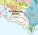
Traditional Owners — This dive site is in the traditional Country of the Boon Wurrung / Bunurong people of the Kulin Nation. This truly ancient Country includes parts of Port Phillip, from the Werribee River in the north-west, down to Wilson's Promontory in the south-east, including the Mornington Peninsula, French Island and Phillip Island, plus Western Port. We wish to acknowledge the Boon Wurrung as Traditional Owners. We pay respect to their Ancestors and their Elders, past, present and emerging. We acknowledge Bunjil the Creator Spirit of this beautiful land, who travels as an eagle, and Waarn, who protects the waterways and travels as a crow, and thank them for continuing to watch over this Country today and beyond.
Goorangai Location Map
Latitude: 38° 17.404′ S (38.290067° S / 38° 17′ 24.24″ S)
Longitude: 144° 40.992′ E (144.6832° E / 144° 40′ 59.52″ E)
Datum: WGS84 |
Google Map
Added: 2012-07-22 09:00:00 GMT, Last updated: 2022-05-11 11:35:29 GMT
Source: Book - Shipwrecks Around Port Phillip Heads GPS (verified)
Nearest Neighbour: Ramsden Reef, 840 m, bearing 243°, WSW
Steam Driven Auxiliary Minesweeper.
Built: Newcastle, NSW, 1919.
Sunk: 20 November 1940.
South Channel, Port Phillip.
Depth: 13 to 15 m.
Dive only on: SWF, SWE.
[ Top ]
DISCLAIMER: No claim is made by The Scuba Doctor as to the accuracy of the dive site coordinates listed here. Should anyone decide to use these GPS marks to locate and dive on a site, they do so entirely at their own risk. Always verify against other sources.
The marks come from numerous sources including commercial operators, independent dive clubs, reference works, and active divers. Some are known to be accurate, while others may not be. Some GPS marks may even have come from maps using the AGD66 datum, and thus may need be converted to the WGS84 datum. To distinguish between the possible accuracy of the dive site marks, we've tried to give each mark a source of GPS, Google Earth, or unknown.


