Petriana
![]() Wreck Dive |
Wreck Dive | ![]() Boat access
Boat access
![]()
![]()
![]()
![]()
![]()
Iron Screw Steamer | Max Depth: 6 m (20 ft)
The Petriana (aka SS Petriana) was an iron screw steamer built in 1879 that was later converted into an oil tanker. On 28 November 1903, while transporting 1,300 tonnes of petroleum from Borneo to Australia, it struck Petriana Reef near Point Nepean, Victoria, outside of Port Phillip.
The vessel was subsequently abandoned, but not before its cargo was released as part of efforts to save the ship, causing Australia's first major oil spill. Under the White Australia policy, the Chinese and Malay sailors crewing the Petriana were refused entry to Australia and forced to stay on a crowded tugboat for several days. Their treatment led to a political controversy in the lead-up to the 1903 federal election.
Diving and Snorkelling the Petriana Shipwreck
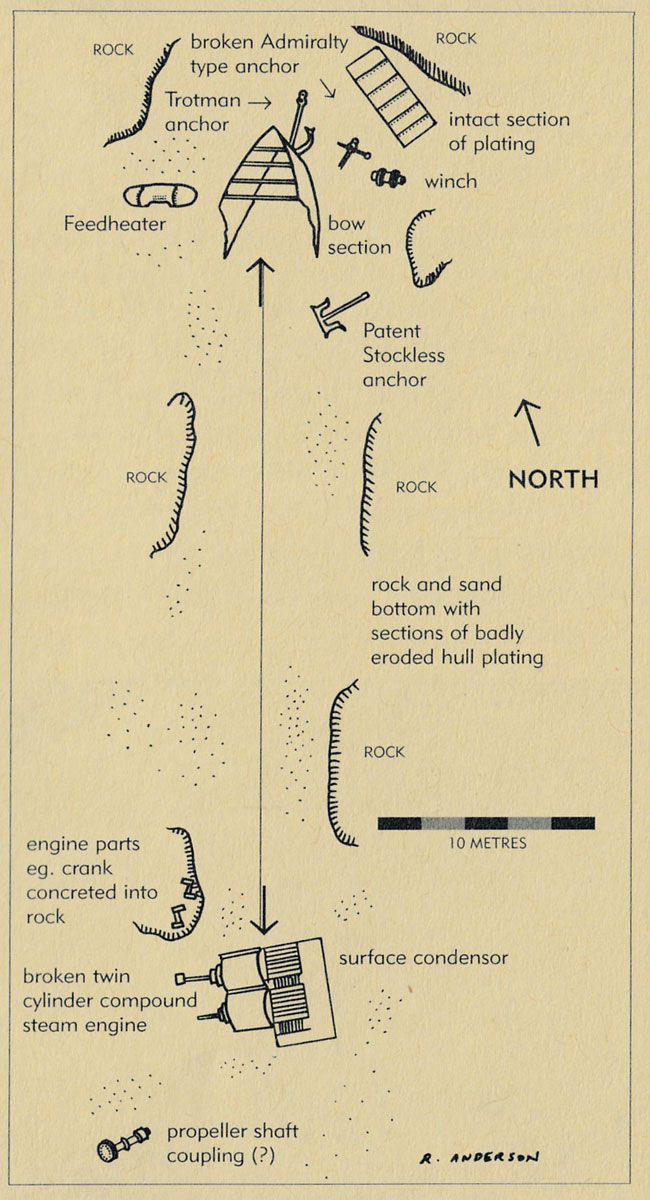
The Petriana shipwreck lies on what is now known as Petriana Reef (or misspelt as Patriana Reef), in shallow water in pieces around 200 metres offshore in front of the Eagles Nest gun emplacement on Point Nepean. Being so close to The Heads the site is influence by strong cross currents and is often swelly and surgy.
The wreck remains are very scattered, but the bow is relatively intact in 3 metres of water, pointing towards the shore. The Petriana wreck can be heavily sanded over at times.
See WillyWeather (Patriana Reef) as a guide for the tide times and the height of the tide.
Bass Strait Warning: Always keep an eye on sea conditions throughout any shore or boat dive in Bass Strait on Victoria's coastline. Please read the warnings on the web page diving-in-bass-strait before diving or snorkelling this site.
The Rip & Tides Warning: Always keep an eye on sea conditions throughout any shore or boat dive within "The Rip" (aka "The Heads"). This is a dangerous stretch of water, where Bass Straight meets Port Phillip, which has claimed many ships and lives. Please read the warnings on the web page diving-the-rip before diving or snorkelling this site.
Petriana Shipwreck History — Built in 1821
The Petriana was a screw steamer cargo ship powered by both steam and sail, 1,821 l-ton (1,850 t), built in 1821, by A. Leslie and Company at its yard in Newcastle upon Tyne, England. The vessel was built on the dimensions of 260.5 ft (79 m) in length, a breadth of 34.2 ft (10 m) and a depth of 21.7 ft (6.61 m).
The Petriana was built as a cargo ship for the London firm of Bell & Symonds, passing through a series of owners before being acquired by petroleum industry pioneer Alfred Suart in 1886. It was converted to a tanker in 1891, and in 1898 was purchased by the Shell Transport & Trading Company, which in 1903 transferred it to the Asiatic Petroleum Company, its new joint venture with Royal Dutch.
The bulk oil carrier Petriana is significant historically as a shipwreck that became a focus in Australian politics for the treatment of its Lascar (Indo-Malay) crew under the White Australia policy. It was also Victoria's, and Australia's first major oil spill, with catastrophic environmental consequences. The remains of the SS Petriana represent the increasing use of fuel oils, and the use of specially made bulk oil transport ships.
Petriana Sinking — 28 November 1903
The Petriana left Balik Papan in the Dutch East Indies (Borneo), travelling to Melbourne via Sydney. It was laden with 1,300 tonnes of bulk oil as well as an unrecorded quantity of naptha and benzene. The ship was under the command of Captain William Kerr, and had 27 Asian crew members — 16 Chinese and 11 Malay — while the nine others on board were British. Part of the cargo was offloaded at Sydney before the steamer left for Melbourne.
At 6 a.m. on the morning of 28 November 1903, Petriana was boarded by Henry Press, a pilot of 20 years' experience, who was to guide the ship through The Heads into Port Phillip. The pilot proceeded towards the notorious Rip at the entrance to Port Phillip.
The fog was thick and the shoreline was obscured but the pilot hoped the fog would clear by the time the leading lights could be seen. Unfortunately the fog did not clear and the Petriana went aground on Portsea Back Beach at 7 a.m. on 28 November 1903. A few moments before the steamer struck, the roar of the breakers was heard, and although the engines were then immediately reversed and put full speed astern, the Petriana slid upon the rocks with a good doal of way still on her. She struck very hard amidships, under the engine room, and ten minutes afterwards that compartment began to fill with water, with the result that the engines were rendered useless, and the vessel could do nothing. An examination of the steamer showed that the injury was confined to the locality of the engines, her oil tanks being intact.
The following day, the salvage schooner Enterprise and the tug Eagle were called to assist. It was hoped that the powerful pumps on the Enterprise could remove some of the water from the Petriana allowing her to be refloated; however, both pumps broke down so this effort was abandoned.
The next strategy was to lighten the vessel by releasing the cargo of 1,300 tonnes of oil into the sea. In a time before modern-day environmental concerns, the spill was described as 'a film of great beauty, radiating all the colours of the rainbow, spread from Sorrento Back Beach to Point Nepean'. The foul-smelling oil contaminated the beaches for months afterwards.
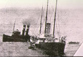
A final attempt was made on Monday 30 November 1903, by the steam tug James Patterson but, by this stage, the Petriana was so badly damaged that it was formally abandoned. The master, Captain William Kerr, and his wife, six officers, a cabin boy, and 27 Asian crew were evacuated and transferred to a hulk lying off Williamstown.
Many of the crew were of Chinese and Malay descent, and a national controversy was sparked. Victorian authorities tried to prevent the seamen from landing in line with the Immigration Restriction Act and the White Australia Policy which prohibited immigrants not of European descent from entering the Commonwealth. Once the Petriana was formally abandoned two days after the spill, the 27 Asian crew members were transferred to the Kasuga Maru, a Japanese mail steamer bound for Hong Kong, from which they were to be returned to their original port of Singapore as required by the Merchant Shipping Act 1854.
The Australian Prime Minister at the time, Alfred Deakin, backed up the local authorities and the debate raged in the press for months with letters variously of protest, explanation or apology. Captain Kerr released a press statement highly critical of the treatment of his crew, in which he said:
"I have sailed in many seas the world over, but have never before seen or heard of a country where the shipwrecked mariner was not allowed to set his foot on dry land. [...] If this treatment of my crew is a fair specimen of your humanity it is about equal to the worst barbarity of other nations, and if it is forced on you by your laws, I regret to say they are a disgrace to the British Empire."
The pilot had 20 years' experience and was held in high esteem; nonetheless his certificate was suspended for 12 months for carelessly navigating a vessel to cause its stranding.
See also, Wikipedia: SS Petriana,
Heritage Council Victoria: SS Petriana, and
Australian National Shipwreck Database: SS Petriana.
Heritage Warning: Any shipwreck or shipwreck relic that is 75 years or older is protected by legislation. Other items of maritime heritage 75 years or older are also protected by legislation. Activities such as digging for bottles, coins or other artefacts that involve the disturbance of archaeological sites may be in breach of the legislation, and penalties may apply. The legislation requires the mandatory reporting to Heritage Victoria as soon as practicable of any archaeological site that is identified. See Maritime heritage. Anyone with information about looting or stolen artefacts should call Heritage Victoria on (03) 7022 6390, or send an email to [email protected].
Port Phillip Heads Marine National Park
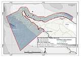
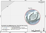
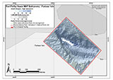
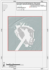
This site lies in the Port Phillip Heads Marine National Park. The park is made up of six separate marine areas around the southern end of Port Phillip: Swan Bay, Mud Islands, Point Lonsdale, Point Nepean, Popes Eye, and Portsea Hole.
Thirty-one of the 120 shipwrecks known to have occurred within a 10 nautical mile radius of Port Phillip Heads are thought to be within the Port Phillip Heads Marine National Park in Point Lonsdale and Point Nepean.
Aboriginal tradition indicates that the Bellarine Peninsula side of the Port Phillip Heads Marine National Park is part of Country of the Wathaurung people, and the Mornington Peninsula side, including Mud Islands, is part of Country of the Boon Wurrung people.
See also, Parks Victoria: Port Phillip Heads Marine National Park,
Park Note: Port Phillip Heads Marine National Park,
Port Phillip Heads Marine National Park - Map,
Divers Guide - Port Phillip Heads Marine National Park,
Port Phillip Heads Marine National Park Identification Booklet, and
Taxonomic Toolkit for the Marine Life of Port Phillip Bay.
You are not permitted to carry a spear gun while snorkelling or scuba diving in Port Phillip Heads Marine National Park.
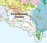
Traditional Owners — This dive site is in the traditional Country of the Boon Wurrung / Bunurong people of the Kulin Nation. This truly ancient Country includes parts of Port Phillip, from the Werribee River in the north-west, down to Wilson's Promontory in the south-east, including the Mornington Peninsula, French Island and Phillip Island, plus Western Port. We wish to acknowledge the Boon Wurrung as Traditional Owners. We pay respect to their Ancestors and their Elders, past, present and emerging. We acknowledge Bunjil the Creator Spirit of this beautiful land, who travels as an eagle, and Waarn, who protects the waterways and travels as a crow, and thank them for continuing to watch over this Country today and beyond.
Petriana Location Map
Latitude: 38° 18.630′ S (38.3105° S / 38° 18′ 37.8″ S)
Longitude: 144° 39.340′ E (144.655667° E / 144° 39′ 20.4″ E)
Datum: WGS84 |
Google Map
Added: 2012-07-22 09:00:00 GMT, Last updated: 2022-05-01 09:00:38 GMT
Source: Book - Shipwrecks Around Port Phillip Heads GPS (verified)
Nearest Neighbour: Nepean Bay Inner West, 709 m, bearing 1°, N
Iron Screw Steamer, 1821 ton.
Built: Newcastle upon Tyne, England, 1879.
Sunk: 28 November 1903.
Point Nepean, Port Phillip Heads Marine National Park.
Depth: 3 to 6 m.
[ Top ]
DISCLAIMER: No claim is made by The Scuba Doctor as to the accuracy of the dive site coordinates listed here. Should anyone decide to use these GPS marks to locate and dive on a site, they do so entirely at their own risk. Always verify against other sources.
The marks come from numerous sources including commercial operators, independent dive clubs, reference works, and active divers. Some are known to be accurate, while others may not be. Some GPS marks may even have come from maps using the AGD66 datum, and thus may need be converted to the WGS84 datum. To distinguish between the possible accuracy of the dive site marks, we've tried to give each mark a source of GPS, Google Earth, or unknown.


